- Usage in publication:
-
- Fauquier formation
- Modifications:
-
- Named
- Dominant lithology:
-
- Marble
- Slate
- Schist
- Gneiss
- AAPG geologic province:
-
- Piedmont-Blue Ridge province
Summary:
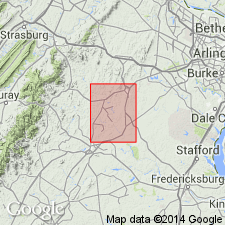
Fauquier formation, here named, is described as a series of marbles, graphitic slates and graphitic schists, mica schists, and biotite-garnet gneisses. Formation enters Warrenton quad. from north where it follows west side of Watery Mountain and extends southwestward through quad. In vicinity of Fauquier White Sulphur Springs and west of Piney Mountain, it is extensively intruded by dikes of greenstone, amphibolite, or metagabbro of Catoctin age. Oldest rocks of sedimentary origin in area. Underlies Precambrian Catoctin volcanic series and locally Warrenton agglomerate member (new) of Catoctin. Rocks of Fauquier were formerly classified with Loudoun formation.
Source: GNU records (USGS DDS-6; Reston GNULEX).
- Usage in publication:
-
- Fauquier Formation
- Modifications:
-
- Revised
- Areal extent
- AAPG geologic province:
-
- Piedmont-Blue Ridge province
Summary:
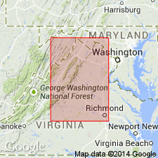
Assigned as upper formation of Lynchburg Group (rank raised). Occurs between underlying Bunker Hill Formation (newly named lower formation of Lynchburg Group) and unconformably overlying Catoctin Greenstone or Swift Run Formation. In Albemarle Co., exposed in a belt 4 to 6 mi wide [author also states on p. 76, 'In Albemarle County (Nelson, 1962, p. 21-22, geologic map) the Charlottesville Formation is the Fauquier Formation and the Johnson Mill Formation corresponds to the dark slate facies. Furcron (1935, p. 41) writes of the Fauquier Formation: "The graphitic schists and associated amphibolite rocks of the University quadrangle are probably a southwestward continuation of this belt of Precambrian rocks" ']. In Warrenton quad, heavily affected by probable Triassic faulting. Fauquier is absent locally, especially in northern Fauquier and Loudoun Cos. Intruded by basic dikes from northern to central VA. Age is late Precambrian.
Source: GNU records (USGS DDS-6; Reston GNULEX).
- Usage in publication:
-
- Fauquier Formation*
- Modifications:
-
- Revised
- Redescribed
- Dominant lithology:
-
- Dolomite
- Meta-arkose
- Metasiltstone
- Metaconglomerate
- AAPG geologic province:
-
- Piedmont-Blue Ridge province
Summary:
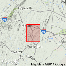
Fauquier Formation of Furcron (1939) was revised by Espenshade and Clark (1976, Geological Society of America, Northeast-Southeast Sections Joint Meeting, Field Trip Guidebook No. 5) because they concluded that Furcron's original nomenclature of 1939 and his revision of 1969 were difficult to apply in the Marshalltown, Rectortown, and Orlean quads. They proposed that Fauquier be redefined to include all Precambrian metasedimentary rocks of post-granite intrusion and pre-Catoctin age. Their revision is also applied to this report. Lithologic terms used by Furcron (1939) are different in this report. Subdivided into metaconglomerate, meta-arkose, meta-arkose and metasiltstone, metarhythmite, and dolomitic units. Fauquier is at same stratigraphic position as Swift Run Formation, which is on western limb of Blue Ridge anticlinorium.
Source: GNU records (USGS DDS-6; Reston GNULEX).
- Usage in publication:
-
- Fauquier Formation
- Modifications:
-
- Overview
- AAPG geologic province:
-
- Piedmont-Blue Ridge province
Summary:
Lynchburg Group, on the southeastern limb of the Blue Ridge anticlinorium, is subdivided in this report into (ascending) Fauquier Formation, unnamed metagraywacke turbidite deposits (which combines Rockfish conglomerate formation and Lynchburg gneiss formation of Nelson, 1962), Johnson Mill Formation, and the Charlottesville Formation. Lynchburg rocks also occur in several outliers, the largest and most westerly of which is the belt containing the Mechum River Formation, which has been previously correlated with the Lynchburg. The Fauquier unconformably overlies Grenville basement and the Robertson River Formation. [Field trip is based on reconnaissance geologic mapping in the Charlottesville 1 deg X 2 deg quad. as part of a new edition of the Geologic Map of VA to be completed by 1993.]
Source: GNU records (USGS DDS-6; Reston GNULEX).
- Usage in publication:
-
- Fauquier Group*
- Modifications:
-
- Revised
- AAPG geologic province:
-
- Piedmont-Blue Ridge province
Kasselas, G.D., 1993, Stratigraphic framework, structural evolution and tectonic implications of the eastern Blue Ridge sequence in the central Appalachians near Warrenton, Virginia: Virginia Polytechnic Institute and State University, Department of Geological Sciences M.S. thesis, __ p.
Summary:
In Warrenton area, Fauquier raised to group status and restricted in the area north of Carter Run fault, where there is distinct change in stratigraphy. Includes (ascending) Bunker Hill, Monumental Mills, Swains Mountain (new), and Carter Run (new) Formations. Correlative with Lynchburg Group, which is extended northward into the southern part of the Warrenton area. Lynchburg includes (ascending) Bunker Hill, Monumental Mills, and Ball Mountain Formations. Report includes geologic maps and correlation chart.
Source: GNU records (USGS DDS-6; Reston GNULEX).

- Usage in publication:
-
- Fauquier Formation
- Modifications:
-
- Overview
- AAPG geologic province:
-
- Piedmont-Blue Ridge province
Summary:
Fauquier Formation, on the State map, is divided into four mappable lithologic units: laminated metasiltstone and phyllite; meta-arkose and metasiltstone; arkosic metasandstone, and metaconglomerate. The laminated metasiltstone and phyllite (called metarhythmite by Espenshade, 1986) is on strike with, and in part equivalent to the Monumental Mills Formation. Parts of the Fauquier as mapped here include some rocks previously mapped as Mechums River Formation. Age is Late Proterozoic.
Source: GNU records (USGS DDS-6; Reston GNULEX).
- Usage in publication:
-
- Fauquier Group*
- Modifications:
-
- Revised
- Areal extent
- AAPG geologic province:
-
- Piedmont-Blue Ridge province
Summary:
Raised in rank to Fauquier Group and includes Thorofare Mountain, Monumental Mills, and Bunker Hill Formations and Rockfish Conglomerate of Wehr (1985). All are in the Jefferson terrane. Includes rocks stratigraphically tied to Laurentia on east limb of Blue Ridge anticlinorium in central and northern VA. Contains alluvial, deltaic, and lake deposits; no known ultramafic or volcanic rocks. A lens of conglomerate containing granitic gneiss cobbles up to 13 cm long is reported by Brown (1958) in strata close to Grenvillian basement just north of James River near Lynchburg; therefore, Fauquier Group probably extends at least this far southwest. South of James River, rocks of Jefferson terrane may be in thrust fault contact with Grenvillian rocks, implying that Fauquier Group has either thinned to a feather edge, has been tectonically removed in hanging wall of thrust fault, or (more likely) overridden by hypothesized thrust at base of Jefferson terrane. Report includes geologic maps, correlation chart, and isotopic data.
Source: GNU records (USGS DDS-6; Reston GNULEX).
- Usage in publication:
-
- Fauquier Formation*
- Modifications:
-
- Overview
- AAPG geologic province:
-
- Piedmont-Blue Ridge province
Summary:
On the correlation chart for Precambrian rocks of the conterminous United States, the Fauquier Formation in the central and southern Laurentian Appalachians is shown as Late Proterozoic (700 Ma and younger).
Source: GNU records (USGS DDS-6; Reston GNULEX).
- Usage in publication:
-
- Fauquier Formation*
- Modifications:
-
- Areal extent
- AAPG geologic province:
-
- Piedmont-Blue Ridge province
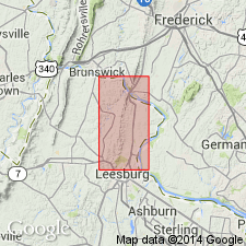
Summary:
Boundary between Swift Run Formation and Fauquier Formation is placed in Lincoln quad to the south of this study area, at two east-trending syn-sedimentary(?) faults, one of which marks the southern termination of Swift Run and the other which marks the northern extent of Fauquier Formation, with Catoctin Formation overlying basement in between. Report includes geologic map, cross sections, and correlation chart.
Source: GNU records (USGS DDS-6; Reston GNULEX).
For more information, please contact Nancy Stamm, Geologic Names Committee Secretary.
Asterisk (*) indicates published by U.S. Geological Survey authors.
"No current usage" (†) implies that a name has been abandoned or has fallen into disuse. Former usage and, if known, replacement name given in parentheses ( ).
Slash (/) indicates name conflicts with nomenclatural guidelines (CSN, 1933; ACSN, 1961, 1970; NACSN, 1983, 2005, 2021). May be explained within brackets ([ ]).

