

- Usage in publication:
-
- El Paso limestone
- Modifications:
-
- Original reference
- Dominant lithology:
-
- Limestone
- Chert
- AAPG geologic province:
-
- Orogrande basin
- Permian basin
Summary:
Pg. 29, geol. map. El Paso limestone. Mainly massive gray fossiliferous limestone, locally arenaceous at base and containing throughout bands of chert irregularly distributed. Of variable hardness. Ranges in color from drab to buff, with locally reddish and bluish streaks, to prevailing gray. Thickness 1,200 feet. Comprises all of Ordovician in Franklin Mountains. Underlies Silurian limestone. In places overlies Cambrian Bliss sandstone and in other places rests on pre-Cambrian rocks. Age is Ordovician.
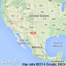
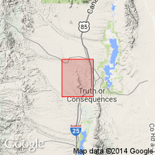
Named from exposures in Franklin and Hueco Mountains, El Paso quadrangle, El Paso Co., western TX.
Source: US geologic names lexicon (USGS Bull. 896, p. 680).
- Usage in publication:
-
- El Paso limestone*
- Modifications:
-
- Revised
- Overview
- AAPG geologic province:
-
- Orogrande basin
- Permian basin
Summary:
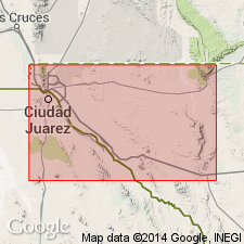
Revised in El Paso quad, El Paso Co, TX, Orogrande basin and Van Horn quad, Culberson Co, TX, Permian basin, where unit conformably underlies Montoya limestone (first used); conformably overlies Bliss sandstone in El Paso quad and unconformably overlies Van Horn sandstone in Van Horn quad. Outcrops in Franklin and Hueco Mountains in El Paso quad (1000 ft thick) and in Beach and Baylor Mountains in Van Horn quad (750 ft thick). List of Beekmantown fauna. Early Ordovician age.
Source: GNU records (USGS DDS-6; Denver GNULEX).
- Usage in publication:
-
- El Paso limestone*
- Modifications:
-
- Revised
- AAPG geologic province:
-
- Basin-and-Range province
Summary:
El Paso limestone is revised in that it now unconformably underlies the newly named Gym limestone (of Late Pennsylvanian age) in some places in the Florida Mountains, Luna Co, NM in Basin-and-Range province. El Paso underlies the newly named Lobo formation (of Triassic? age) in northern Florida Mountains. Geologic map. El Paso limestone is of Early Ordovician age.
Source: GNU records (USGS DDS-6; Denver GNULEX).
- Usage in publication:
-
- El Paso limestone*
- Modifications:
-
- Areal extent
- AAPG geologic province:
-
- Basin-and-Range province
Summary:
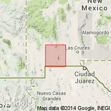
El Paso limestone present in Silver City quad, Grant Co, NM in Basin-and-Range province. Outcrops on Lone Mountain, in Silver City Range and its outliers, and in the country adjacent to Bear Creek north of Bear Mountain. Several sq mi east of Juniper Hill and south of Bear Creek are underlain by El Paso, and a bit of it is exposed beneath the Silurian strata at extreme eastern edge of quad. Two sections measured in the quad. Overlies the Cambrian Bliss sandstone with apparent conformity, although the fossils found indicate a considerable hiatus; fossils also indicate an important time break between El Paso and the overlying Ordovician Montoya limestone. Is of Ordovician age. Geologic map.
Source: GNU records (USGS DDS-6; Denver GNULEX).
- Usage in publication:
-
- El Paso limestone
- Modifications:
-
- Overview
- AAPG geologic province:
-
- Pedregosa basin
Summary:
No attempt made to distinguish the Sierrite limestone and Bat Cave formation of El Paso group of Caballo Mountains, Sierra Co, NM. Geologic map included. Divisible in area northwest of Preacher Mountain, Hidalgo Co, Pedregosa basin, into three informal members, and in the vicinity of the mountain is 553 ft where a section was measured. Fossils are rare. Has some gastropods and endoceroid siphuncles. Age based on fossils collected is Late Cambrian and Early Ordovician.
Source: GNU records (USGS DDS-6; Denver GNULEX).
- Usage in publication:
-
- El Paso Formation
- Modifications:
-
- Areal extent
- Overview
- AAPG geologic province:
-
- Pedregosa basin
Summary:
Divided into Sierrite (base) and Bat Cave Members. Three measured sections described: in Mescal Canyon, NE1/4 SE1/4 sec 29, T30S, R15W, 1070 ft thick; in Ram Gorge, sec 20, T30S, R15W, 916 ft thick; and in Chaney Canyon, secs 31 and 36, T30S, R16W, 595 ft thick. Overlies Bliss Formation conformably. Underlies Montoya Dolomite disconformably. Assigned to the Canadian Series of the Ordovician. Trilobite, gastropod, cephalopod, brachiopod, and stromatolite fossils, and cystoid plates identified.
Source: GNU records (USGS DDS-6; Denver GNULEX).
- Usage in publication:
-
- El Paso Limestone*
- Modifications:
-
- Overview
- AAPG geologic province:
-
- Orogrande basin
- Pedregosa basin
- Basin-and-Range province
Summary:
Used across area from El Paso area, TX in Orogrande basin west to Santa Catalina Mountains, Pima Co, AZ. Report area covers Orogrande and Pedregosa basins, and Basin-and-Range province. Overlies Bliss Sandstone as far west as eastern Hidalgo Co, NM. Overlies Coronado Sandstone (name changed from Coronado Quartzite) into easternmost AZ. Overlies Abrigo Formation to west border (about 111 deg.) of report area. Is 500 m thick at type. Thins north and east from type owing to Middle Ordovician erosion. Is of Early Ordovician age in southwesternmost NM portion of study area (areas C, D, E, and F of fig. 1) where it is overlain by Montoya Group disconformably (to eastern Hidalgo Co.). In Graham, Greenlee, and Cochise Cos., AZ (areas A', B' of fig.1) El Paso is Late Cambrian and Early Ordovician age. Fig. 2 is stratigraphic diagram. Is overlain by Devonian rocks to west.
Source: GNU records (USGS DDS-6; Denver GNULEX).
- Usage in publication:
-
- El Paso Limestone*
- Modifications:
-
- Overview
- AAPG geologic province:
-
- Pedregosa basin
Summary:
Is mapped in central Peloncillo Mountains, Hidalgo Co, NM in Pedregosa basin. Unconformably overlies Bliss Sandstone (Upper Cambrian). Unconformably underlies Ready Pay Member of Percha Shale (Upper Devonian). Is 180 m thick. Contains fossil echinoderm, brachiopod, algae, trilobite, and gastropod fragments. Age is Early Ordovician; [apparently on basis of previous work].
Source: GNU records (USGS DDS-6; Denver GNULEX).
- Usage in publication:
-
- El Paso Group*
- Modifications:
-
- Overview
- AAPG geologic province:
-
- Orogrande basin
Summary:
Divided into the Sierrite (base) and Bat Cave (top) Formations, names extended into the west flank of the Mud Springs Mountains, Sierra Co, NM in the Orogrande basin. In earlier reports on this area, El Paso was divided into Sierrite and Bat Cave only in the Caballo Mountains, and into the Hitt Canyon Formation (base) and McKelligon Limestone (top) in the mountains to the east. The contacts mapped in this quad correspond to those of Sierrite and Bat Cave rather than those for the Hitt Canyon and McKelligon. Assigned to the Early Ordovician.
Source: GNU records (USGS DDS-6; Denver GNULEX).

- Usage in publication:
-
- El Paso Formation*
- Modifications:
-
- Mapped 1:24k
- Dominant lithology:
-
- Limestone
- Dolomite
- AAPG geologic province:
-
- Pedregosa basin
Summary:
El Paso Formation. Mapped in Big Hatchet Mountains, Hidalgo County, southwestern New Mexico. Divided into upper and lower dolomitic limestone members separated by a limestone member. Bat Cave and Sierrite Members previously described by Zeller (1965) are not recognized. Thickness about 916 to 1,070 feet. Underlies Montoya Group; overlies Bliss Formation. Fossils sparse. Age is Early Ordovician.
Source: Publication.
- Usage in publication:
-
- El Paso Formation*
- Modifications:
-
- Mapped 1:24k
- Redescribed
- Dominant lithology:
-
- Dolomite
- Limestone
- Siltstone
- AAPG geologic province:
-
- Pedregosa basin
Summary:
El Paso Formation. Dolomite, limestone, and some dolomitic siltstone [thus redescribed as "El Paso Formation"]. Is mostly light- to medium-gray and some light-brownish-gray, fine-grained, thin- to medium-bedded, slightly cherty and sparsely fossiliferous. Outcrops in northwest striking bands in northern part of quadrangle, Cochise County, Arizona. Thickness 137 m (citing Sabins, 1957, AAPG Bull., v. 41, p.446-510) or 124 to 190(?) m (citing R.J. Ross, Jr., written commun., 1980). Conformably overlies Coronado Sandstone; unconformably underlies Portal and Martin Formations. Age is Early Ordovician.
Source: Publication; supplemental information from GNU records (USGS DDS-6; Denver GNULEX).
For more information, please contact Nancy Stamm, Geologic Names Committee Secretary.
Asterisk (*) indicates published by U.S. Geological Survey authors.
"No current usage" (†) implies that a name has been abandoned or has fallen into disuse. Former usage and, if known, replacement name given in parentheses ( ).
Slash (/) indicates name conflicts with nomenclatural guidelines (CSN, 1933; ACSN, 1961, 1970; NACSN, 1983, 2005, 2021). May be explained within brackets ([ ]).