


- Usage in publication:
-
- Dwale shales
- Modifications:
-
- Original reference
- Dominant lithology:
-
- Shale
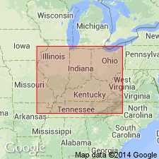
- AAPG geologic province:
-
- Appalachian basin
Summary:
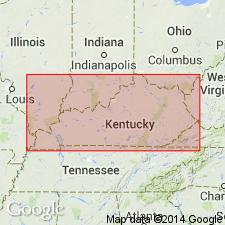
Pg. 296. Dwale shales. The lowest and oldest fossiliferous bed that was studied in the region [stretching from Tug Fork of Big Sandy River at Borderland on the east, to North Fork of Kentucky River at Copeland on the west] may be designated Dwale shales, from town of Dwale, [Floyd County, eastern Kentucky], where they are associated with Prestonburg No. 1 coal, which underlies them. They lie 45 feet below Elkins Fork shales. The fossils came from the dump of the abandoned mine of Dwale Coal Company 0.5 mi northwest of Dwale, Floyd County. They belong to LINGULA CARBONARIA, and hence the shales may represent brackish-water deposits rather than marine. Age is Pennsylvanian.
Source: US geologic names lexicon (USGS Bull. 896, p. 646).
- Usage in publication:
-
- Dwale shale
- Modifications:
-
- Revised
- AAPG geologic province:
-
- Appalachian basin
Summary:
Pg. 42, 43, 82. Dwale shale. In lower part of Breathitt formation, forming roof of Prestonburg coal. [Age is Pennsylvanian.]
Source: US geologic names lexicon (USGS Bull. 1200, p. 1189).
- Usage in publication:
-
- Dwale shale member
- Modifications:
-
- Revised
- Dominant lithology:
-
- Shale
- AAPG geologic province:
-
- Appalachian basin
Summary:
Breathitt Formation is informally elevated to group rank and subdivided into the following eight informal formations: Pocahontas, Bottom Creek, Alvy Creek, Grundy, Pikeville, Hyden, Four Corners, and Princess formations. Marine and brackish-water shales within the Upper Elkhorn No. 3 coal zone of the Pikeville formation are informally called the Dwale shale member in this report. Underlies the Darby coal bed (Upper Elkhorn No. 3 1/2). Marine shales overlying the Upper Elkhorn No. 3 1/2 are informally referred to as the Elkhorn shale member. [Revisions made in this paper are strongly contested by C. Rice and other USGS scientists who work in this area (oral commun., 9/3/93).]
Source: GNU records (USGS DDS-6; Reston GNULEX).

- Usage in publication:
-
- Dwale shale
- Modifications:
-
- Areal extent
- AAPG geologic province:
-
- Appalachian basin
Summary:
Corr. chart. Dwale shale (informal, unranked) in Pikeville Formation of Breathitt Group (KY); Dwale shale (informal, unranked) in Indian Bluff Formation (TN). Shale and/or mudstone. In Kentucky is an informal, unranked unit in upper part of Pikeville Formation below the Elkins Fork shale (informal, unranked) and above Crummies Member. In Tennessee is an informal, unranked unit in lower part of Indian Bluff Formation; lies between the Stockstill and Joyner coals, below the Elkins Fork shale (informal, unranked) in Indian Bluff Formation and above the Newcomb Sandstone (unranked) in Slatestone Formation. Carries marine fossils. Age is Middle Pennsylvanian (Westphalian; Atokan).
[Peppers (1996, GSA Memoir 188, p. 9, pl.) placed the Indian Bluff Formation in Westphalian B, MICRORETICULATISPORITES NOBILIS-FLORINITES JUNIOR (NJ) miospore assemblage zone of western Europe. The Dwale shale is correlative with rocks above the No. 2 Gas coal zone of West Virginia, which Eble and others (2009, Kentucky Geol. Survey, ser. XII, Spec. Pub. 10, fig. 5.2) placed in middle part of Duckmantian (Westphalian B) on basis of miospores.]
[See also Chesnut, 1997 (revised Oct. 12, 1999), Stratigraphy of the coal-bearing strata of the Eastern Kentucky coal field, available online through the Kentucky Geol. Survey (http://www.uky.edu/KGS/coal/coalcorrel.htm). Shows Dwale shale in Big Sandy district, eastern Kentucky, correlative with middle part of Upper Elkhorn No. 3 coal zone; lies between Nosben (Upper Elkhorn No. 3.5) and Van Lear (Millers Creek, Sidney) coals.]
Source: Publication.
For more information, please contact Nancy Stamm, Geologic Names Committee Secretary.
Asterisk (*) indicates published by U.S. Geological Survey authors.
"No current usage" (†) implies that a name has been abandoned or has fallen into disuse. Former usage and, if known, replacement name given in parentheses ( ).
Slash (/) indicates name conflicts with nomenclatural guidelines (CSN, 1933; ACSN, 1961, 1970; NACSN, 1983, 2005, 2021). May be explained within brackets ([ ]).