

- Usage in publication:
-
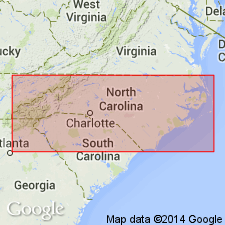
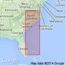
- Duplin beds*
- Modifications:
-
- Original reference
- Dominant lithology:
-
- Marl
- Sand
- AAPG geologic province:
-
- Atlantic Coast basin
Summary:
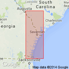
Pg. 338. Duplin beds. Late Miocene marls of Duplin County, North Carolina. Unit was described by Conrad (1841, Amer. Jour. Sci., 1st ser., v. 12 [41], p. 335-343). [Conrad described the deposits but did not name them.]
[Named from exposures in Duplin Co., NC, especially in Natural Well southwest of Magnolia.]
Source: US geologic names lexicon (USGS Bull. 896, p. 644-645).
- Usage in publication:
-
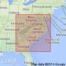
- Duplin formation*
- Modifications:
-
- Revised
- Areal extent
- Dominant lithology:
-
- Clay
- AAPG geologic province:
-
- Atlantic Coast basin
Summary:
Duplin formation described as unconsolidated sands, arenaceous clays, and shell marls representing latest phase of Miocene deposition in region south of Neuse River. North of Neuse River, the Yorktown formation occupies same stratigraphic position, and the two formations may be in part contemporaneous. The differences in faunas, however, make it inadvisable to include them in a single formation. In regions where Duplin strata occur no other deposits of Miocene age have been recognized, and wherever the basal beds are exposed, the formation is seen to rest unconformably on Cretaceous or Eocene strata. Near Mount Olive, the Duplin rests on the Trent, with which it is markedly unconformable. In vicinity of Wilmington, the Duplin beds are found immediately overlying Castle Hayne deposits. The formation is unconformably overlain by either Waccamaw marl (Pliocene) or by Pleistocene deposits. Thickness about 100 ft. Near Lake Waccamaw an unusual phase of Duplin is developed. Outcropping along bluff on north shore of lake is a compact fossiliferous limestone that contains many casts of Molluscan shells, CREPIDULA especially abundant. This limestone is overlain by a loose characteristic shell marl and underlain by yellowish-brown sand that contains some phosphatic pebbles and water-worn casts of Cretaceous fossils at base. This phase also occurs along Peedee River in SC, particularly in vicinity of Bostick.
Source: GNU records (USGS DDS-6; Reston GNULEX).
- Usage in publication:
-
- Duplin Marl
- Modifications:
-
- Not used
- AAPG geologic province:
-
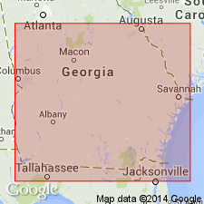
- South GA-North FL sedimentary province
Summary:
Alum Bluff, Duplin, and Chipola, which have been used in GA for all or part of the Hawthorne Group, are no longer applicable or useful.
Source: GNU records (USGS DDS-6; Reston GNULEX).
- Usage in publication:
-
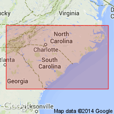
- Duplin Formation*
- Modifications:
-
- Areal extent
- AAPG geologic province:
-
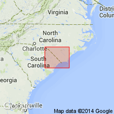
- Atlantic Coast basin
Summary:
In the area between southern VA (the type locality of the Yorktown) and the boundary of the Florence quad, the name Duplin is retained. The use of the name Yorktown seems premature until the area is mapped in closer detail.
Source: GNU records (USGS DDS-6; Reston GNULEX).
- Usage in publication:
-
- Duplin Formation*
- Modifications:
-
- Age modified
- Biostratigraphic dating
- AAPG geologic province:
-
- Atlantic Coast basin
Summary:
Samples from the Duplin Formation in NC are dated by planktonic foraminifers and calcareous nannofossils as 3.5 to 3.0 Ma. Samples from outcrops of Raysor Formation on the Savannah River, GA, contain planktonic foraminifers equivalent to zone PL-3 of Berggren (1983) and zone N20 of Blau (1960) according to Huddlestun (1988). The Raysor and Duplin correlate with each other and represent a marine transgression that occupied the Orangeburg scarp. Both formations are shown in correlation chart as early and late Pliocene.
Source: GNU records (USGS DDS-6; Reston GNULEX).
- Usage in publication:
-
- Duplin Formation
- Modifications:
-
- Areal extent
- AAPG geologic province:
-
- Atlantic Coast basin
Summary:
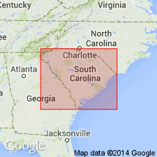
Following Dubar and others (1974), authors recommend that the Natural Well section near Magnolia, in Duplin Co., NC, be designated the stratotype and that the lower boundary of the Duplin Formation be placed at the base of the 0.9-m-thick, very shelly quartz sandstone bed. Duplin beds consist of sands, sandy and silty clays, and very shelly sands, which frequently overlie a phosphatic basal conglomerate. Some of the Duplin beds in southern NC are less glauconitic and more uniformly coarse-grained than the equivalent members of the Yorktown Formation to the north. Authors agree with Bailey (1987) who proposed that the Duplin be reinstated as a formal lithic unit for early to middle Pliocene strata south of the Neuse River. The Duplin is lithologically and stratigraphically distinct and has passed the test of mappablility. Unit interfingers with the correlative Raysor Formation in SC.
Source: GNU records (USGS DDS-6; Reston GNULEX).
- Usage in publication:
-
- Duplin Formation
- Modifications:
-
- Revised
- AAPG geologic province:
-
- Atlantic Coast basin
Summary:
In past years, the name Duplin Formation has been applied to several lithologically similar Pliocene beds in southeastern NC and eastern SC. Some of these have since been assigned to other Pliocene or Pleistocene formations on the basis of faunal correlations. It is now apparent that even some "classic" Duplin localities, consist of several distinct depositional sequences only one of which correlates with the type Duplin at Natural Well. Authors restrict the name Duplin to beds with faunas indicative of the depositional sequence present at Natural Well, even though the Code discourages use of biostratigraphic data to define formations.
Source: GNU records (USGS DDS-6; Reston GNULEX).
- Usage in publication:
-
- Duplin Formation*
- Modifications:
-
- Overview
- AAPG geologic province:
-
- Atlantic Coast basin
Summary:
The Yorktown in southeastern VA contains a diverse and abundant planktonic foraminiferal assemblage and is dated at between 3.0 and 4.0 Ma based on the presence of DENTOGLOBIGERINA ALTISPIRA, SPHAEROIDINELLOPSIS, and GLOBOROTALIA PUNCTICULATA. This confirms correlation with the Duplin and Raysor Formations of SC and provides supporting evidence for an extensive middle Pliocene marine transgression on the Atlantic Coastal Plain.
Source: GNU records (USGS DDS-6; Reston GNULEX).
- Usage in publication:
-
- Duplin Formation*
- Modifications:
-
- Biostratigraphic dating
- Overview
- AAPG geologic province:
-
- Atlantic Coast basin
Summary:
Although Duplin and Raysor Formations probably include sediments deposited during several cycles, the cycles presently cannot be differentiated either by paleontologic analysis or stratigraphic position. In southeastern GA, fossils consistent with Zone PL3 of Berggren (1973) are equivalent wholly or in part to Duplin and Raysor Formations, to Rushmere Member of upper part of Yorktown Formation in southeastern VA and northeastern NC (numerous references and L.W. Ward, Virginia Museum of Natural History, 1990, written commun.), and to Jackson Bluff Formation of extreme northern FL. Figure 6 shows these equivalent relationships. Duplin Formation, used in southeastern NC and northeastern SC, is assigned a late early and late Pliocene age. Raysor Formation, used in southeastern SC and all of GA, is assigned late Pliocene age. Jackson Bluff Formation, and Rushmere and Morgarts Beach Members of Yorktown Formation are assigned late Pliocene age.
Source: GNU records (USGS DDS-6; Reston GNULEX).
- Usage in publication:
-
- Duplin Formation
- Modifications:
-
- Age modified
- AAPG geologic province:
-
- Atlantic Coast basin
Summary:
Both the Goose Creek Limestone and the Raysor Marl are older than the Duplin Formation at its Natural Well stratotype. The Raysor Marl is equivalent to the upper Goose Creek and unconformably overlies the lower Goose Creek. Molluscan range zones support an early mid-Pliocene age (3.9 to 3.5 Ma) for the Goose Creek. The Duplin unconformably overlies the upper Goose Creek and is therefore younger. Unit is shown in figure 1 as approximately 3.2 Ma and correlative with the middle Pinecrest of FL.
Source: GNU records (USGS DDS-6; Reston GNULEX).
For more information, please contact Nancy Stamm, Geologic Names Committee Secretary.
Asterisk (*) indicates published by U.S. Geological Survey authors.
"No current usage" (†) implies that a name has been abandoned or has fallen into disuse. Former usage and, if known, replacement name given in parentheses ( ).
Slash (/) indicates name conflicts with nomenclatural guidelines (CSN, 1933; ACSN, 1961, 1970; NACSN, 1983, 2005, 2021). May be explained within brackets ([ ]).