The National Geologic Map Database is migrating to a new infrastructure. We apologize for any service disruptions during this process.
|
|---|


- Usage in publication:
-
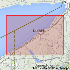
- Dunkirk shale
- Modifications:
-
- Original reference
- Dominant lithology:
-
- Shale
- AAPG geologic province:
-
- Appalachian basin
Summary:
Pg. 24 and chart. In Lake Erie section the succession [of Naples beds] is varied by introduction of a third band of black shale lying above horizon of Westhill flags. This is Dunkirk shale. Overlain by Portland shale and underlain by Angola shale, both of which contain an abundance of Naples fossils. [Age is Late Devonian.]
Source: US geologic names lexicon (USGS Bull. 896, p. 642-643).
- Usage in publication:
-
- Dunkirk black shale
- Modifications:
-
- Areal extent
- AAPG geologic province:
-
- Appalachian basin
Summary:
Pg. 1019-1029. Dunkirk black shale, 53 to 55 feet thick, underlies Portland gray shales and overlies Silver Creek shales. Included in Portage group of Lake Erie region. [Age is Late Devonian.]
Source: US geologic names lexicon (USGS Bull. 896, p. 642-643).
- Usage in publication:
-
- Dunkirk shale
- Modifications:
-
- Revised
- AAPG geologic province:
-
- Appalachian basin
Summary:
Pg. 78 and chart. The Dunkirk shale is a black shale occurring next above horizon of Grimes sandstone, apparently within basal Gardeau. [In chart, however, he placed it beneath Gardeau flags.] The formation is regarded as local, not having been observed outside of Chautauqua County, [western New York]. The term "Portland" has been used locally to designate certain shales and flags lying above Dunkirk shale. As this term is preoccupied, and it is now evident that these beds are embraced in upper Gardeau, the name Gardeau will be used to include these beds. [In chart the underlying formation is called Hanover.] Included in Portage. [Age is Late Devonian.]
Named from Dunkirk, Chautauqua Co., western NY.
Source: US geologic names lexicon (USGS Bull. 896, p. 642-643).
- Usage in publication:
-
- Dunkirk shale
- Modifications:
-
- Revised
- AAPG geologic province:
-
- Appalachian basin
Summary:
Pg. 4, 7-65. Dunkirk shale excluded from Gardeau shale of Erie County, [western New York], because it is distinct enough to warrant our excluding it. Overlain by Gardeau shale, and underlain by Hanover shale. Included in Portage. [Age is Late Devonian.]
Source: US geologic names lexicon (USGS Bull. 896, p. 642-643).
- Usage in publication:
-
- Dunkirk black shale
- Modifications:
-
- Revised
- AAPG geologic province:
-
- Appalachian basin
Summary:
Pg. 157. Dunkirk black shale included in Chemung. Overlain by Gowanda ("Portland") beds and disconformably underlain by Hanover shales. [Age is Late Devonian.]
Source: US geologic names lexicon (USGS Bull. 896, p. 642-643).

- Usage in publication:
-
- Dunkirk shale
- Modifications:
-
- Areal extent
- AAPG geologic province:
-
- Appalachian basin
Summary:
Pg. 69. Dunkirk shale of Chautauqua County [western New York] is overlain by Gowanda shale and underlain by Hanover shale; in Cattaraugus County [western New York] it is overlain by Gowanda beds and underlain by Wiscoy shale (In part = Hanover shale). Assigned to Chemung. Equivalent to upper part of Cayuta shale member of Chemung. [Age is Late Devonian.]
Source: US geologic names lexicon (USGS Bull. 896, p. 642-643).

- Usage in publication:
-
- Dunkirk black shale
- Modifications:
-
- Areal extent
- AAPG geologic province:
-
- Appalachian basin
Summary:
Pg. 149-157. Dunkirk black shale extends from Van Buren Point, on Lake Erie, to Holland, [western New York], where it is over 160 feet thick. Two characteristic (and unlike) septarian zones divide it into three members, throughout this distance, the upper of which was included by Luther in his overlying Portland shales. Included in Chemung group. Underlies Gowanda beds and overlies Hanover shale. [Age is Late Devonian.]
Source: US geologic names lexicon (USGS Bull. 896, p. 642-643).

- Usage in publication:
-
- Dunkirk shale
- Modifications:
-
- Overview
- AAPG geologic province:
-
- Appalachian basin
Summary:
Pg. 369. Included in the Chemung the Dunkirk shale and all overlying beds up to top of Chadakoin of Chadwick. [Age is Late Devonian.]
Source: US geologic names lexicon (USGS Bull. 896, p. 642-643).
- Usage in publication:
-
- Dunkirk shale
- Modifications:
-
- Revised
- AAPG geologic province:
-
- Appalachian basin
Summary:
Included Fall Creek conglomerate in Dunkirk shale, making it basal bed of the Dunkirk. He repeated this classification in GSA Bull., v. 46, no. 2, p. 323, 1935. In both reports he transferred to his Canadaway group (q.v.) Dunkirk shale and all overlying beds up to top of Northeast shale. [Age is Late Devonian.]
Source: US geologic names lexicon (USGS Bull. 896, p. 642-643).

- Usage in publication:
-
- Dunkirk shale
- Dunkirk sandstone
- Modifications:
-
- Overview
- AAPG geologic province:
-
- Appalachian basin
Summary:
Dunkirk shale (also Dunkirk sandstone). In Steuben and adjacent counties of south-central New York the Dunkirk is a sandstone and is called Dunkirk sandstone. To west the formation is shale and is called Dunkirk shale. Age is Late Devonian.
Source: US geologic names lexicon (USGS Bull. 896, p. 642-643).
- Usage in publication:
-
- Dunkirk Shale Member*
- Modifications:
-
- Areal extent
- AAPG geologic province:
-
- Appalachian basin
Summary:
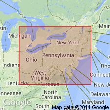
Dunkirk Shale Member of Perrysburg Formation extended from southwestern NY into western PA, eastern OH, and northernmost WV.
Source: GNU records (USGS DDS-6; Reston GNULEX).

- Usage in publication:
-
- Dunkirk Shale Member*
- Modifications:
-
- Areal extent
- AAPG geologic province:
-
- Appalachian basin
Summary:
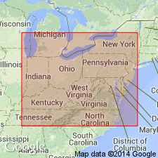
In the type area, Perrysburg consists of the Dunkirk Shale Member (a basal black shale with calcareous nodules), the South Wales Member (a medial gray shale and siltstone sequence), and the Gowanda Shale Member (an upper gray shale and mudrock sequence with calcareous nodules and scattered beds of siltstone and black shale). Most of these rocks are fine to very fine grained. To the south and east, they grade into and interfinger with coarser grained quartzose rocks. The Dunkirk is the youngest extensive black shale in the NY section. In the subsurface, the Dunkirk extends from western NY to north-central WV and the net thickness of radioactive black shale exceeds 100 ft in northwestern PA. Near the PA-OH State line, the Dunkirk grades westward into the lower part of the Huron Member of the Ohio Shale. The vertical boundary between the Dunkirk Shale Member of the Perrysburg and the Huron Member of the Ohio is an arbitrary boundary set up for convenience and is not based on lithologic change.
Source: GNU records (USGS DDS-6; Reston GNULEX).
- Usage in publication:
-
- Dunkirk Shale Tongue
- Modifications:
-
- Revised
- AAPG geologic province:
-
- Appalachian basin
Summary:
Cross section between Norton and Asberrys, VA, in the Clinch Mountain outcrop belt shows more detailed divisions of Chattanooga Shale than previously indicated. Base of Chattanooga marked by Belpre Ash. Ascending, members are Rhinestreet Shale, Angola Shale, Java Shale (including the Center Hill Ash), Dunkirk Shale Tongue of Huron Shale Member and remaining upper part of Huron, Three Lick Bed, Cleveland Shale Member, and Sunbury Shale Member. According to authors, divisions are based on careful outcrop description and outcrop gamma-ray log. Divisions can be traced by borehole gamma-ray logs to their type areas in OH and NY.
Source: GNU records (USGS DDS-6; Reston GNULEX).
- Usage in publication:
-
- Dunkirk Shale
- Modifications:
-
- Biostratigraphic dating
- AAPG geologic province:
-
- Appalachian basin
Summary:
Pg. 166. Dunkirk Shale of Canadaway Group. Dark petroliferous shale. Overlies Hanover Shale Member of Java Formation; contact placed at massive black shale of the Dunkirk. Basal part carries conodonts PALMATOLEPIS TRIANGULARIS Sannemann, P. SUBPERLOBATA Branson and Mehl, P. DELICATULA DELICATULA Branson and Mehl, and P. CLARKI Ziegler. Age is Late Devonian (early Famennian; Middle TRIANGULARIS zone).
Source: Publication.
For more information, please contact Nancy Stamm, Geologic Names Committee Secretary.
Asterisk (*) indicates published by U.S. Geological Survey authors.
"No current usage" (†) implies that a name has been abandoned or has fallen into disuse. Former usage and, if known, replacement name given in parentheses ( ).
Slash (/) indicates name conflicts with nomenclatural guidelines (CSN, 1933; ACSN, 1961, 1970; NACSN, 1983, 2005, 2021). May be explained within brackets ([ ]).