- Usage in publication:
-
- Dry Creek shales*
- Modifications:
-
- Original reference
- Dominant lithology:
-
- Shale
- AAPG geologic province:
-
- Montana folded belt
Summary:
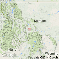
Dry Creek shales. Shales or shaly calcareous sandstones which rest on the glauconitic or pebbly layers that cap the mottled limestones of Gallatin formation in Threeforks region and are overlain by the pebbly limestones forming top member of the Gallatin. Outcrops obscure in most places. Best exposures seen on Dry Creek [northeast corner of Threeforks (Three Forks) quadrangle], where thickness is 30+/- feet. Here they consist of brownish-yellow, red and pink sandstones, sacchariodal, breaking into thin laminae, with streaks and seams of calcite. No fossils. Age is Cambrian.
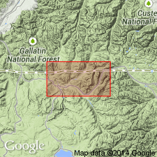
Mapped with Gallatin formation north of East Gallatin River in Dry Creek (T. 1 N., R. 4 E.), Gallatin County, Montana.
Source: US geologic names lexicon (USGS Bull. 896, p. 635); supplemental information from GNU records (USGS DDS-6; Denver GNULEX).
- Usage in publication:
-
- Dry Creek shales*
- Modifications:
-
- Principal reference
- AAPG geologic province:
-
- Montana folded belt
Summary:
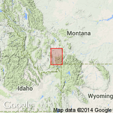
Dry Creek shales. Consist of 30 feet of brownish, yellow, red, and pink saccharoidal shales and thin-bedded sandstones. Underlies 145 feet of light-colored laminated limestones, pebbly throughout and glauconitic.
[Type locality of Dry Creek shale is in northeast corner of Threeforks (Three Forks) quadrangle.]
Source: US geologic names lexicon (USGS Bull. 896, p. 635).
- Usage in publication:
-
- Dry Creek shale*
- Modifications:
-
- Areal extent
- AAPG geologic province:
-
- Sweetgrass arch
Summary:
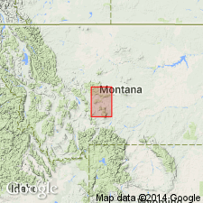
Dry Creek shale. The reddish argillaceous or arenaceous beds of Dry Creek shale, usually about 40 feet thick are underlain by Pilgrim limestone and overlain by Yogo limestone, which consists of gray or mottled limestone with a few layers of interbedded shale. [Age is Late Cambrian.]
Source: US geologic names lexicon (USGS Bull. 896, p. 635).
- Usage in publication:
-
- Dry Creek shale*
- Modifications:
-
- Areal extent
- AAPG geologic province:
-
- Sweetgrass arch
Summary:
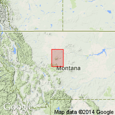
Dry Creek shale. The brick-red shales and limestones constituting Dry Creek shale are overlain by 100 feet of Yogo limestone. [Age is Late Cambrian.]
Source: US geologic names lexicon (USGS Bull. 896, p. 635).
- Usage in publication:
-
- Dry Creek shale*
- Modifications:
-
- Revised
- Age modified
- AAPG geologic province:
-
- Sweetgrass arch
Summary:
Pg. 286. Dry Creek shale. Brick-red and bright-yellow sandy shale, 40 to 50 feet thick, between Pilgrim limestone (Middle Cambrian) and Jefferson formation (Devonian). Good sections at head of King Creek, near Yogo, in Big Park, on Belt Creek above Monarch, and on Pilgrim Creek, central southern Montana. Age is considered Middle Cambrian. [See also 1900 entry under Yogo.]
Source: Publication.
- Usage in publication:
-
- Dry Creek shale*
- Modifications:
-
- Areal extent
- AAPG geologic province:
-
- Montana folded belt
Summary:
Pg. 91. Dry Creek shale of Helena district [northwest of Threeforks (Three Forks) quadrangle] consists of 40 feet of light-colored brownish-yellow, red, and pink shales and calcareous sandstone. Correlated on basis of lithology and stratigraphic position with Dry Creek shale of Threeforks and Little Belt regions. Age is considered Middle Cambrian.
Source: US geologic names lexicon (USGS Bull. 896, p. 635).
- Usage in publication:
-
- Dry Creek shale
- Modifications:
-
- Principal reference
- Revised
- Dominant lithology:
-
- Shale
- Limestone
- AAPG geologic province:
-
- Central Montana uplift
- Montana folded belt
- Sweetgrass arch
- Yellowstone province
Summary:
Pg. 1284, 1335-1337, strat. sections. Weed's (1900) definition of Dry Creek shale emended. Dry Creek rests on Pilgrim limestone (emended) and is youngest Cambrian formation in any of measured sections. Underlies Devonian limestones; term Yogo limestone discard. Characteristically bright maroon and yellow-buff dolomitic sandy calcareous mudstones, interbedded with red and green shales and thin limestones. Average thickness 68 feet, exclusive of Checkerboard and Helena sections. From maximum thickness of 99 feet, on Belt Creek, formation thins eastward to 32 feet in Big Snowy Mountains, and westward to extinction in Beaver Creek area in Big Belt Mountains; thickness 50 feet at emended type section, herein designated. Weed (1900) defined Dry Creek shale as lying "between the beds of the massive Pilgrim limestone and the dark chocolate-colored beds of the Jefferson formation." The statement gives exactly the actual conditions observable wherever these rocks are exposed and is concise in placing Cambrian-Devonian boundary at top of Dry Creek shale. Consequently, Yogo limestone or any other Cambrian rocks could not be present in Little Belt Mountains above Dry Creek. That Weed did not find Cambrian rocks in these mountains is implied in his statement. If Weed's statement had not been confused by the definition of the fictitious Yogo limestone, much confusion would have been avoided, and a more correct picture of Cambrian stratigraphy in central Montana would have resulted. Weed (1900) did not specify type section for Dry Creek shale, name of which he obviously took from Peale's (1893) Three Forks section, instead of from Little Belt Mountains. Type of Dry Creek shale (formation) must be in Little Belt Mountains province, or serious confusion will result. In section on north side of Dry Wolf Creek, Little Belt Mountains, Dry Creek shale is sharply defined at its top by SPIRIFER bed which marks base of Devonian. However, Dry Creek shale is better exposed in Yogo Gulch, and lower 13 feet contain only identifiable Dry Creek fossils in Montana known to writer. Age is latest Cambrian. [See also Flathead quartzite.]
Type section (emended): on north side of Yogo Gulch, on northeastern side of Little Belt Mountains, Judith Basin Co., MT. Section measured approx. 1/8 mi west of mouth of Bear Creek, in SE/4 sec. 1, T. 13 N., R. 10 E. Peal (1893) did not designate type locality but stated unit was best exposed on Dry Creek, northeast corner Three Forks quadrangle, Gallatin Co.
Source: US geologic names lexicons (USGS Bull. 896, p. 635; USGS Bull. 1200, p. 1163-1165).
- Usage in publication:
-
- Dry Creek shale*
- Modifications:
-
- Not used
- AAPG geologic province:
-
- Montana folded belt
- Sweetgrass arch
- Central Montana uplift
- Yellowstone province
Summary:
Pg. 551. Unit termed Dry Creek shale by Deiss (1936) apparently represents lower part of Snowy Range formation (new); [Dry Creek not used].
Source: US geologic names lexicon (USGS Bull. 1200, p. 334-335); supplemental information from GNU records (USGS DDS-6; Denver GNULEX).
- Usage in publication:
-
- Dry Creek shale*
- Modifications:
-
- Areal extent
- AAPG geologic province:
-
- Williston basin
Summary:
Extended into Little Rocky Mountains region, Blaine and Phillips Counties, Montana (Williston basin). Name applied to a sequence 60 feet thick of variegated, thinly bedded dolomite, intraformational conglomerate, and shale. Formerly included in the Deadwood formation in the Little Rocky Mountains, Montana, by Collier and Cathcart (1922). Overlain by Bighorn limestone; underlain by unnamed Cambrian rocks. Age is Cambrian.
Source: Modified from GNU records (USGS DDS-6; Denver GNULEX).
- Usage in publication:
-
- Dry Creek shale
- Modifications:
-
- Revised
- AAPG geologic province:
-
- Montana folded belt
- Sweetgrass arch
Summary:
Pg. 2-3, 4 (fig. 1), 6-12. Dry Creek shale is partly emended by resticting all limestone pebble conglomerates and gray-green shales to underlying Pilgrim formation. This revision gives lithologic unity to both Dry Creek and Pilgrim in all sections and restricts fossil horizons to Pilgrim. As thus emended, contact between the two formations differs in most sections from that designated by Deiss (1936). Unconformably underlies Devonian Jefferson dolomite; boundary arbitrarily placed at base of first thick-bedded, chocolate-brown, strongly petroliferous limestones typical of Jefferson. At Mount Helena section (=Deiss' Grizzly and Oro Fino Gulches section), west of Big Belt Mountains, Lewis and Clark County, Montana, rocks tentatively assigned by Deiss (1936) to Dry Creek are reallocated to Red Lion formation due to similarity to Red Lion of Philipsburg area, Granite County, Montana. Age is Late Cambrian, based on stratigraphic position.
Source: US geologic names lexicon (USGS Bull. 1200, p. 1163-1165); supplemental information from GNU records (USGS DDS-6; Denver GNULEX).
- Usage in publication:
-
- Dry Creek shale
- Modifications:
-
- Revised
- AAPG geologic province:
-
- Montana folded belt
Summary:
Pg. 1405-1406, 1407-1409, 1413, 1415. Dry Creek shale. In central Montana, shales, mudstones, and argillaceous dolomites assigned to Devonian are apparently transitional with beds lithologically like Upper Cambrian Dry Creek shale. Weed (1900) and Deiss (1936) assigned all shales to Cambrian, although Deiss recognized difficulty of separating them from Devonian. It is believed that a variable proportion of the shale previously placed in the Cambrian is Devonian in age. In Three Forks area, basal Devonian rocks are predominantly red shales, mudstones, and argillaceous dolomites. These beds are in apparent transition with underlying Cambrian strata and were formerly grouped with them in Dry Creek shale. For purposes of this report, the glauconitic, micaceous, and sandy shales associated with flat-pebble conglomerates, bearing trilobite fragments and phosphatic brachiopods, are assigned to the Cambrian Dry Creek shale; the non-micaceous and less fissile shales and mudstones interbedded with rocks of Devonian-type are placed in the Devonian ("basal Devonian unit" and "beds of undetermined age" unit). At Logan, Judith Basin County, Montana, the Dry Creek shale is 45 feet thick. At Yogo Creek section, Judith Basin County, Montana, the Dry Creek shale is 34 feet thick. Overlies Pilgrim limestone; underlies "beds of undetermined age." Age is Late Cambrian.
Source: US geologic names lexicon (USGS Bull. 1200, p. 1163-1165); supplemental information from GNU records (USGS DDS-6; Denver GNULEX).
- Usage in publication:
-
- Dry Creek shale member
- Modifications:
-
- Revised
- AAPG geologic province:
-
- Montana folded belt
Summary:
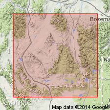
Pg. 2200-2222. Dry Creek shale member of Snowy Range formation. Name Dry Creek shale was originally proposed by Peale (1893, USGS Bull. 110) for small nonfossiliferous unit in Gallatin formation in Upper Cambrian sequence in vicinity of Three Forks, Montana. Weed (1899, USGS Geol. Atlas of the US, Fort Benton folio, no. 55) used same name for formation of brick-red shales and dolomites, a unit entirely different in age, lithology, and stratigraphic position from that of Peale. Subsequent usage of term, with or without definition, has been regarded by authors as implying that they were referring to beds which where wholly or in part the equivalent of original Dry Creek shale member of Peale. With exception of Knopf (1913, USGS Bull. 527), no author using Dry Creek shale as formational unit in Montana sections referred to beds which were lithologic or time equivalent of Peale's Dry Creek shales. Names should be used as originally defined by Peale, but strata involved do not constitute a mappable lithic unit by present mapping standards. Peale's Dry Creek shales constitute lower member of Snowy Range formation; name Sage pebble conglomerate is proposed for upper member of this formation. Weed's (1899) formation of brick-red shales and dolomites is mappable lithic unit of Devonian age; it is basal Devonian unit (unit C) of Sloss and Laird (1947, AAPG Bull., v. 31, no. 8) should be called Maywood formation, the name proposed by Emmons and Calkins (1913, USGS Prof. Paper 78) for same lithologic unit in Philipsburg quadrangle. Age is Late Cambrian.
[Study area in Horseshoe Hills area between Logan and Dry Creek, Gallatin County, Montana. Thickness 35 to 60 feet.]
Source: US geologic names lexicon (USGS Bull. 1200, p. 1163-1165); supplemental information (in brackets) from GNU records (USGS DDS-6; Denver GNULEX).
- Usage in publication:
-
- Dry Creek shale
- Modifications:
-
- Not used
- AAPG geologic province:
-
- Montana folded belt
Summary:
Pg. 2146. Term Red Lion formation favored for beds formerly assigned to Dry Creek shale in extreme southwestern Montana. Study area is south of Boulder batholith and west of Yellowstone National Park, within parts of Beaverhead, Madison, and Gallatin Counties, Montana. Authors prefer nomenclature used in Philipsburg quadrangle, located to north of study area, for Upper Cambrian carbonate rocks.
Source: US geologic names lexicon (USGS Bull. 1200, p. 1163-1165); supplemental information from GNU records (USGS DDS-6; Denver GNULEX).
- Usage in publication:
-
- Dry Creek shale member
- Modifications:
-
- Revised
- Areal extent
- AAPG geologic province:
-
- Montana folded belt
Summary:
Pg. 12, 18, pl. 5. Dry Creek shale member of Red Lion formation. Lochman restricted term Dry Creek to Peale's original usage, and, as thus defined, the Dry Creek shale becomes lower shale member of Red Lion formation in southwestern Montana, from Phillipsburg, Granite County, to Madison Range, Madison County. Conformably overlies Pilgrim formation; conformably underlies Sage pebble conglomerate member. Thickness commonly 20 feet; locally absent at Camp, Whitetail, and Jourdain Creeks. Age is Late Cambrian.
[Misprint: US geologic names lexicon (USGS Bull. 1200, p. 1164-1165) states Dry Creek shale "overlies Sage pebble conglomerate member." Underlies Sage.]
Source: US geologic names lexicon (USGS Bull. 1200, p. 1163-1165); supplemental information from GNU records (USGS DDS-6; Denver GNULEX).
- Usage in publication:
-
- Dry Creek shale
- Modifications:
-
- Revised
- AAPG geologic province:
-
- Yellowstone province
- Green River basin
- Bighorn basin
- Wind River basin
Summary:
Chart 2 (footnote). Lochman (1950) revised and redescribed Dry Creek shale and named what, in Wyoming, is called "upper Gallatin limestone" the Sage pebble conglomerates. This name seems applicable in Wyoming, but because of lithic changes it is better called Sage limestone. Dry Creek shale is thin and rarely mappable and most commonly should be regarded as member of Sage limestone. Gallatin is herein raised to rank of group with Sage limestone as upper member. Age is Late Cambrian (early Franconian).
[Misprint: US geologic names lexicon (USGS Bull. 1200, p. 1165) states Gallatin is herein raised to rank of group with Sage limestone as upper member. Sage limestone is upper formation.]
Source: US geologic names lexicon (USGS Bull. 1200, p. 1163-1165); supplemental information from GNU records (USGS DDS-6; Denver GNULEX).
- Usage in publication:
-
- Dry Creek shale member
- Modifications:
-
- Areal extent
- AAPG geologic province:
-
- Montana folded belt
Summary:
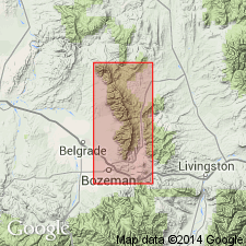
Pg. 1388-1390 (table 1), 1392, 1395. Dry Creek shale member of Snowy Range formation. In Bridger Range, Gallatin County, Montana, is lower member of Snowy Range formation (following Lochman, 1950, AAPG Bull., v. 34; Peale, 1893). Consists of gray-green fissile shale with interbedded yellow calcareous siltstone and sandstone. Thickness 42 to 76 feet. Overlies Maurice formation; underlies Sage pebble-conglomerate member of Snowy Range. No fossils recovered. Age is considered Late Cambrian, based on stratigraphic position.
Source: Publication.
- Usage in publication:
-
- Dry Creek shale member
- Modifications:
-
- Revised
- AAPG geologic province:
-
- Yellowstone province
- Green River basin
- Wind River basin
Summary:
Pg. 38, 39 (fig. 1), 40 (fig. 2), 41. Rank reduced to member status in Open Door limestone (new) of Gallatin group in Teton County (Yellowstone province), Sublette County (Greater Green River basin), and in Fremont County (Wind River basin), southwestern Wyoming. Overlies Du Noir limestone of Gallatin group. Forms basal part of formation; name applied to the weak reentrant-forming part of Open Door. Age is Late Cambrian. The Dresbachian-Franconian boundary lies within the Dry Creek shale member.
Source: US geologic names lexicon (USGS Bull. 1200, p. 1163-1165); supplemental information from GNU records (USGS DDS-6; Denver GNULEX).
- Usage in publication:
-
- Dry Creek shale*
- Modifications:
-
- Not used
Summary:
Name not used in Little Rocky Mountains, Blaine and Phillips Counties, Montana (Williston basin). Emerson formation (new) proposed for rocks lying between Flathead sandstone and Bighorn dolomite, including the part formerly referred by Knechtel (1944, USGS Oil and Gas Inv. Map OM-4) as the Dry Creek shales.
Source: GNU records (USGS DDS-6; Denver GNULEX).
- Usage in publication:
-
- Dry Creek shale*
- Modifications:
-
- Not used
Summary:
Pg. 400-401. Dry Creek shale not used in this report [area east and southeast of Livingston, Park and Sweet Grass Counties, Montana] because of inconsistencies in use of name. Replaced with Snowy Range formation. Formation in this area apparently includes beds in stratigraphic position of Peale's Dry Creek shales and pebbly limestones and still younger beds.
Source: US geologic names lexicon (USGS Bull. 1200, p. 1163-1165); supplemental information from GNU records (USGS DDS-6; Denver GNULEX).
- Usage in publication:
-
- Dry Creek Member
- Modifications:
-
- Age modified
- AAPG geologic province:
-
- Montana folded belt
- Central Montana uplift
- Bighorn basin
- Yellowstone province
Summary:
Snowy Range Formation measured at 24 locations in Horseshoe Hills and Bridger Mountains, Montana, and at 8 locations near Yellowstone National Park, between Missouri River and Clarks Fork of Yellowstone River, in Gallatin, Park, and Carbon Counties, Montana, and Park County, Wyoming (Montana folded belt province, Central Montana uplift, Bighorn basin, and Yellowstone province). Snowy Range divided into (ascending) Dry Creek, Sage, and Grove Creek Members. Dry Creek Member is present at all measured sections except at Mount Ellis where it is faulted out. Thickness in Horseshoe Hills ranges from 30 to 95 feet, averaging 55 feet; in Bridger Mountains ranges from 45 to 105 feet, averaging 65 feet; between Bridger Mountains and Yellowstone, ranges from 15 to 30 feet; at Mill Creek it is 105 feet thick; and east of Yellowstone it is a relatively constant 50 feet. Overlies Pilgrim Formation with sharp contact. Age is early and middle Late Cambrian (Dresbachian and Franconian), based on fossils. At 3 localities, Bill Smith Creek and Bighorn Lake in Bridger Mountains, Montana, and at Fox Creek, in Park County, Wyoming, fossils of early Late Cambrian age (Dresbachian APHELASPIS Zone) identified from lower part of member. Report includes petrographic descriptions, fossil list and descriptions, cross sections showing trilobite zones.
Source: Modified from GNU records (USGS DDS-6; Denver GNULEX).
- Usage in publication:
-
- Dry Creek Shale Member*
- Modifications:
-
- Reference
- AAPG geologic province:
-
- Yellowstone province
- Montana folded belt
Summary:
Dry Creek Shale Member, basal member of Snowy Range Formation. Mapped undivided with overlying Sage Limestone and Grove Creek Members, in northern part of Yellowstone National Park, Park County, Wyoming, and Park County, Montana. Thickness about 40 feet in Gallatin Range and 50 feet on Buffalo Plateau. Conformably overlies Pilgrim Limestone. Age is Late Cambrian. Report includes stratigraphic chart.
Reference section (for Snowy Range Formation): Three Rivers Peak, at head of Gallatin River in Gallatin Range.
Source: Modified from GNU records (USGS DDS-6; Denver GNULEX).
For more information, please contact Nancy Stamm, Geologic Names Committee Secretary.
Asterisk (*) indicates published by U.S. Geological Survey authors.
"No current usage" (†) implies that a name has been abandoned or has fallen into disuse. Former usage and, if known, replacement name given in parentheses ( ).
Slash (/) indicates name conflicts with nomenclatural guidelines (CSN, 1933; ACSN, 1961, 1970; NACSN, 1983, 2005, 2021). May be explained within brackets ([ ]).

