The National Geologic Map Database is migrating to a new infrastructure. We apologize for any service disruptions during this process.
|
|---|


- Usage in publication:
-
- Doughnut formation*
- Modifications:
-
- Named
- Dominant lithology:
-
- Limestone
- Shale
- AAPG geologic province:
-
- Wasatch uplift
Summary:
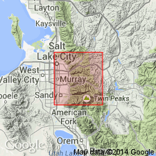
Named "provisionally" for cliffs east and northeast of Doughnut Falls on Mill "D", South Fork of Big Cottonwood Creek, that are called Doughnut Cliffs, [sec 19, T2S, R3E], Salt Lake Co, UT on Wasatch uplift. No type locality designated. Consists of lower beds of resistant, sandy, siliceous tawny-weathering rocks [rock type not specified] succeeded by blue limestone, 50 to 100 ft of black shale, and 200 ft of thin-bedded limestone. Total thickness not given. Limestone is fossiliferous. Overlies Humbug formation. Underlies Morgan? formation. Regional application of name not discussed. Of Carboniferous age. Geologic map.
Source: GNU records (USGS DDS-6; Denver GNULEX).
- Usage in publication:
-
- Doughnut formation*
- Modifications:
-
- Named
- Dominant lithology:
-
- Shale
- Sandstone
- AAPG geologic province:
-
- Wasatch uplift
Summary:
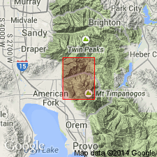
Proposed as a formal name. Type locality is in cliffs, east and northeast of Doughnut Falls, east edge NE1/4 sec 19, T2S, R3E on Mill D South Fork, tributary of Big Cottonwood Creek about 8 mi north of quad, Salt Lake Co, UT on the Wasatch uplift. Occurs only at northeast edge by quad. Overlies main body of Oquirrh formation. Is older than Weber quartzite. Mapped at northeast edge of quad. Cross section. Consists of dark-gray to black shale with a few beds of rusty-weathering sandstone that grades upward into black to dark-gray, thin-bedded, fossiliferous limestone. The limestone weathers to pale-gray to pinkish plates and slabs. Fossils [not listed] indicate entire formation is Late Mississippian. Is 1,200 ft thick on east side of American Fork at northeast edge of quad. Decreases in thickness to northeast. Is less than 300 ft thick in Cottonwood area. Geologic map.
Source: GNU records (USGS DDS-6; Denver GNULEX).
- Usage in publication:
-
- Doughnut Shale*
- Modifications:
-
- Areal extent
- Redescribed
- Dominant lithology:
-
- Shale
- AAPG geologic province:
-
- Green River basin
Summary:
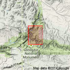
Name Doughnut Formation changed to Doughnut Shale in this quad which lies in the Greater Green River basin. Described as a poorly exposed dark-gray clayey shale (predominant) and red shale (subordinate) near base. Mapped with underlying Humbug Formation across the central part of the map where map unit overlies Madison Limestone and underlies Round Valley Limestone. Assigned a Late Mississippian age.
Source: GNU records (USGS DDS-6; Denver GNULEX).
- Usage in publication:
-
- Doughnut Shale*
- Modifications:
-
- Areal extent
- AAPG geologic province:
-
- Uinta basin
- Uinta uplift
Summary:
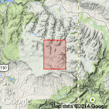
Mapped as several major exposures across quad from the southeast side to the west-central side in Uintah Co in the Uinta basin and Daggett Co in the Uinta uplift. Mapped with underlying Humbug Formation. Underlies Round Valley Limestone. Of Late Mississippian age.
Source: GNU records (USGS DDS-6; Denver GNULEX).
For more information, please contact Nancy Stamm, Geologic Names Committee Secretary.
Asterisk (*) indicates published by U.S. Geological Survey authors.
"No current usage" (†) implies that a name has been abandoned or has fallen into disuse. Former usage and, if known, replacement name given in parentheses ( ).
Slash (/) indicates name conflicts with nomenclatural guidelines (CSN, 1933; ACSN, 1961, 1970; NACSN, 1983, 2005, 2021). May be explained within brackets ([ ]).