

- Usage in publication:
-
- Decker Ferry limestone
- Modifications:
-
- Named
- Dominant lithology:
-
- Limestone
- AAPG geologic province:
-
- Appalachian basin
Summary:
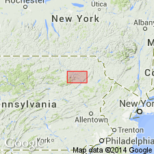
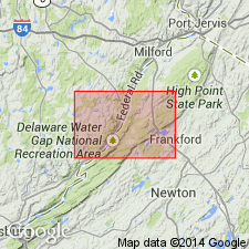
Pg. 76-77, 137-141. Decker Ferry limestone. Bluish gray, usually brecciated limestone, 20 feet thick, underlying Stormville cement bed (which separates it from the overlying Stormville limestone) and overlying Decker Ferry sandstone, which rests on Decker Ferry shales. The limestone often becomes slaty in lower portion, and is usually more or less sandy. In Ross Township, Monroe County, [Pennsylvania], iron ore occurs at horizon of this limestone and in base of overlying Stormville limestone. The Decker Ferry limestone, Decker Ferry sandstone and Decker Ferry shales are all exposed near Decker's Ferry below Flatbrookville, Sussex County, New Jersey. Age is late Silurian.
Source: US geologic names lexicon (USGS Bull. 896, p. 582-583).
- Usage in publication:
-
- Decker Ferry limestone
- Modifications:
-
- Revised
- AAPG geologic province:
-
- Appalachian basin
Summary:
Pg. 62. Applied Decker Ferry limestone to same unit defined by White [1882, Pennsylvania Geol. Survey Rpt. Prog., 2nd ser., v. G6], stating that it "is quite distinct, both faunally and lithologically from underlying Decker Ferry formation here recognized." Weller's Decker Ferry formation included Decker Ferry sandstone and Decker Ferry shale of White, which he stated are closely allied.
Source: US geologic names lexicon (USGS Bull. 896, p. 582-583).

- Usage in publication:
-
- Decker Ferry limestone
- Decker Ferry formation
- Modifications:
-
- Overview
- AAPG geologic province:
-
- Appalachian basin
Summary:
According to C.A. Hartnagel, 1903 (New York State Mus. Bull., no. 69) the "Decker Ferry formation of New Jersey" is = Cobleskill, Rosendale, and Wilbur limestones of New York. In 1905 (New York State Mus. Bull., no. 80, p. 342-357) Hartnagel restricted name Decker Ferry formation to the beds (41 feet thick at Nearpass, New Jersey) beneath the Cobleskill and above Bossardville limestone, or to equivalents of Rosendale and Wilbur limestones of [previous] reports and stated that Decker Ferry formation of Weller included also the equivalent of the Cobleskill. Hartnagel's Decker Ferry formation consisted of 15 feet of limestones and shales, underlain by 2 feet of red crystalline limestone characterized by PTILODICTYA FRONDOSA, which rested on 24 feet of highly fossiliferous hard crystalline limestone designated CHONETES JERSEYENSIS zone. In 1908 (New York State Mus. Bull., no. 107, p. 51) Hartnagel divided the Salina of Ulster County, New York, into (descending): Decker Ferry (=Rosendale cement and Wilbur limestone); Binnewater sandstone; and High Falls shale; the latter two correlated with Longwood shale. (At Port Jervis, Orange County, New York, he identified the Decker Ferry beneath the Cobleskill and above the Bossardville limestone). In New York State Mus. Hdbk., no. 19, 1912, Hartnagel stated that Decker Ferry formation is best developed in Pennsylvania and New Jersey and that the most favorable place for its examination in New York is at Accord, [Ulster County], where entire thickness is shown.
In 1908 (USGS Franklin Furnace folio, no. 161) the name was shortened to Decker limestone and was applied to 50 feet of dark-gray impure siliceous and shaly limestone overlying Longwood shale and containing fossils which correlated it "with the lower portion of the 'Decker Ferry' limestone on Delaware River and the upper Salina beds of New York."
In 1913 (Maryland Geol. Survey Lower Devonian vol., table opp. P. 30) C.K. Swartz, C. Schubert, and C.S. Prosser correlated Decker Ferry limestone of New Jersey with Decker Ferry of New York, and with Cobleskill, Rosendale, and Wilbur limestones, the Cobleskill being overlain by Rondout limestone. All of these formations they classified as Lower Devonian. The same year, on p. 115 to 116 of same volume, E.O. Ulrich assigned the Decker Ferry of New York to Lower Devonian, and showed it as underlying the Rondout and as younger than typical Manlius limestone, which he stated rests on the Cobleskill and which he assigned to Silurian. In 1915 (New Jersey Geol. Survey Bull., no. 14) J.V. Lewis and H.B. Kummel gave the following sequence of Silurian formations of New Jersey (descending): Manlius limestone; Rondout limestone; Decker limestone (52 feet of limestone to northeast and calcareous sandstones to southwest, with Salina fossils); Bossardville limestone; Poxino[sic] Island shale; High Falls formation (=Longwood shale); Shawangunk conglomerate.
The age and stratigraphic relations of Decker limestone are still [ca. 1938] debated.
Source: US geologic names lexicon (USGS Bull. 896, p. 582-583).
- Usage in publication:
-
- Decker Formation*
- Modifications:
-
- Revised
- AAPG geologic province:
-
- Appalachian basin
Summary:
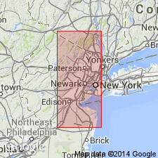
Pg. 4 (fig. 2), 5 (fig. 3), 9, pl. 1. Herein proposed that (1) name Decker Formation (=Decker Ferry Formation of Weller, 1900, New Jersey Geol. Survey Ann. Rpt. State Geol. 1899, p. 7; [also Weller, 1903, New Jersey Geol. Survey Rpt. on Paleo., v. 3]) be applied to strata lying between Bossardville Limestone and Rondout Formation in northeastern Pennsylvania and New Jersey, (2) the calcareous facies northeast of Hainesville area, New Jersey, be designated Clove Brook Member, and (3) the arenaceous facies southwest of Hainesville area be designated Wallpack Center Member. On fig. 3 (p. 5, chart showing previous and present nomenclature) Wallpack Center corresponds to White's (1882, Pennsylvania Geol. Survey Rpt. Prog., 2nd ser., v. G6) Decker Ferry sandstone of northeastern Pennsylvania. Age is Late Silurian. Report includes measured sections. Decker Formation and its members adopted by the USGS.
Source: Publication; GNU records (USGS DDS-6; Reston GNULEX); Changes in stratigraphic nomenclature, 1967 (USGS Bull. 1274-A, p. A5, A6, A7, A20).
- Usage in publication:
-
- Decker Soil*
- Modifications:
-
- Named
- Dominant lithology:
-
- Soil
- AAPG geologic province:
-
- Wasatch uplift
Summary:
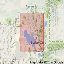
Is an immature dark-gray to light-gray soil consisting of an "A" horizon enriched in organic matter lying over the Ridgeland Formation (new) of Lake Bonneville Group. Is 5 to 30 cm thick. Occurs below the Gilbert shoreline in Salt Lake City area and in desert north of Great Salt Lake. Age is Holocene. Ostracod fossils identified in unit.
Type section: measured in SW/4 SE/4 sec. 20, T. 1 S., R. 1 W. Named for Decker Pond, 1.5 km southeast of type section, Salt Lake Co., UT (Wasatch uplift).
Source: Modified from GNU records (USGS DDS-6; Denver GNULEX).
- Usage in publication:
-
- Decker Formation
- Modifications:
-
- Areal extent
- AAPG geologic province:
-
- Appalachian basin
Summary:
Rondout and Decker Formations mapped undivided, but discussed separately in text. Decker is light- to medium-gray, calcareous quartz siltstone and sandstone, locally a fine-pebble conglomerate. Locally interbedded with medium-gray, medium- to coarse-grained, thin- to medium-bedded limestone and very fine-grained dolomite. Total thickness approximately 72 feet. Lower contact with Bossardville Limestone is gradational. Age is Late Silurian.
Source: GNU records (USGS DDS-6; Reston GNULEX).
- Usage in publication:
-
- Decker Formation*
- Modifications:
-
- Age modified
- Biostratigraphic dating
- AAPG geologic province:
-
- Appalachian basin
Summary:
Age of Decker Formation refined to late Pridolian. Contains conodont species OULODUS ELEGANS, which is no older than late Ludlovian and no younger than latest Pridolian. Regional stratigraphic relationships indicate late Pridolian age.
Source: GNU records (USGS DDS-6; Reston GNULEX).
For more information, please contact Nancy Stamm, Geologic Names Committee Secretary.
Asterisk (*) indicates published by U.S. Geological Survey authors.
"No current usage" (†) implies that a name has been abandoned or has fallen into disuse. Former usage and, if known, replacement name given in parentheses ( ).
Slash (/) indicates name conflicts with nomenclatural guidelines (CSN, 1933; ACSN, 1961, 1970; NACSN, 1983, 2005, 2021). May be explained within brackets ([ ]).