

- Usage in publication:
-
- Copper Basin Formation*
- Modifications:
-
- Named
- Dominant lithology:
-
- Siltstone
- Quartzite
- Argillite
- Conglomerate
- Limestone
- AAPG geologic province:
-
- Idaho Mountains province
Summary:
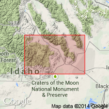
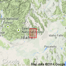
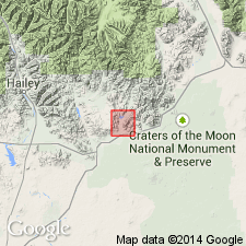
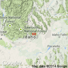
Named for exposures in upper part of Star Hope Creek at south edge of Copper Basin depression near the middle of the western part of the Mackay quad, Custer Co, ID in the Idaho Mountains province. [These exposures inferred to be the type locality.] May be more than 10,000 ft thick at its type. Thought to be continuous to north, south, and southwest, and possibly into the Lost River Range to the east. Includes siltstone, sandy quartzite, argillite, conglomerate, and limestone. [Detailed lithologic description and lithologic sequence not given.] Is scantily fossiliferous, indicating an Early Mississippian and Pennsylvanian age. May also include some Permian-age rocks. Is interleaved with the Milligen, Wood River, and White Knob (new) Formations. May be underlain in part by the Milligen Formation. Is probably overlain locally by Wood River and by White Knob. Assigned an age range of Early Mississippian to Early Permian.
Source: GNU records (USGS DDS-6; Denver GNULEX).
- Usage in publication:
-
- Copper Basin Formation*
- Modifications:
-
- Age modified
- Overview
- AAPG geologic province:
-
- Idaho Mountains province
- Snake River basin
Summary:
Mapped. Best exposures in southern half and north-central part of quad, Blaine and Butte Cos, ID, Snake River basin and Custer Co, ID, Idaho Mountains province. Consists of quartzite, sandstone, siltstone, argillite, mudstone, conglomerate, and limestone; limestone and argillite interbeds in middle part of unit. Thickness not given. Unconformably underlies Challis Volcanics; overlies Milligen Formation. Intertongues with part of White Knob Limestone, however, there is no paleontologic or stratigraphic evidence to indicate that any of the Copper Basin is younger than Pennsylvanian. Assigned Early Mississippian to Late Pennsylvanian age.
Source: GNU records (USGS DDS-6; Denver GNULEX).

- Usage in publication:
-
- Copper Basin Group
- Modifications:
-
- Revised
- AAPG geologic province:
-
- Snake River basin
- Idaho Mountains province
Summary:
Raised to group rank and divided into six formations (ascending): Lower? to Upper Mississippian Milligen Formation, 3,700+ ft thick; Upper Mississippian Drummond Mine Limestone (new), 2,620 ft thick; Upper Mississippian Scorpion Mountain Formation (new), 3,625 ft thick; Upper Mississippian? to Lower Pennsylvanian? Muldoon Canyon Formation (new), 4,150 ft thick and its Green Lake Limestone Member near top; Lower? and Middle? Pennsylvanian Brockie Lake Conglomerate (new), 2,150 ft thick; Middle? Pennsylvanian Iron Bog Creek Formation (new), 1,500 ft thick. This sequence continuous in central Pioneer Mountains, Custer Co, Idaho Mountains province and Blaine Co, ID, Snake River basin. Base of Milligen not observed. Correlation chart. Measured sections.
Source: GNU records (USGS DDS-6; Denver GNULEX).
- Usage in publication:
-
- Copper Basin Formation*
- Modifications:
-
- Age modified
- AAPG geologic province:
-
- Snake River basin
Summary:
An interbedded sequence of gray quartzite, granule to cobble conglomerate, argillite and limestone mapped at the Fish Creek Reservoir, called lower part of Copper Basin Formation. The sequence is about 3,000 ft thick and is thought to be equivalent to the Milligen Formation, Drummond Mine Limestone, and Scorpion Mountain Formation in the lower part of the Copper Basin Group of Paull and others (1972). Geologic map; mapped area lies in Blaine Co, ID in the Snake River basin. Copper Basin is younger than Picabo Formation and older than Wood River Formation. Is a turbidite, interturbidite and submarine fan deposit. Paleontologic evidence suggests Copper Basin is probably entirely Mississippian age. No Pennsylvanian fossils have been identified. Conodonts and calcareous forams suggest Early to Late Mississippian age.
Source: GNU records (USGS DDS-6; Denver GNULEX).
- Usage in publication:
-
- Copper Basin Group
- Modifications:
-
- Revised
- Age modified
- AAPG geologic province:
-
- Snake River basin
Summary:
Name Milligen Formation removed from Copper Basin Group and restricted to area of Wood River valley, Blaine and Custer Cos, ID where it is a Devonian age unit. Rocks formerly assigned to Milligen beneath Drummond Mine Limestone of Copper Basin Group renamed Little Copper Formation. Little Copper is 1,120 m thick. Stratigraphic chart. In central Pioneer Mountains, Custer Co, ID, Snake River basin, Copper Basin includes the Lower Mississippian Little Copper Formation, Drummond Mine Limestone, Scorpion Mountain Formation, the Lower and Upper Mississippian Muldoon Canyon Formation, and the Upper Mississippian Brockie Lake Conglomerate and Iron Bog Creek Formation. [These age assignments differ from those assigned earlier (1972) to formations of Copper Basin Group though evidence for ages of Drummond Mine-Bog Creek not discussed.]
Source: GNU records (USGS DDS-6; Denver GNULEX).
- Usage in publication:
-
- Copper Basin Formation*
- Modifications:
-
- Areal extent
- AAPG geologic province:
-
- Idaho Mountains province
Summary:
Restricted from White Knob Mountains, Custer Co, ID. [Mapped in White Knob Mountains by Nelson and Ross (1969). In this report, in the White Knob Mountains, the Milligen and Copper Basin Formations of Nelson and Ross are replaced by McGowan Creek Formation.] Occurs in Pioneer Mountains, southwest of White Knob Mountains, in Butte and Blaine Cos, ID, Snake River basin and Custer Co, ID, Idaho Mountains province. Cross sections; isopach maps. Correlation chart shows that lower part correlates with McGowan Creek Formation and upper part correlates with all but uppermost part of White Knob Limestone. Lower Mississippian and lowermost Upper Mississippian part is more than 3,316 m thick; Upper Mississippian part has minimum thicknesses ranging from 580-2,000 m thick. Lower part is interpreted as foreland-basin flysch; upper part interpreted to be deposited in a shoaling foreland basin. Upper part is bounded by thrust faults. Unconformably overlies Picabo Formation; overlying units not discussed.
Source: GNU records (USGS DDS-6; Denver GNULEX).
- Usage in publication:
-
- Copper Basin Formation*
- Modifications:
-
- Revised
- AAPG geologic province:
-
- Idaho Mountains province
- Snake River basin
Summary:
Two sequences of Copper Basin mapped. The one in the Copper Basin thrust plate is divisible into (ascending order) Little Copper Member (reduced in stratigraphic rank), Drummond Mine Limestone Member (reduced in stratigraphic rank), and an upper clastic unit. The Copper Basin plate occupies 50 sq mi along Star Hope, Iron Bog, and Muldoon Creeks, Custer and Blaine Cos, ID, Idaho Mountains province and Snake River basin. The Glide Mountain plate is exposed at Glide Mountain on southwest side of Copper Basin and in north-central part of study area, Custer Co, ID in Idaho Mountains province. In Glide Mountain plate, Copper Basin separable into three parts where Green Lake Limestone Member is recognized. In both plates evidence points to an Early Mississippian, Kinderhookian age.
Source: GNU records (USGS DDS-6; Denver GNULEX).
- Usage in publication:
-
- Copper Basin Formation*
- Modifications:
-
- Overview
Summary:
Mapped mostly in northern half of study area within Custer and Blaine Cos, ID, Idaho Mountains province and Snake River basin. Outcrops on Glide Mountain thrust plate represent western facies; rocks are carbonate-poor and marginal marine to terrigenous; characterized by tight folding, well-developed axial plane cleavage, and locally strong shearing. Outcrops on Copper Basin thrust plate represent eastern facies; rocks are carbonate-rich and dominantly marine; generally characterized by broad folding, but strongly sheared, tightly folded, and imbricated at structural base. Copper Basin on Glide Mountain plate divided into (ascending) Lower Mississippian quartzite, limestone, and argillaceous units, and an Upper Mississippian conglomerate unit. Age of limestone unit based on late Kinderhookian conodonts; age of conglomerate unit based on poorly preserved Mississippian brachiopod, crinoid, and mollusk fragments. Copper Basin on Copper Basin plate divided into (ascending) Lower Mississippian Little Copper and Drummond Mine Limestone Members and Upper Mississippian upper clastic unit. Age of Little Copper inferred from gradation with overlying Drummond Mine; age of Drummond Mine based on late Kinderhookian conodonts; age for upper clastic unit based on equivalent beds in adjacent area to southeast. Base of Copper Basin is thrust fault; younger than Devonian rocks; older than Wood River Formation.
Source: GNU records (USGS DDS-6; Denver GNULEX).
- Usage in publication:
-
- Copper Basin Group*
- Modifications:
-
- Revised
- AAPG geologic province:
-
- Idaho Mountains province
- Snake River basin
Summary:
Revised; Argosy Creek Formation named as uppermost formation of Copper Basin Group. Argosy Creek includes all units within Copper Basin above Drummond Mine Limestone: Scorpion Mountain, Muldoon Canyon, Brockie Lake Conglomerate, and Iron Bog Creek Members, all reduced from formation rank. Argosy Creek defined because upper part of Copper Basin Group is poorly exposed and abrupt facies changes make previous formation-rank units difficult to map. Revised Copper Basin consists of (ascending) Little Copper Formation; Drummond Mine Limestone, and Argosy Creek Formation. Occurs west of Copper Basin thrust fault, Custer (Idaho Mountains province) and Blaine (Snake River basin) Cos, south-central ID. Measured sections, correlation charts, geologic maps. Correlates with McGowan Creek Formation in White Knob Mountains. Unconformably overlies Devonian Milligen Formation in Pioneer thrust plate and Devonian Picabo Formation in Copper Basin thrust plate; unconformably underlies Eocene conglomerates or Eocene Challis Volcanic Group. Early and Late Mississippian (Kinderhookian to Chesterian) age.
Source: GNU records (USGS DDS-6; Denver GNULEX).
For more information, please contact Nancy Stamm, Geologic Names Committee Secretary.
Asterisk (*) indicates published by U.S. Geological Survey authors.
"No current usage" (†) implies that a name has been abandoned or has fallen into disuse. Former usage and, if known, replacement name given in parentheses ( ).
Slash (/) indicates name conflicts with nomenclatural guidelines (CSN, 1933; ACSN, 1961, 1970; NACSN, 1983, 2005, 2021). May be explained within brackets ([ ]).