

- Usage in publication:
-
- Colony Creek shale
- Modifications:
-
- Original reference
- Dominant lithology:
-
- Shale
- AAPG geologic province:
-
- Bend arch
Summary:
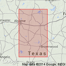
Pg. 20. Colony Creek shale. Proposed that name Colony Creek shale be given to beds between Ranger and Home Creek limestones and that name Hog Creek shale, misapplied by Drake and others, be dropped. [Age is Late Pennsylvanian.]
Type area: branching headwaters of Colony Creek in vicinity of Colony School, 4 mi west of Ranger, northeastern Eastland Co., TX.
Source: US geologic names lexicon (USGS Bull. 1200, p. 890).
- Usage in publication:
-
- Colony Creek shale member*
- Modifications:
-
- Revised
- AAPG geologic province:
-
- Bend arch
Summary:
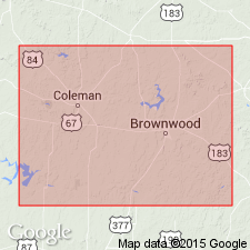
Pg. 51. Shown on columnar section, Brown and Coleman Counties, as Colony Creek shale member of Caddo Creek formation. Underlies Home Creek limestone member; overlies Ranger limestone member of Brad formation. Thickness about 20 feet. Mainly gray shale; locally contains thin beds of sandstone; not present in areas of reefs of Ranger limestone. [Age is Late Pennsylvanian.]
Source: US geologic names lexicon (USGS Bull. 1200, p. 890).
- Usage in publication:
-
- Colony Creek shale member*
- Modifications:
-
- Revised
- Adopted
- AAPG geologic province:
-
- Bend arch
Summary:
Pg. 67. Colony Creek shale member of Caddo Creek formation. Because of confusion that has resulted from miscorrelations of Home Creek limestone and misapplication of term "Hog Creek," adoption of Cheney's term Colony Creek shale is herein recommended for shale member below Home Creek limestone member. Unit is gray shale that contains conspicuous fine-grained thinly to thickly and irregularly bedded sandstone near top. In southern part of area, Colony Creek is about 25 feet thick; locally, member is absent and Home Creek limestone member is continguous with limestone members of Brad formation. Average thickness of member about 60 feet in north-central Brown County, Texas. [Age is Late Pennsylvanian.]
Source: US geologic names lexicon (USGS Bull. 1200, p. 890).

- Usage in publication:
-
- Colony Creek Shale
- Modifications:
-
- Areal extent
- AAPG geologic province:
-
- Bend arch
- Fort Worth syncline
Summary:
[See also adjacent Geol. Atlas Texas sheets Sherman (Barnes, 1967, revised 1991) and Abilene (Barnes, 1972).]
Colony Creek Shale of Canyon Group. Shale, sandstone, conglomerate, and limestone. Thickness 35 to 220 feet. Includes Cundiff Limestone [unranked] in lower part. Underlies Home Creek Limestone of Canyon Group; where Home Creek is absent, underlies Thrifty and Graham Formations (undivided) of Cisco Group. Overlies Ranger Limestone of Canyon Group. Rocks included in Caddo Creek Formation by earlier workers. Fossils. Age is Late Pennsylvanian (Missouri).
Source: Publication.

- Usage in publication:
-
- Colony Creek Shale
- Modifications:
-
- Mapped 1:250k
- Dominant lithology:
-
- Shale
- AAPG geologic province:
-
- Fort Worth syncline
Summary:
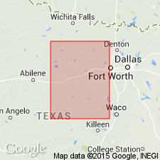
Pamphlet [p. 12]. Colony Creek Shale of Canyon Group. Shale, gray, greenish-gray, weathers to light-brown, minor maroon and black, some laminated and burrowed siltstone, sparse ferruginous nodules throughout, locally calcareous and gypsiferous; local thin to medium beds of fine-grained sandstone, laminated, burrowed, ripple-marked; thin argillaceous limestone lentil locally below ss1, coarse-grained, bioclastic. Includes separately mapped units, descending: (1) at top of formation, ss2, sandstone, brown, fine- to medium-grained with sparse lenses of chert pebbles, massive and cross-bedded, 10 to 25 feet thick, locally interbedded with shale; (2) in middle part, ss1, sandstone, brown, reddish-brown, fine- to coarse-grained, lenses of clay clasts and chert pebbles, in part cross-bedded, minor interbedded tan and gray shale containing discontinuous bioclastic limestone lentil, thickness 20 to 45 feet; and (3) in basal part, Cundiff Limestone [unranked]; [see entry under Cundiff]. Total thickness of formation 200 to 220 feet. Lies above Ranger Limestone of Canyon Group and below Thrifty and Graham Formations, [undifferentiated], in Cisco Group; southwest of map area, lies below Home Creek Limestone of Canyon Group. In northeastern Jack County, where Home Creek Limestone is absent, is top formation of Canyon Group; upper contact of formation = top of ss2 unit, part of contact extrapolated to Cretaceous rocks. Age is Late Pennsylvanian (Missourian).
[Mapped in Jack and Wise Cos., central northern TX; western edge of map sheet. Rocks previously (1967 ed. of map) included in "Graham and Caddo Creek Formations, undivided." See also adjacent Wichita Falls-Lawton sheet, Texas Geol. Atlas, 1987.]
Source: Publication.
- Usage in publication:
-
- Colony Creek Shale Member*
- Modifications:
-
- Biostratigraphic dating
- Age modified
- AAPG geologic province:
-
- Bend arch
- Fort Worth syncline
Summary:
Pg. 16-17 (figs. 10-11), 39 (fig. 20), 40, 94. Colony Creek Shale Member of Caddo Creek Formation. Ammonoids identified from [middle of Colony Creek] horizon SMC VI are Late Pennsylvanian age (early Virgilian; PSEUDAKTUBITES STAINBROOKI Subzone of PSEUDAKTUBITES Zone).
Specimens collected from several localities in Brown, Jack, Stephens, and Wise Cos., north-central TX.
Source: Publication.
For more information, please contact Nancy Stamm, Geologic Names Committee Secretary.
Asterisk (*) indicates published by U.S. Geological Survey authors.
"No current usage" (†) implies that a name has been abandoned or has fallen into disuse. Former usage and, if known, replacement name given in parentheses ( ).
Slash (/) indicates name conflicts with nomenclatural guidelines (CSN, 1933; ACSN, 1961, 1970; NACSN, 1983, 2005, 2021). May be explained within brackets ([ ]).