The National Geologic Map Database is migrating to a new infrastructure. We apologize for any service disruptions during this process.
|
|---|


- Usage in publication:
-
- Colina limestone*
- Modifications:
-
- Original reference
- Dominant lithology:
-
- Limestone
- AAPG geologic province:
-
- Pedregosa basin
Summary:
Pg. 1, 23-26, 38-41; James Gilluly, 1956, USGS Prof. Paper 281, p. 8, 42-44, pl. 5. Colina limestone of Naco group. Most characteristic lithologic feature is dominance of dense limestone that appears very dark-gray to almost black on fresh fracture. It seems safe to conclude that in central Cochise County any continuous such limestone that is as much as 25 feet thick is part of the Colina limestone. Generally weathers dark-gray but locally weathers light-gray or almost white. Thickness at type section 638 feet. Lower boundary of Colina taken arbitrarily at highest of the dolomite beds that weather to an orange-red surface. Overlies Earp formation (new); underlies Epitaph dolomite (new) with gradational contact and underlies Scherrer formation with sharp contact. Fossiliferous (brachiopods, gastropods, echinoids, fusulinid, corals, bryozoans). Contains abundance of gastropods, especially of a very large OMPHALOTROCHUS. Age is considered Early Permian (Wolfcamp and Leonard?). Report includes stratigraphic sections, measured sections, fossil lists.
Type section: on west slope of Colina Ridge, in Tombstone Hills, 4,000 feet south of Horquilla Peak, Cochise Co., southeastern AZ. Named from Colina Ridge.
Source: US geologic names lexicon (USGS Bull. 1200, p. 883); supplemental information from GNU records (USGS DDS-6; Denver GNULEX).
- Usage in publication:
-
- Colina limestone
- Modifications:
-
- Areal extent
- AAPG geologic province:
-
- Pedregosa basin
Summary:
Colina limestone of Naco group. Present in northern Chiricahua Mountains, Cochise County, Arizona. Overlies Earp formation; underlies Scherrer formation. Correlates with Fort Apache limestone member of Supai formation. Fossils (echinoid spines, pelecypods, gastropods, mollusks, brachiopods, scaphopods, ammonites). Age is Permian (Wolfcamp and Leonard).
Measured sections: (1) in SW/4 sec. 14, T. 15 S., R. 30 E., partial section approx. 420 ft thick; (2) in NE/4 sec. 27, T. 15 S., R. 30 E., partial section 400+ ft thick; (3) in SE/4 sec. 18, T. 16 S., R. 30 E., 535 ft thick; and (4) in NE/4 sec. 21, T. 17 S., R. 31 E., 400+ ft thick.
Source: Modified from GNU records (USGS DDS-6; Denver GNULEX).
- Usage in publication:
-
- Colina limestone
- Modifications:
-
- Areal extent
- Overview
- AAPG geologic province:
-
- Pedregosa basin
Summary:
Extended to central Peloncillo Mountains, Hidalgo Co, NM in Pedregosa basin. Section measured in sec 21, T25S, R21W. Identification of formation in NM based on similarity of lithic characteristics, composition, stratigraphic position, and presence of characteristic gastropods and scaphopods with formation in its type in AZ. Exact age unknown in Peloncillo Mountains, so age of Wolfcamp and Leonard?, or Early Permian [accepted]. Geologic map included.
Source: GNU records (USGS DDS-6; Denver GNULEX).
- Usage in publication:
-
- Colina Limestone
- Modifications:
-
- Areal extent
- AAPG geologic province:
-
- Pedregosa basin
Summary:
Extended to Animas Mountains, Hidalgo Co, NM in Pedregosa basin. Lumped in mapping with underlying Earp Formation. Is of Permian age.
Source: GNU records (USGS DDS-6; Denver GNULEX).

- Usage in publication:
-
- Colina limestone*
- Modifications:
-
- Overview
- AAPG geologic province:
-
- Pedregosa basin
Summary:
Is similar lithologically to Colina at type except for a few dolomite and sandstone beds in upper part. Measured section 441 ft thick in SE1/4 sec 29, T15S, R23E described where Colina overlies Earp formation and underlies alluvium. Another measured section, NE1/4 sec 28, T15S, R23E, 327 1/2 ft was measured, but the base unit exposed. Is a formation of Naco group. Assigned an Early Permian age in Pedregosa basin. Geologic map.
Source: GNU records (USGS DDS-6; Denver GNULEX).
- Usage in publication:
-
- Colina Limestone
- Modifications:
-
- Areal extent
- Overview
- AAPG geologic province:
-
- Pedregosa basin
Summary:
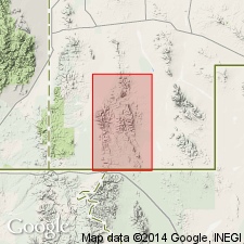
Extended without query as a formation of the Naco Group to Big Hatchet Mountains, NM (see Zeller, 1958), in the Pedregosa basin. Is of Permian (Wolfcamp or Leonard) age. Fossil fauna includes gastropods, echinoid spines and plates. Measured section of Colina, 355 ft thick, described in NW1/4 SE1/4 sec 36, T31S, R15W to N1/2 sec 1, T32S, R15W.
Source: GNU records (USGS DDS-6; Denver GNULEX).
- Usage in publication:
-
- Colina Limestone*
- Modifications:
-
- Areal extent
- Overview
- AAPG geologic province:
-
- Basin-and-Range province
- Pedregosa basin
Summary:
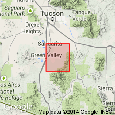
Used in Whetstone Mountains, AZ in the Pedregosa basin and Basin-and-Range province. Section measured in NW1/4 sec 24, T18S, R18E, Pima Co and in NW1/4 sec 27, T19S, R19E, Cochise Co, 271 ft thick and 180 ft thick respectively. Is of Early Permian age.
Source: GNU records (USGS DDS-6; Denver GNULEX).
- Usage in publication:
-
- Colina Limestone*
- Modifications:
-
- Areal extent
- AAPG geologic province:
-
- Basin-and-Range province
- Pedregosa basin
Summary:
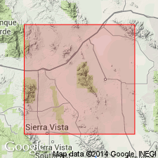
Extended as a formation of Naco Group in the Mustang Mountains, Santa Cruz Co, AZ in the Basin-and-Range province and Huachuca Mountains, Cochise Co, AZ in the Pedregosa basin. As mapped in Huachuca Mountains, includes as much as 175 ft of the basal part of overlying Epitaph Dolomite. Is about 350 ft thick in the Mustang Mountains. Is of Early Permian age.
Source: GNU records (USGS DDS-6; Denver GNULEX).
- Usage in publication:
-
- Colina Limestone
- Modifications:
-
- Overview
- AAPG geologic province:
-
- Pedregosa basin
- Basin-and-Range province
Summary:
Isopach map shows Colina outcrops in Pima, Santa Cruz, and Cochise Cos., AZ and Hidalgo Co, NM in the Pedregosa basin and Basin-and-Range province. Is interpreted to have been deposited in a subtidal environment in central Cochise Co, and in an intertidal environment in Pima Co. Is of Permian (late Wolfcampian?, early Leonardian?) age.
Source: GNU records (USGS DDS-6; Denver GNULEX).
- Usage in publication:
-
- Colina Limestone*
- Modifications:
-
- Areal extent
- AAPG geologic province:
-
- Basin-and-Range province
Summary:
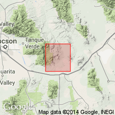
Extended to Santa Rita Mountains, Pima Co, AZ in Basin-and-Range province. Is of Early Permian age.
Source: GNU records (USGS DDS-6; Denver GNULEX).
- Usage in publication:
-
- Colina Limestone*
- Modifications:
-
- Areal extent
- AAPG geologic province:
-
- Basin-and-Range province
Summary:
Extended as a formation of Naco Group to Patagonia Mountains, Santa Cruz Co, AZ in Basin-and-Range province. Is of Early Permian age.
Source: GNU records (USGS DDS-6; Denver GNULEX).
- Usage in publication:
-
- Colina Limestone*
- Modifications:
-
- Areal extent
- AAPG geologic province:
-
- Pedregosa basin
Summary:
Extended as a formation of Naco Group to Rincon Mountains, Cochise Co, AZ in the Pedregosa basin. Is of Early Permian age.
Source: GNU records (USGS DDS-6; Denver GNULEX).
- Usage in publication:
-
- Colina Limestone*
- Modifications:
-
- Overview
- AAPG geologic province:
-
- Pedregosa basin
Summary:
Mapped as formation of Naco Group in Peloncillo Mountains, Hidalgo Co, NM in the Pedregosa basin. Conformably overlies Earp Formation of Naco Group. Overlain by Scherrer Formation of Naco. Was deposited in a subtidal to supratidal environment. Is of Early Permian age; [apparently following previous work].
Source: GNU records (USGS DDS-6; Denver GNULEX).
- Usage in publication:
-
- Colina Limestone*
- Modifications:
-
- Mapped 1:24k
- Dominant lithology:
-
- Limestone
- AAPG geologic province:
-
- Pedregosa basin
Summary:
Colina Limestone of Naco Group. Medium-dark-gray, fine-grained, medium-bedded, sparsely cherty limestone. Commonly unfossiliferous; in places carries gastropods and echinoid spines. Thickness estimated 180 to 300 m; variation due to structural control and mapping uncertainty in metamorphosed terrane. Age is Early Permian.
Source: Publication.
- Usage in publication:
-
- Colina Limestone*
- Modifications:
-
- Areal extent
- AAPG geologic province:
-
- Basin-and-Range province
Summary:
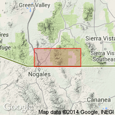
Extended into West Lime Hills area of Tres Hermanas Mountains, southern Luna Co, NM, Basin-and-Range province. Rocks previously mapped as an unnamed Lower Cretaceous massive limestone by Balk (1962, New Mexico Bureau of Mines and Mineral Resources Geologic Map 16) here assigned to undifferentiated Colina Limestone and Epitaph Dolomite. Assignment on basis of lithologic similarity to these formations in nearby ranges and on basis of euomphalid gastropods indicative of Colina. Is lowermost unit in study area; underlies Epitaph. Geologic map (fig. 15). Early Permian age.
Source: GNU records (USGS DDS-6; Denver GNULEX).

- Usage in publication:
-
- Colina Limestone*
- Modifications:
-
- Mapped 1:24k
- Dominant lithology:
-
- Limestone
- AAPG geologic province:
-
- Pedregosa basin
Summary:
Colina Limestone. Mapped in Big Hatchet Mountains, Hidalgo County, southwestern New Mexico. Medium- to darker-gray, thin- to medium-bedded, sparsely cherty limestone. Thickness about 350 to 500 feet (100 to 150 m). Conformably overlies Earp Formation (Lower Permian). Underlies and locally intertongues with Epitaph Dolomite (Lower Permian). Sparsely fossiliferous (gastropods, echinoids). Age is Early Permian.
Source: Publication.
For more information, please contact Nancy Stamm, Geologic Names Committee Secretary.
Asterisk (*) indicates published by U.S. Geological Survey authors.
"No current usage" (†) implies that a name has been abandoned or has fallen into disuse. Former usage and, if known, replacement name given in parentheses ( ).
Slash (/) indicates name conflicts with nomenclatural guidelines (CSN, 1933; ACSN, 1961, 1970; NACSN, 1983, 2005, 2021). May be explained within brackets ([ ]).