The National Geologic Map Database is migrating to a new infrastructure. We apologize for any service disruptions during this process.
|
|---|


- Usage in publication:
-
- Cole Canyon dolomite*
- Modifications:
-
- Original reference
- Dominant lithology:
-
- Dolomite
- AAPG geologic province:
-
- Great Basin province
- South Western Overthrust
Summary:
Cole Canyon dolomite. Alternating beds, 10 to 25 feet thick, with nearly white and dark-gray weathered surfaces; some beds dense and finely banded, others finely crystalline. Thickness 500 to 510 feet. Underlies Opex dolomite and overlies Bluebird dolomite. Scattered exposures occur along upper west slope of Cole Canyon, Tintic district, central northern Utah. Top and bottom drawn arbitrarily at lowest and highest light-colored bed. Age is Middle(?) Cambrian.
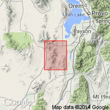
Named from exposures along west slope of Cole Canyon, which extends north from Eureka Gulch 0.75 mi west of Eureka, [in secs. 12, 13, T. 10 S., R. 3 W., western edge Eureka 7.5-min quadrangle], Tintic district, Juab Co., central northern UT.
Source: US geologic names lexicons (USGS Bull. 896, p. 487; USGS Bull. 1200, p. 880).
- Usage in publication:
-
- Cole Canyon dolomite
- Modifications:
-
- Areal extent
- AAPG geologic province:
-
- Great Basin province
- South Western Overthrust
Summary:
Pg. 5 (fig. 2), 8. Cole Canyon dolomite. Described in East Tintic Mountains, where it conformably overlies Bluebird dolomite and concordantly underlies Opex formation. As mapped by the USGS, it is 830 to about 900 feet thick and includes lower dolomite member of Opex dolomite as defined by Loughlin (1930). Lower 600 feet consists of alternating beds of light-gray laminated dolomite resembling Dagmar limestone and massive dusky-blue-gray commonly "twiggy" dolomite resembling the Bluebird; light-gray beds weathering creamy white are 1 foot or so to about 25 feet thick, but one bed is 60 to 90 feet thick; dark-colored beds are 10 to 30 feet thick. Zone that was formerly considered part of Opex is 125 to about 300 feet thick, consists chiefly of dusky blue-gray dolomite with some "twiggy" beds, some beds of mottled cross-bedded dusky-blue-gray dolomite, and few, if any, interlayered white beds. Base of Cole Canyon is placed at base of lowest creamy-white laminated dolomite, and top is placed at base of sequence of thin-bedded limestones and dolomites of Opex. Age is Middle Cambrian.
Source: US geologic names lexicon (USGS Bull. 1200, p. 879-880).
- Usage in publication:
-
- Cole Canyon dolomite of Loughlin (1919)
- Modifications:
-
- Areal extent
- AAPG geologic province:
-
- Great Basin province
Rigby, J.K., 1958, Geology of the Stansbury Mountains, [Utah]: Utah Geological Society, Guidebook to the geology of Utah, no. 13, p. 1-134.
Summary:
Pg. 14 (fig. 3), 21-22, geol. map. Cole Canyon dolomite. In Stansbury Mountains, Tooele County, central northern Utah, 320 to 370 feet thick; underlies Opex formation and overlies Bluebird dolomite. Mapped as originally used by Loughlin. [Age is Middle Cambrian.]
Source: US geologic names lexicon (USGS Bull. 1200, p. 879-880).
- Usage in publication:
-
- Cole Canyon dolomite
- Modifications:
-
- Areal extent
- AAPG geologic province:
-
- Great Basin province
- South Western Overthrust
Summary:
Pg. 12 (table 1), 52-53, pls. 1, 17. Cole Canyon dolomite. Described in Sheeprock Mountains, Tooele and Juab Counties, Wasatch National Forest, western Utah, where it is about 899 feet thick and consists of nearly equal parts of dolomite and limestone. Overlies Marjum formation; in fault contact with Opex formation. [Age is Middle Cambrian.]
Source: US geologic names lexicon (USGS Bull. 1200, p. 879-880).
- Usage in publication:
-
- Cole Canyon dolomite of Loughlin (1919)
- Modifications:
-
- Areal extent
- AAPG geologic province:
-
- Great Basin province
- South Western Overthrust
Summary:
Pg. 14 (table 1), 25-26, 29 (fig. 9), pl. 1. Cole Canyon dolomite. In southern Oquirrh Mountains, Tooele and Utah Counties, central northern Utah, about 200 feet thick; underlies Opex dolomite and overlies Bluebird dolomite. Cole Canyon dolomite of type area as originally defined by Loughlin (1919) probably correlates well with the rocks here included in the formation. [Age is Middle Cambrian.]
Source: US geologic names lexicon (USGS Bull. 1200, p. 879-880).

- Usage in publication:
-
- Cole Canyon dolomite*
- Modifications:
-
- Revised
- Age modified
- Dominant lithology:
-
- Dolomite
- AAPG geologic province:
-
- Great Basin province
Summary:
Pg. 39-44, pls. 2-5. Cole Canyon dolomite. Includes all of Cole Canyon as originally described by Loughlin together with lower unit of dusky-blue dolomite [about 150 feet] of original Opex formation. (Opex restricted to sandstone, limestone, dolomite, and shale series; = upper Opex of Loughlin.) Consists of alternating light and dark dolomite beds; conglomerate lenses common in lower part. Thickness 830 to 900 feet, averages about 850 feet. Upper boundary of Cole Canyon placed at bottom of lowest calcareous shale or shaly limestone of the Opex. Conformably overlies Bluebird dolomite. Fossils from upper part of formation, as here defined, include trilobite ELDORADIA cf. E. PROSPECTENSIS (Walcott) indicating a late Middle Cambrian age (identified by A.R. Palmer, USGS, written commun., Sept. 5, 1953, USGS colln. 1389-CO). OBOLUS MCCONNELLI also collected from near top of formation (as here defined); see Walcott (USGS Mon. 51, 1912).
Measured section [composite]: upper part (loc. 7b, pl. 3), on Eureka Ridge, main Tintic district, 600 ft south-southwest of Centennial Eureka shaft, in E/2 sec. 24, T. 10 S., R. 3 W.; lower part (loc. 7a, pl. 3), in Cole Canyon 1,800 ft west of Sacramento Mine, main Tintic district, in W/2 sec. 13, T. 10 S., R. 3 W.
[GNC remark (ca. 1955): This revised definition and geologic age adopted by the USGS.]
Source: Publication; GNC index card files (USGS-Reston).
For more information, please contact Nancy Stamm, Geologic Names Committee Secretary.
Asterisk (*) indicates published by U.S. Geological Survey authors.
"No current usage" (†) implies that a name has been abandoned or has fallen into disuse. Former usage and, if known, replacement name given in parentheses ( ).
Slash (/) indicates name conflicts with nomenclatural guidelines (CSN, 1933; ACSN, 1961, 1970; NACSN, 1983, 2005, 2021). May be explained within brackets ([ ]).