

- Usage in publication:
-
- Cloverly formation*
- Modifications:
-
- Original reference
- Dominant lithology:
-
- Sandstone
- Clay
- AAPG geologic province:
-
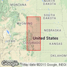
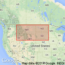
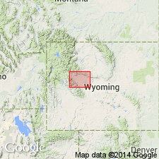
- Bighorn basin
- Powder River basin
Summary:
Pg. 394-401. Cloverly formation. Gray to reddish purple clay, 30 to 40 feet thick, resembling Fuson formation, underlain by 10 to 60 feet of corase-grained buff or dirty gray cross-bedded massive sandstone, with some very thin deposits of coal or coaly shale, and believed to represent the Lakota formation of the Black Hills. Owing to lack of definite evidence as to equivalency of these beds on east side of Bighorn Mountains to the Fuson and Lakota, and especially in consideration of apparent absence of deposits representing the Dakota sandstone, it has been thought best to give the series a separate designation. Underlies Benton formation, the lower part of which as here discriminated may possibly include beds representing Dakota sandstone. Rests on Morrison formation. Age is Cretaceous. Report includes correlation diagram.
Named from Cloverly, a post office on eastern side of Bighorn basin, WY.
Source: US geologic names lexicon (USGS Bull. 896, p. 470).
- Usage in publication:
-
- Cloverly formation*
- Modifications:
-
- Revised
- AAPG geologic province:
-
- Bighorn basin
Summary:
table opp. p. 166, p. 167, 168. Cloverly formation. At type locality of Cloverly formation, near Cloverly, Wyoming, about 15 miles northeast of Basin, Bighorn County, Wyoming, the Cloverly formation, according to N.H. Darton (USGS Prof. Paper 51, p. 52, 1906), consists of 113 feet of strata, a detailed section of which is here given. Upper 20 feet (light-buff or tan-colored sandstone) of this formation constitutes Greybull sand, which carries oil and gas in Greybull field and water in Lamb anticline and Torchlight dome. The Greybull sand is overlain by Thermopolis shale (new). Age is Early Cretaceous. Report includes stratigraphic table.
Source: US geologic names lexicon (USGS Bull. 896, p. 470); supplemental information from GNU records (USGS DDS-6; Denver GNULEX).
- Usage in publication:
-
- Cloverly formation*
- Modifications:
-
- Overview
- AAPG geologic province:
-
- Bighorn basin
Summary:
Pg. 19. Cloverly formation. Defined base of Thermopolis shale and top of Cloverly formation as top of Greybull sandstone member, and stated that the Thermopolis includes the "rusty beds" [20 to 100 feet thick] described by Washburne (in USGS Bull. 340, p. 350, 1908) as basal member of Colorado formation in Bighorn basin, Wyoming.
Source: US geologic names lexicon (USGS Bull. 896, p. 470).
- Usage in publication:
-
- Cloverly formation*
- Modifications:
-
- Revised
- AAPG geologic province:
-
- Bighorn basin
Summary:
Pg. 64. Cloverly formation. Included the "rusty beds" in his Greybull sandstone member of Cloverly formation. Age is Early Cretaceous.
Source: US geologic names lexicon (USGS Bull. 896, p. 470).
- Usage in publication:
-
- Cloverly formation*
- Modifications:
-
- Revised
- AAPG geologic province:
-
- Bighorn basin
Summary:
Pg. A23-A28. Cloverly formation. Included the "rusty beds" in Thermopolis shale [of Colorado age] and treated Greybull sandstone as top member of Cloverly formation. This is present approved definition of Cloverly formation. The Greybull sandstone is tentatively classified as Lower(?) Cretaceous.
Source: US geologic names lexicon (USGS Bull. 896, p. 470).
- Usage in publication:
-
- Cloverly formation*
- Modifications:
-
- Mapped 1:48k
- AAPG geologic province:
-
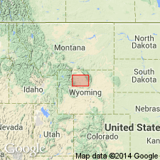
- Powder River basin
Summary:
Pg. B56-B57. Cloverly formation. In Johnson County, Wyoming, overlies Morrison formation and underlies Skull Creek shale. Thickness 135 to 165 feet. Age is Early Cretaceous. Report includes geologic map.
Source: US geologic names lexicon (USGS Bull. 1200, p. 848-849).
- Usage in publication:
-
- Cloverly formation*
- Modifications:
-
- Revised
- AAPG geologic province:
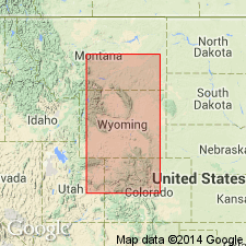
-
- Powder River basin
Summary:
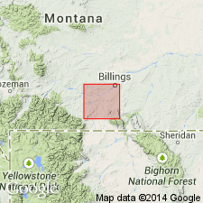
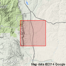
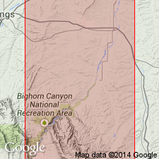
Pg. 42-45. In Bighorn Canyon-Hardin area, Montana-Wyoming, formation is 300 to 400 feet thick, includes Pryor conglomerate member at base and Birdhead sandstone member at top. Overlies Morrison formation; underlies Thermopolis shale. Lupton (1916, USGS Bull. 621) called the 20 feet of sandstone at top of Darton's type Cloverly Greybull sandstone. This unit has been called member of Cloverly but not always top member. Overlying Greybull sandstone member in Bighorn basin is unit of shales and rusty-weathering sandstones which Darton called "rusty series" or "rusty beds." The "rusty beds" have been included in Thermopolis shale by some workers and in Greybull sandstone by other workers. If Cloverly formation from Birdhead sandstone down to the variegated beds is correlative with Darton's "rusty beds," then Cloverly in Bighorn Canyon-Hardin area, includes strata younger than type Cloverly. Inclusion of "rusty beds" in the Cloverly constitutes a redefinition of Cloverly as described by Darton. This redefinition is justifiable because Darton's upper unit of Cloverly, the Greybull sandstone member, is not readily separated in many localities from underlying "rusty beds." Top of Cloverly --if it is to occur at a lithologic break of considerable areal extent-- should be placed either below Greybull sandstone member and above variegated beds in middle of Cloverly or below black Skull Creek shale (or its stratigraphic equivalent) and above the so-called rusty beds. Age is Early Cretaceous. Report includes geologic map, columnar section, measured sections.
Source: US geologic names lexicon (USGS Bull. 1200, p. 848-849).
- Usage in publication:
-
- Cloverly formation*
- Modifications:
-
- Overview
Summary:
Fig. 19. Cloverly formation. Correlation with other Cretaceous units in northeast Wyoming (Powder River basin), central Wyoming (Wind River basin), and southeast Wyoming and northeast and south-central Colorado (Denver basin).
Source: Modified from GNU records (USGS DDS-6; Denver GNULEX).
- Usage in publication:
-
- Cloverly group
- Modifications:
-
- Revised
- AAPG geologic province:
-
- North Park basin
- Laramie basin
Summary:
Pg. 48, 49 (fig. 1). Cloverly group. Base of Cretaceous comprises tripartite unit traditionally divided into Lakota sandstone, Fuson shale, and Dakota sandstone. In Laramie basin, same division is recognizable, but the three names are not used; instead, entire unit is called Cloverly formation. In this report, both sets of names are used for North Park, Colorado, but Cloverly is elevated to rank of group.
Source: US geologic names lexicon (USGS Bull. 1200, p. 848-849).

- Usage in publication:
-
- Cloverly formation
- Modifications:
-
- Revised
- AAPG geologic province:
-
- Bighorn basin
Summary:
Pg. 1143 (fig. 2), 1145-1149, pl. 1; also 1958, Dissert. Abs., v. 18, no. 1, p. 198. Cloverly formation. As redefined here, includes nonmarine sedimentary rocks which lie above Morrison formation and below Sykes Mountain formation (new; replaces Greybull member of Cloverly). Comprises (ascending) Little Sheep mudstone (new), Pryor conglomerate, and Himes (new) members. Thickness 382 feet at type locality; ranges from 150 to 400 feet. Contact with Morrison formation placed at base of lowest beds with volcanic debris or black chert granules. South of Sykes Mountain, the Morrison-Cloverly contact is conformable. Between Red Dome, Carbon County, Montana, and Sykes Mountain, Bighorn County, Wyoming, the contact exhibits channeling; the Little Sheep mudstone member is absent and Morrison is overlain by Pryor conglomerate member. Age is Early Cretaceous. Fossils (freshwater gastropods and reptiles) recovered from Little Sheep mudstone member. Report includes cross section, nomenclature chart, fossil list.
[Misprint (US geologic names lexicon, USGS Bull. 1200, p. 849): Little Sheep Mountain member should be Little Sheep mudstone member.]
Source: US geologic names lexicon (USGS Bull. 1200, p. 848-849); supplemental information from GNU records (USGS DDS-6; Denver GNULEX).
- Usage in publication:
-
- Cloverly Formation
- Modifications:
-
- Revised
- AAPG geologic province:
-
- Bighorn basin
Summary:
Cloverly Formation. Recognized in eastern Washakie, northern Natrona, and western Johnson Counties, around the southern Big Horns in the Bighorn basin, Wyoming. Divided into (ascending) Otter Creek Sandstone Member (new) and unnamed mudstone member, both of nonmarine origin. Otter Creek is a white to gray, ledge-forming sandstone. Mudstone member is variegated (red, maroon, violet, purple, lavender and green), locally silty or sandy, and a slope-former. Disconformably overlies Jurassic Morrison Formation. Underlies Rusty Beds Member [previously called "Rusty Beds"] of Thermopolis Shale; contact is an unconformity. Correlates with Kootenai Formation of central Montana; Lakota Formation of Black Hills; Lytle Formation of Front Range, Colorado; Cedar Mountain and Burro Canyon Formations of Colorado Plateau; and post-Ephraim part of Gannett Group of southeast Idaho-southwest Wyoming. Age is Early Cretaceous. Report includes correlation chart.
Source: Modified from GNU records (USGS DDS-6; Denver GNULEX).
- Usage in publication:
-
- Cloverly Formation*
- Modifications:
-
- Mapped 1:32k (Fremont Co, WY)
- Dominant lithology:
-
- Claystone
- Siltstone
- Sandstone
- AAPG geologic province:
-
- Wind River basin
Summary:
Cloverly Formation. Mapped undivided with Morrison Formation (Jurassic) along crest of Little Dome anticline in north-central Fremont County, Wyoming (Wind River basin). Section measured along East Fork Sheep Creek; probable Morrison-Cloverly contact about 162 feet above base of section. Consists of (ascending) cliff-forming conglomerate and sandstone, 27 feet; variegated red and purple claystone and siltstone interbedded with minor white fine- to medium-grained sandstone, forms conspicuous, brightly colored slopes, 220 feet; "rusty beds," gray, brown, and olive-drab rusty-weathering sandstone and siltstone and minor dark shale, 152 feet. Overlies Morrison Formation; underlies Lower Cretaceous Thermopolis Shale. Age is Early Cretaceous. Report includes generalized stratigraphic section.
Source: Modified from GNU records (USGS DDS-6; Denver GNULEX).
- Usage in publication:
-
- Cloverly Formation*
- Modifications:
-
- Not used
- AAPG geologic province:
-
- Green River basin
Summary:
Cloverly Formation. Not used in this report, in northeast Routt County, Colorado (Greater Green River basin). Previous geographic extension of Cloverly Formation into northwestern Colorado rescinded; its rocks now included in Dakota Sandstone. Its usage elsewhere remains unchanged.
Source: Changes in stratigraphic nomenclature, 1972 (USGS Bull. 1395-A, p. A10-A11).
- Usage in publication:
-
- Cloverly Formation*
- Modifications:
-
- Areal extent
- Not used
- AAPG geologic province:
-
- Sweetgrass arch
Summary:
Cloverly Formation. In south-central Montana only, Cloverly Formation and its Birdhead Sandstone Member, as used by Richards (1955, USGS Bull. 1026, Bighorn Canyon-Hardin area, p. 42-45) are abandoned. The basal part of the unit correlates with the Kootenai Formation that extends over the entire State. The Kootenai Formation is unconformably overlain by the Fall River Sandstone that Richards (1955, p. 43) termed the Birdhead Sandstone Member. Cloverly usage elsewhere remains unchanged.
Source: Changes in stratigraphic nomenclature, 1975 (USGS Bull. 1422-A, p. A4-A5, A6-A7, A66-A67).
- Usage in publication:
-
- Cloverly Formation*
- Modifications:
-
- Overview
- Age modified
- AAPG geologic province:
-
- Wind River basin
Summary:
Represents fluvial and lacustrine deposition over most of central WY including Wind River basin which is area of study. Consists of coarse clastics of fluvial conglomerate and sandstone interbedded with overbank mudstone and carbonate-silica lacustrine or pedogenic deposits. Underlies "rusty beds" of Thermopolis Formation [author follows Mirsky (1962) in assignment of "rusty beds" to Thermopolis, however, author apparently does not consider unit to be a formal member of Thermopolis]; overlies Morrison Formation. Stratigraphic sections (figs. 3 and 4). Morrison-Cloverly interval is equivalent to Gannett Group to west in Sevier orogenic belt. Assigned [basis of assignment not discussed] Neocomian and Aptian (Early Cretaceous) age.
Source: GNU records (USGS DDS-6; Denver GNULEX).
- Usage in publication:
-
- Cloverly Formation*
- Modifications:
-
- Overview
- AAPG geologic province:
-
- Wind River basin
Summary:
Cloverly Formation. Characterized by a basal conglomerate, middle shale, and an upper sandstone. [Author considers upper sandstone to be equivalent to "rusty beds" of Love and others (1945, USGS Oil and Gas Inv. Chart 13.] Unit has a thickness of 100 feet. Unconformably overlies Morrison Formation; underlies Thermopolis Shale with gradational contact. Age is Early Cretaceous (Neocomian and Aptian) following May (1992). Report includes cross section.
Source: Modified from GNU records (USGS DDS-6; Denver GNULEX).
For more information, please contact Nancy Stamm, Geologic Names Committee Secretary.
Asterisk (*) indicates published by U.S. Geological Survey authors.
"No current usage" (†) implies that a name has been abandoned or has fallen into disuse. Former usage and, if known, replacement name given in parentheses ( ).
Slash (/) indicates name conflicts with nomenclatural guidelines (CSN, 1933; ACSN, 1961, 1970; NACSN, 1983, 2005, 2021). May be explained within brackets ([ ]).