The National Geologic Map Database is migrating to a new infrastructure. We apologize for any service disruptions during this process.
|
|---|


- Usage in publication:
-
- Church Rock member*
- Modifications:
-
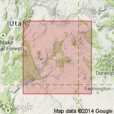
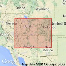
- Areal extent
- Dominant lithology:
-
- Siltstone
- Sandstone
- AAPG geologic province:
-
- Paradox basin
- Black Mesa basin
Summary:
Pg. 448 (fig. 4), 459-460, 461 (fig. 8). Church Rock member of Chinle formation. Described in southeastern Utah where it is composed of pale-reddish-brown and light-brown very fine grained sandy siltstone; siltstone may be structureless, horizontally laminated to very thick bedded, or, in places, ripple laminated. Sandstone more common in northern part of southeastern Utah where it includes unit termed Bowknot bed. Thickness ranges from wedge-edge to 400 feet in Utah. Conformably overlies Owl Rock member in most of southeastern Utah. Conformably overlies Moss Back member in San Rafael Swell, and unconformably overlies Moenkopi formation in Moab area. Disconformably underlies Wingate sandstone. Member thickens abruptly north of Elk Ridge area, probably by incorporating strata which are equivalent to Owl Rock farther south. Extends into Monument Valley, Ariz. Rock Point member of Wingate sandstone, which is largely, or entirely, the same unit as Church Rock member, is present in large part of Arizona and locally extends into west-central New Mexico. Name Church Rock is used in southeastern Utah and in areas in Arizona north of Laguna Creek, and name Rock Point member of Wingate is used in New Mexico and in areas of Arizona south of Laguna Creek. Church Rock member corresponds to A division of Chinle formation described by Gregory (1917 USGS Prof. Paper 93). Name credited to Witkind and Thaden.
Source: US geologic names lexicon (USGS Bull. 1200, p. 797-798).
- Usage in publication:
-
- Church Rock member*
- Modifications:
-
- Overview
- Dominant lithology:
-
- Siltstone
- Sandstone
- AAPG geologic province:
-
- Black Mesa basin
Summary:
A detailed published description as a member (1 of 4 members) of the Upper Triassic Chinle formation. Neither intent to name nor designation of a type stated. Called Division A by Gregory (1917). The most "typical" section is on Comb Ridge, about 6 1/2 miles northeast of Kayenta, Navajo Co, AZ in the Black Mesa basin. Overlies the Owl Rock member of Chinle and underlies the Wingate sandstone. Intertongues with Owl Rock member, a relationship that suggests the Church Rock belongs with the Chinle and not with the Wingate. Its stratigraphic equivalent north of Laguna Creek is called Rock Point member and is placed with the overlying Wingate sandstone. Consists of 246 ft of red-brown, red-orange to gray, even-bedded, cross-bedded siltstone and a few tan to brown, thin-bedded, ripple-marked sandstone at the typical section. Has an average thickness of about 150 ft.
Source: GNU records (USGS DDS-6; Denver GNULEX).
- Usage in publication:
-
- Church Rock Member*
- Modifications:
-
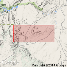
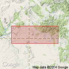
- Areal extent
- AAPG geologic province:
-
- Paradox basin
Summary:
Church Rock Member, as one of the younger members of the Upper Triassic Chinle Formation, is recognized east of the pinchout of the Temple Mountain, Shinarump, Monitor Butte, and Owl Rock Members of the Chinle. Only the Moss Back, Petrified Forest?, and Church Rock Members identified in report area in the Paradox basin. Church Rock divided into (ascending): unit 1 or the so-called Black ledge, averages 20 ft thick; unit 2, 200-275 ft thick; and unit 3, 140-190 ft thick. Measured sections of each unit. Unit 1 pinches out in northeast Summit Canyon. Unit 2 merges with Petrified Forest Member by facies changes and intertonguing in subsurface where unit 1 is absent northeast of Summit Canyon. Geologic map. Stratigraphic chart.
Source: GNU records (USGS DDS-6; Denver GNULEX).
- Usage in publication:
-
- Church Rock Member
- Modifications:
-
- Not used
Summary:
Name Church Rock Member of Chinle Formation has been applied to a reddish-orange, very fine grained sandstone and siltstone in Monument Valley area, southeast UT in the Paradox basin and northeast AZ in the Black Mesa basin, to rocks equivalent to division A (Gregory, 1917) and to the Hite Bed of Chinle. The Hite has a wide distribution and can be recognized as a separate unit. The name Church Rock has been applied to rocks older than division A that are of different ages in different places. Author believes that rocks formerly assigned to division A above the Hite belong to the Rock Point Member of the Wingate Sandstone, and the "so-called Church Rock" of southeast UT should be renamed.
Source: GNU records (USGS DDS-6; Denver GNULEX).
- Usage in publication:
-
- Church Rock Member*
- Modifications:
-
- Principal reference
- AAPG geologic province:
-
- Black Mesa basin
- Paradox basin
Summary:
Is one of several members of the Upper Triassic Chinle Formation recognized in Monument Valley, AZ, Black Mesa basin, north into southeast UT, Paradox basin. Type section [principal reference] designated as the section in AZ described by Witkind and Thaden (1963) about 4 mi north of Church Rock, on Comb Ridge and about 6.5 mi northeast of Kayenta. Name used north of Laguna Creek which runs along south side of Monument Valley. Equivalent rock south of creek assigned to Rock Point Member of Wingate Sandstone. Two persistent units described. The informally designated "Black Ledge" is a 30 to 40 ft thick cross-stratified sandstone that lies at the base or 45 to 95 ft above base and grades upward through horizontally and ripple laminated siltstone. The 34 ft thick red sandstone, conglomeratic sandstone, and conglomerate at the top formally named Hite Bed. Intervening beds are brown, orange, fine to coarse siltstone with some irregular sandstone lenses. Contains volcanic detritus. Feldspar abundant. Lies above Owl Rock Member of Chinle, a contact usually placed at top of uppermost limestone. Underlies Wingate Sandstone. Rocks included in member in UT may be older than those at type. Stratigraphic diagrams. Areal extent map of Hite and Black Ledge units. Ranges from 0 to 300 ft thick.
Source: GNU records (USGS DDS-6; Denver GNULEX).
- Usage in publication:
-
- Church Rock Member*
- Modifications:
-
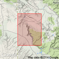
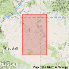
- Areal extent
- AAPG geologic province:
-
- Black Mesa basin
Summary:
Present as an upper member of the Upper Triassic Chinle Formation in northeast AZ in the Black Mesa basin. Can be traced into southeast UT. Along Comb Ridge 14 km north of AZ-UT state line and in the Paradox basin, all of the Church Rock grades laterally into the Hite Bed of the Church Rock. The Hite Bed is sporadically distributed; it thins northward and is absent near Moab, Grand Co, UT. Farther eastward in San Juan basin, the Church Rock and the Hite Bed are missing, and the older or Petrified Forest Member is the upper member of the Chinle. Southward in the San Juan basin the Church Rock is missing, and the stratigraphically older Owl Rock Member is the upper member of the Chinle. Correlation chart.
Source: GNU records (USGS DDS-6; Denver GNULEX).
- Usage in publication:
-
- Church Rock Member*
- Modifications:
-
- Overview
- AAPG geologic province:
-
- Paradox basin
Summary:
Is the top member of the Upper Triassic Chinle Formation studied in the White and Red Canyon areas, San Juan Co, UT in the Paradox basin. Is the most areally limited of the members of the Chinle. Many of the sandstones are structureless or contain faint, large-scale trough cross-stratification or minor lateral accretion bedding. Mudstones are also structureless and have desiccation cracks. Deposited on lacustrine or playa mudflats traversed by small fluvial systems and laterally restricted floodplains. Large-scale cross-stratification indicates eolian deposition. Interfingering of sandstones and mudstones suggest alternating wet and dry conditions. Presence of hematite and lack of organic carbon thought to mean deposition in an oxygenated lacustrine mudflat and playa environment.
Source: GNU records (USGS DDS-6; Denver GNULEX).
- Usage in publication:
-
- Church Rock Member*
- Modifications:
-
- Overview
- AAPG geologic province:
-
- Paradox basin
- Black Mesa basin
Summary:
Considered to be equivalent to the Rock Point Member which is reassigned from the Wingate Sandstone of the Glen Canyon Group to upper member of Chinle Formation. Previously, use of Church Rock has been limited to areas north of Laguna Creek, AZ, Black Mesa basin, and north in east UT, Paradox basin, and its equivalent limited to areas south of Laguna Creek. Consists of red-brown to red-orange siltstone and very fine grained sandstone with a gradational upward transition to very thick bedded, very fine grained sandstone. Bioturbated strata have 0.5 cm diameter vertical and horizontal meniscate burrows. Includes Hite Bed, a coarse-grained conglomeratic sandstone at top. Overlies Owl Rock Member of Chinle; underlies Wingate Sandstone (restricted to the eolian sandstone). Contact with Wingate marked by sand filled desiccation cracks that extend down into the Hite Bed about 10 cm. Thinly laminated and burrowed strata are of marginal lacustrine mudflat origin. The finely laminated strata with mud drapes and desiccation cracks represent low relief, periodic sedimentation. Abundant trace fossils (nonmarine arthropods) indicate periodic damp to subangular conditions. A lacustrine margin mudflat deposit. Correlates with Dolores Formation. Cross section shows Church Rock used between Comb Ridge and Owl Rock, AZ.
Source: GNU records (USGS DDS-6; Denver GNULEX).
For more information, please contact Nancy Stamm, Geologic Names Committee Secretary.
Asterisk (*) indicates published by U.S. Geological Survey authors.
"No current usage" (†) implies that a name has been abandoned or has fallen into disuse. Former usage and, if known, replacement name given in parentheses ( ).
Slash (/) indicates name conflicts with nomenclatural guidelines (CSN, 1933; ACSN, 1961, 1970; NACSN, 1983, 2005, 2021). May be explained within brackets ([ ]).