The National Geologic Map Database is migrating to a new infrastructure. We apologize for any service disruptions during this process.
|
|---|


- Usage in publication:
-
- Chaffee formation*
- Modifications:
-
- Named
- Dominant lithology:
-
- Sandstone
- Limestone
- Shale
- AAPG geologic province:
-
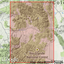
- Eagle basin
- Piceance basin
Summary:
Named for Chaffee Co, CO. Rocks assigned to Chaffee in this report were assigned as the lower part of the Leadville limestone in the Leadville district. Two sections, one measured near Salida in Chaffee Co, Eagle basin and the other described at Monarch, Gunnison Co, Piceance basin, considered good sections but neither one designated as the type. Is 166+/-ft thick near Salida where it overlies Upper Ordovician rocks and underlies Mississippian Leadville limestone (restricted). Consists of (ascending): 1) partly concealed thin-bedded limestone, shale, sandstone; 2) calcareous sandstone, sandstone, locally coarse, lenticular limestone; 3) gray-weathering limestone that weathers into small angular fragments; 4) buff- to brown-weathering magnesian limestone with siliceous network; 5) thin-bedded dolomitic limestone with siliceous network; 6) thin-bedded gray limestone; 7) green and red shal[e] at Salida. Locally cross-bedded. Includes, in the Leadville and Alma districts, a basal member, the newly designated Parting quartzite member. Fossiliferous (stromatoporoids, an Ouray fauna found near base, and at some localities fish remains. Occurrence at other localities discussed.
Source: GNU records (USGS DDS-6; Denver GNULEX).
- Usage in publication:
-
- Chaffee formation*
- Modifications:
-
- Revised
- AAPG geologic province:
-
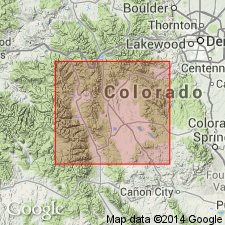
- Eagle basin
- South Park basin
Summary:
Divided in Eagle and South Park basins into the: Parting member at base, and Dyer member (new) at top. Overlies Manitou limestone (called "White" limestone by miners); underlies Leadville limestone (called "Blue" limestone by miners). Assigned a Devonian age.
Source: GNU records (USGS DDS-6; Denver GNULEX).
- Usage in publication:
-
- Chaffee formation
- Modifications:
-
- Areal extent
- [Revised]
- AAPG geologic province:
-
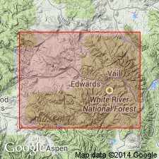
- Eagle basin
Tweto, Ogden, and Lovering, T.S., 1947, The Gilman district, Eagle County, [Colorado]: Colorado Mineral Resources Board [Bulletin], p. 378-387., (Part 2 prepared by the U.S. Geological Survey, under the general supervision of W.S. Burbank.)
Summary:
Pg. 380 (chart of geologic formations in Gilman district). Chaffee formation. In Gilman district, [Eagle County, Colorado], includes Parting quartzite member below and Dyer dolomite member above. Thickness about 120 feet. Overlies Harding sandstone; underlies Gilman sandstone member ["new"] of Leadville limestone. [Age is Late Devonian.]
Source: Modified from US geologic names lexicon (USGS Bull. 1200, p. 704).
- Usage in publication:
-
- Chaffee formation*
- Modifications:
-
- Revised
- Areal extent
- AAPG geologic province:
-
- Eagle basin
Summary:
Pg. 152 (table 1), 169-177. Chaffee formation. Described in Pando area, [Eagle County, Colorado], where it unconformably overlies Harding quartzite or Peerless formation and unconformably underlies Gilman sandstone member [new] of Leadville dolomite. Comprises two members. Parting quartzite below and Dyer dolomite above. Thickness 118 to 137 feet. [Age is Late Devonian.]
Source: Modified from US geologic names lexicon (USGS Bull. 1200, p. 704).
- Usage in publication:
-
- Chaffee formation*
- Modifications:
-
- Overview
- AAPG geologic province:
-
- Piceance basin
Summary:
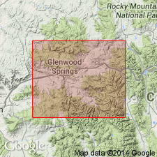
Parting member, basal member of Chaffee formation, overlies Tie Gulch member (new) of Manitou formation in Glenwood Canyon, Garfield Co., CO in the Piceance basin. Is of Late Devonian age.
Source: GNU records (USGS DDS-6; Denver GNULEX).
- Usage in publication:
-
- Chaffee Group
- Modifications:
-
- Revised
- Overview
- AAPG geologic province:
-
- Piceance basin
- Green River basin
- Eagle basin
Summary:
Chaffee raised to group rank consisting of (ascending) Parting (rank raised) and Dyer (rank raised, redescribed) Formations. Chaffee occurs in Rio Blanco and Garfield Cos, Piceance basin; Routt Co, Greater Green River basin; and Eagle and Pitkin Cos, Eagle basin. Isopach map shows Chaffee is thickest in west and southwest part of study area; thins to northeast. Unconformably overlies Harding Formation or older rocks; disconformably underlies Gilman Sandstone Member of Leadville Formation. Late Devonian age though upper part of Coffee Pot Member (new) of Dyer may be Kinderhookian age.
Source: GNU records (USGS DDS-6; Denver GNULEX).
- Usage in publication:
-
- Chaffee Group*
- Modifications:
-
- Age modified
- AAPG geologic province:
-
- Piceance basin
Summary:
Both the Parting Formation and Dyer Dolomite of the Chaffee Group are assigned to the Famennian or late Late Devonian. The Gilman Sandstone at the top of the Chaffee is considered Late Devonian and Early Mississippian although its age is not known. Section in the Glenwood Canyon area, Garfield Co, CO in the Piceance basin described.
Source: GNU records (USGS DDS-6; Denver GNULEX).
- Usage in publication:
-
- Chaffee Group*
- Modifications:
-
- Revised
- Age modified
- Overview
- AAPG geologic province:
-
- Eagle basin
Summary:
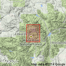
Revised in that Gilman Sandstone is removed as lower member of Leadville Limestone (or Dolomite) and is reassigned to Chaffee Group as its uppermost of three formations. Chaffee now consists of (ascending) Parting Formation (redescribed), Dyer Dolomite (redescribed, age modified), and Gilman (revised). Within Minturn quad, Eagle and Summit Cos, CO, Eagle basin, Chaffee is exposed only in area near Eagle River and in part in small fault slices along Gore fault in Gore Range. Thickness ranges from 140-165 ft; thins to northeast toward Gore Range. Rocks of Chaffee are host rocks for ore deposits at Gilman, Leadville, and several other mining districts. Unconformably overlies Harding Sandstone; unconformably underlies Leadville. Stratigraphic chart; measured sections of constituent formations; geologic map. Late Devonian age for Parting and lower half or more of Dyer; Late Devonian and Early Mississippian? age for upper part of Dyer; and Late Devonian or Early Mississippian age for Gilman. Chaffee is Late Devonian and Early Mississippian? age.
Source: GNU records (USGS DDS-6; Denver GNULEX).
- Usage in publication:
-
- Chaffee Formation*
- Modifications:
-
- Areal extent
- AAPG geologic province:
-
- Piceance basin
Summary:
Regarded as a formation of Devonian age in subsurface of Moffat Co, CO, Piceance basin. [Not present to north on outcrop near Uinta Mountains, CO.] No evidence of Mississippian rocks within Chaffee of report area. Overlies Cambrian Lodore Formation. Underlies Mississippian Madison Limestone.
Source: GNU records (USGS DDS-6; Denver GNULEX).
- Usage in publication:
-
- Chaffee Group
- Modifications:
-
- Revised
- AAPG geologic province:
-
- Eagle basin
Summary:
Top formation of Chaffee Group, Gilman Sandstone, restricted. The uppermost 15+ feet of dolomite previously assigned to the Gilman by Tweto and Lovering (1977, = their beds 6, 7, and 8) are transferred to overlying Red Cliff Member of Leadville Dolomite. Chaffee Group (restricted) separated from the Red Cliff by M-1 unconformity. Age is considered Late Devonian and Early Mississippian.
Described from Leadville mining district, Lake Co., west-central CO.
Source: Modified from GNU records (USGS DDS-6; Denver GNULEX).
For more information, please contact Nancy Stamm, Geologic Names Committee Secretary.
Asterisk (*) indicates published by U.S. Geological Survey authors.
"No current usage" (†) implies that a name has been abandoned or has fallen into disuse. Former usage and, if known, replacement name given in parentheses ( ).
Slash (/) indicates name conflicts with nomenclatural guidelines (CSN, 1933; ACSN, 1961, 1970; NACSN, 1983, 2005, 2021). May be explained within brackets ([ ]).