The National Geologic Map Database is migrating to a new infrastructure. We apologize for any service disruptions during this process.
|
|---|


- Usage in publication:
-
- Cedarton bed
- Modifications:
-
- Original reference
- Dominant lithology:
-
- Clay
- Sandstone
- AAPG geologic province:
-
- Bend arch
- Llano uplift
Summary:
Pg. 387, 391. Cedarton bed in Canyon division. Sandy clay containing some usually gritty or conglomeratic sandstone. Prevailingly blue, but purple, red, and yellowish outcrops occur. Thickness 40 to 90 feet. Member of Canyon division (Canyon is 3rd from top of 5 Carboniferous divisions of Cummins, 1891). Overlies Adams Branch limestone, and underlies Clear Creek bed. Fossiliferous (corals, brachiopods, gastropods, cephalopods, pelecypods). Age is Pennsylvanian.
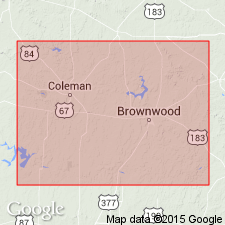
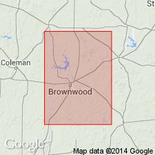
[Named from Cedarton, Brown Co., Colorado River region, central TX.] Notable exposures about 3 mi south of Jim Ned Creek and Willis Creek-Cedarton area, Colorado River region, central TX.
Source: US geologic names lexicon (USGS Bull. 896, p. 383-384; USGS Bull. 1200, p. 691); supplemental information from GNU records (USGS DDS-6; Denver GNULEX).

- Usage in publication:
-
- Cedarton shale and sandstone member
- Modifications:
-
- Principal reference
- Revised
- AAPG geologic province:
-
- Bend arch
- Llano uplift
Summary:
Pg. 24, 31, 35; Univ. Texas Bull., no. 2132, p. 109, 114. Cedarton shale and sandstone, 20 to 100 feet thick, is basal member of Brad formation in Colorado River Valley. Underlies Clear Creek limestone and overlies Adams Branch limestone member of Graford formation. Consists of blue sandy shale (in places weathering red and purple) with sandstone lentils and a few thin beds of conglomerate. Age is Pennsylvanian.
Named from Cedarton, Brown Co., Colorado River region, central TX.
Source: US geologic names lexicon (USGS Bull. 896, p. 383-384).

- Usage in publication:
-
- Cedarton member*
- Modifications:
-
- Revised
- AAPG geologic province:
-
- Bend arch
Summary:
Pg. 104, 111. Cedarton member of Graford formation. Restricted Brad formation to Placid shale member of Plummer and Moore and Ranger limestone member, and included Cedarton member in Graford formation. Age is Pennsylvanian.
Source: US geologic names lexicon (USGS Bull. 896, p. 383-384).

- Usage in publication:
-
- Cedarton shale member*
- Modifications:
-
- Areal extent
- AAPG geologic province:
-
- Bend arch
Summary:
Pg. 104-105. Introduced Winchell shale member for beds overlying Cedarton shale member and forming top member of Graford formation in both Brazos River and Colorado River regions, central Texas. [Age is Late Pennsylvanian.]
Source: US geologic names lexicons (USGS Bull. 896, p. 383-384; USGS Bull. 1200, p. 691).

- Usage in publication:
-
- Cedarton shale
- Modifications:
-
- Revised
- AAPG geologic province:
-
- Bend arch
Summary:
Pg. 66 (fig. 1), 88. Cedarton shale of Graford group. Rank raised to formation in Graford group. Overlies Adams Branch formation; underlies Winchell formation. [Age is Late Pennsylvanian.]
Source: US geologic names lexicon (USGS Bull. 1200, p. 691).
- Usage in publication:
-
- Cedarton shale member*
- Modifications:
-
- Areal extent
- AAPG geologic province:
-
- Bend arch
Summary:
Pg. 51. Cedarton shale member of Graford formation. In Brown and Coleman Counties, central Texas, consists of shale, red in upper part and gray in lower part. Upper part locally contains fern leaf prints; lower part contains crinoid debris and a few fusulinids. Thickness about 70 feet. Overlies Adams Branch limestone member; underlies unnamed limestone at base of Winchell limestone. [Age is Late Pennsylvanian.]
Source: US geologic names lexicon (USGS Bull. 1200, p. 691).
- Usage in publication:
-
- Cedarton shale member
- Modifications:
-
- Revised
- AAPG geologic province:
-
- Bend arch
Summary:
Cedarton revised--removed from Graford formation and assigned to newly named Brookesmith formation as topmost member. Name Graford formation, as defined by the USGS in 1960--with Brownwood shale member (at base), Adams Branch limestone, and Cedarton shale member (at top)--not used. Name Brookesmith, here named, is proposed instead. Brookesmith includes Adams Branch limestone member (base) and Cedarton shale member (top). Area of report is the Colorado River Valley area, Brown Co, TX on Bend arch. Brookesmith overlies Brownwood formation (revised--removed as a shale member of Graford formation and rank raised to formation); underlies Winchell limestone. Stratigraphic chart. Of Canyon [Pennsylvanian] age. [Author does not capitalize rank terms; however, units are considered to be formal.]
Source: GNU records (USGS DDS-6; Denver GNULEX).
- Usage in publication:
-
- Cedarton Shale Member*
- Modifications:
-
- Biostratigraphic dating
- AAPG geologic province:
-
- Bend arch
Summary:
Pg. C1-C4, C11; see also USGS Prof. Paper 550-B, p. B47-B50, 1966. Adams Branch Limestone Member of Graford Formation of Canyon Group. Measured section along Adams Branch in cuts of Gulf, Colorado and Santa Fe RR, 3 miles from Brownwood, Brown County, Texas. Thickness 36 feet. Age is Late Pennsylvanian (early Missourian of Midcontinent terminology); lies at base of TRITICITES faunal zone.
Fusulinids: TRIITCITES MUSCERDA Myers, n. sp. (USGS fossil loc. F10018, f10028, f10099, f10100, f10110, f10115, f10116 collected from near top); OKETAELLA EARGLEI Myers, 1966 (USGS fossil loc. F10109 collected from upper part); KANSANELLA VOLUMINOSA Myers, n. sp. (USGS fossil loc. F10001, f10013, f10112, f10113, f10114 collected from basal few feet).
Source: Publication.
For more information, please contact Nancy Stamm, Geologic Names Committee Secretary.
Asterisk (*) indicates published by U.S. Geological Survey authors.
"No current usage" (†) implies that a name has been abandoned or has fallen into disuse. Former usage and, if known, replacement name given in parentheses ( ).
Slash (/) indicates name conflicts with nomenclatural guidelines (CSN, 1933; ACSN, 1961, 1970; NACSN, 1983, 2005, 2021). May be explained within brackets ([ ]).