

- Usage in publication:
-
- Carmel formation*
- Modifications:
-
- First used
- Dominant lithology:
-
- Sandstone
- Limestone
- Shale
- Gypsum
- AAPG geologic province:
-
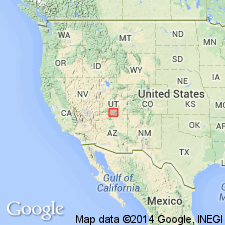
- Paradox basin
Summary:
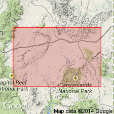
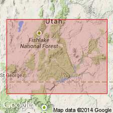
Designated as the basal formation of San Rafael group (new) in San Rafael Swell, Emery Co, UT in the Paradox basin. Intent to name, source of name, type locality not stated. Ranges from 50 ft thick at mouth of Dolores R., 60 ft in Salt Valley anticline, 95 ft thick at mouth of San Rafael River to 170 ft thick at Black Dragon Canyon, and 650 ft thick near junction of Last Chance and Starvation Creeks in San Rafael Swell. [Listed as 449+ ft at the latter locality in the measured section description p. 84]. Consists in the Swell as having basal limy buff to greenish-yellow sandstone composed of reworked Navajo sandstone and gray fossiliferous sandy limestones succeeded by gray, orange-red, and greenish shales with much highly contorted gypsum beds. The limestone contains abundant marine fossils. Anhydrite and gypsiferous beds suggest deposition in lagoons by evaporation. Thought to be Late Jurassic.
Source: GNU records (USGS DDS-6; Denver GNULEX).
- Usage in publication:
-
- Carmel formation*
- Modifications:
-
- Overview
- Dominant lithology:
-
- Shale
- Limestone
- Sandstone
- Gypsum
- AAPG geologic province:
-
- Plateau sedimentary province
Summary:
Composite of measured partial sections at type locality (l) between Virgin River bridge and a point 2 mi west of Carmel village; 2) about 2 mi west of Meskin Bar, Colorado River; 3) about 2 mi east of Escalante; 4) Halls Valley near Burr trail; 5) head of Parunuweap Canyon; 6) Dry Canyon, about 2 mi above junction with Paria River). Mount Carmel (the source of the name) is in sec 8, T41N, R7W, Kane Co, UT in the Plateau sedimentary province and west of report area mapped to north in Garfield Co in the Paradox basin. Consists of a series of beds composed of cream to gray, sandy, partly oolitic to dense, brittle hard limestone, banded pale red and white, fine grained friable to gray to buff, very calcareous sandstone, white gypsum, and white gypsiferous to a gray buff or gray cream calcareous to brick red hard shale. Is 269 ft thick at locality near Mt. Carmel. Overlies Navajo sandstone; underlies Entrada sandstone at most localities or Summerville formation at others. Is fossiliferous. Assigned as basal formation of the Upper Jurassic San Rafael group.
Source: GNU records (USGS DDS-6; Denver GNULEX).
- Usage in publication:
-
- Carmel formation*
- Modifications:
-
- Revised
- AAPG geologic province:
-
- Great Basin province
Summary:
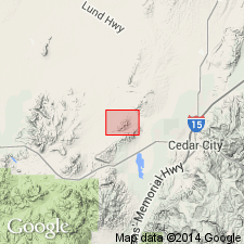
Divided into a siltstone member at base, a few tens of ft thick, and the Homestake limestone member (reduced in rank and newly assigned to Carmel), 220 to 250 ft thick. Both the siltstone and the overlying limestone were included in the Homestake formation by Leith and Harder (1908). The siltstone was misidentified by them as an altered limestone. The siltstone member is the oldest unit mapped. The Homestake is overlain by the Entrada sandstone, newly recognized in report area. Leith and Harder assigned all rocks above Homestake and beneath Claron formation to the Pinto sandstone (abandoned in this report). The siltstone member is light to dark gray, thin bedded and massive, and equivalent to the middle shale-siltstone unit of the Carmel farther east in southern UT. Member mapped (geologic map) in northeast corner of quad near the Three Peaks intrusion, around Granite Mountain in the central part of the quad, and south of Desert Mound arch in the southwest part of the quad, Iron Co, UT in the Great Basin province. Assigned to the Jurassic.
Source: GNU records (USGS DDS-6; Denver GNULEX).
- Usage in publication:
-
- Carmel formation*
- Modifications:
-
- Areal extent
- AAPG geologic province:
-
- Black Mesa basin
Summary:
Pg. 3 (fig. 2), 33-35, pls. 1, 3. Carmel formation of San Rafael group. Over most of Navajo country, Carmel consists of typically silty strata, but, in southwestern part of area, has different lithologic characteristics owing to introduction of locally derived sand. This variation of deposition continued during deposition of Entrada sandstone; hence, the two units are difficult to differentiate in this area. Thickness between 100 and 200 feet. [Age is Middle and Late Jurassic.]
Source: US geologic names lexicon (USGS Bull. 1200, p. 642-643).
- Usage in publication:
-
- Carmel Formation*
- Modifications:
-
- Areal extent
- AAPG geologic province:
-
- Paradox basin
Summary:
Rocks formerly assigned to Carmel Formation east of Green River, UT in Paradox basin removed from Carmel, thereby restricting eastern areal limits of Carmel. Rocks are reassigned to the younger Entrada Sandstone because of the greater lithologic similarity to Entrada. The rocks reassigned to the Entrada are named the Upper Jurassic Dewey Bridge Member (new).
Source: GNU records (USGS DDS-6; Denver GNULEX).
- Usage in publication:
-
- Carmel formation*
- Modifications:
-
- Contact revised
- AAPG geologic province:
-
- Plateau sedimentary province
Summary:
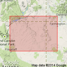
Lower contact revised in that the main body of the Carmel formation of Glen Canyon group overlies the newly named Thousand Pockets tongue of the Navajo sandstone. A lower unit, assigned to the Carmel, composed mostly of sandstone and siltstone lying about 230 ft below the base of the main body of the Carmel, and between the main body of the Navajo sandstone and the Thousand Pockets tongue, is named Judd Hollow tongue of the Carmel. Main body mapped along north part of map area (geologic maps), Coconino Co, AZ, Plateau sedimentary province. Judd Hollow tongue mapped in west part of map area. Main body divided in text into: 1) a lower unit of red-brown, thin-bedded siltstone and gray-yellow, medium- to fine-grained sandstone; 2) a middle unit of massive and thick-bedded, horizontally bedded to cross-bedded, brown, medium- to fine-grained sandstone with interbedded siltstone in lowermost and uppermost parts; and 3) an upper unit of red-brown, thin-bedded siltstone and mudstone with local resistant sandstone beds. Thicknesses given in sections measured north of mapped area in Kane Co (Plateau sedimentary province) range from 204 to 299 ft. Underlies Entrada sandstone of San Rafael group. Assigned a Middle and Late Jurassic age. Columnar section.
Source: GNU records (USGS DDS-6; Denver GNULEX).
- Usage in publication:
-
- Carmel Formation*
- Modifications:
-
- Overview
- Areal extent
- AAPG geologic province:
-
- Great Basin province
- Plateau sedimentary province
Summary:
Persistent thin bentonite beds occur at or near the base of the Jurassic Carmel in southwest UT in Washington and Iron Cos, Great Basin province, Kane Co, Plateau sedimentary province, and Garfield Co, Paradox basin. The bentonites are dark-purple or pale-green claystone, one or two inches thick, and are conspicuously different from the redbeds. Petrologic and mineralogic description of bentonites included. The bentonite beds were deposited on a tidal flat at the same time as the sea encroached from west. Most of the samples farthest from encroaching sea (east) are red or purple due to included hematite presumably caused by oxidation during repeated exposure to wetting and drying. Samples collected seaward (west) are green indicating little exposure to alternating wetting and drying conditions. Mineralogical variations in samples not totally explained by depositional conditions. Alteration influenced by chemistry of circulating connate water.
Source: GNU records (USGS DDS-6; Denver GNULEX).
- Usage in publication:
-
- Carmel Formation*
- Modifications:
-
- Geochronologic dating
- AAPG geologic province:
-
- Plateau sedimentary province
- Great Basin province
- Paradox basin
Summary:
Carmel Formation. Samples collected from bentonite beds in the lower and upper parts of the Carmel Formation at 6 localities in southwestern Utah (Kane and Washington Counties) and east-central Utah (Emery County); thickness of bentonite beds average 1-inch. Samples collected from lower Carmel Formation (carries Bajocian fossils) in southwestern Utah; from upper Carmel Formation (probably Bathonian) in east-central Utah. K-Ar and Rb-Sr ages on biotite ranges from about 165 Ma to 140 Ma; minimum age is 163 Ma. Span of ages is attributed to chemical alteration of the biotite by groundwater.
Source: Modified from GNU records (USGS DDS-6; Denver GNULEX).
- Usage in publication:
-
- Carmel Formation
- Modifications:
-
- Revised
- AAPG geologic province:
-
- Paradox basin
Summary:
Intertongues with Navajo Sandstone. Divided into Kolob Limestone Member (new, at base), Crystal Creek Member (new), which are equivalent to the Judd Hollow Tongue of Carmel east of Cedar Mountain, Paria River Member (new), Winsor Member, and Wiggler Wash Member (new, at top). Underlies Gunsight Butte Member (new) of Entrada Sandstone from Lick Wash (Ts39 and 40S, Rs3 and 4W), east to Cottonwood Creek (Ts39 to 41S, R1W), Kane Co, UT in the Paradox basin. Assigned to the Middle Jurassic. Measured sections. Cross sections. Block diagram.
Source: GNU records (USGS DDS-6; Denver GNULEX).
- Usage in publication:
-
- Carmel Formation*
- Modifications:
-
- Areal extent
- AAPG geologic province:
-
- San Juan basin
- Paradox basin
- Black Mesa basin
Summary:
Is lowermost of five formations of San Rafael Group. Thickness and eastern limit shown on fig. 2 in Four Corners area of UT, CO, NM and AZ in San Juan, Paradox and Black Mesa basins. Eastern limit of unit occurs east of Comb Ridge, UT, east of Chinle, AZ and between Toadlena and Gallup, NM. Within study area thickness ranges up to 280 ft. Unconformably overlies Glen Canyon Group; conformably underlies Entrada Sandstone of San Rafael. Middle Jurassic, in lower part, and Late Jurassic age.
Source: GNU records (USGS DDS-6; Denver GNULEX).
- Usage in publication:
-
- Carmel Formation*
- Modifications:
-
- Revised
- Reference
- Dominant lithology:
-
- Sandstone
- Gypsum
- Limestone
- AAPG geologic province:
-
- Paradox basin
- Great Basin province
- Plateau sedimentary province
Summary:
Is an eastward-thinning, slope-forming unit, usually basal formation of San Rafael Group above Navajo Sandstone and below Entrada Sandstone. Present in UT (Iron and Washington Cos, Great Basin province into Paradox basin), northern AZ and UT, Kane Co, Plateau sedimentary province. Divided into limestone, banded and gypsiferous members, and Winsor Member at type. Divided into Judd Hollow Tongue (revised) and upper member separated by Thousand Pockets Tongue (revised) of Page Sandstone (new). Only Upper member present at Page and Cow Springs, Coconino Co, AZ. Reference sections designated at 1) N1/2 SW1/4 SW1/4 sec 29, E1/2 SE1/4 SE1/4 sec 30, T34S, R3E, Garfield Co, UT and at 2) SW1/4 SW1/4 sec 1, SE1/4 SE1/4 sec 2, T41N, R8E, Coconino Co, AZ. Upper member consists of sandstone that may be gray, orange, red brown, coarse silty to very fine grained, moderately to poorly sorted, irregularly laminated to thin bedded. Gray gypsum, orange to gray, very fine-grained to microcrystalline, thin-bedded to cross-laminated limestone, and red-brown, silty thin-bedded mudstone. Judd Hollow at #1 composed of gray, very fine to fine-grained, moderately to well sorted, very thin-bedded sandstone and orange and gray, very fine-grained limestone. Is 140 m thick at #1 and 77.7 m thick at #2. Of late middle Bajocian to early Callovian, Middle Jurassic age. Correlation chart. Cross sections. Measured sections.
Source: GNU records (USGS DDS-6; Denver GNULEX).
- Usage in publication:
-
- Carmel Formation*
- Modifications:
-
- Mapped 1:24k (Moffat Co, CO)
- Dominant lithology:
-
- Shale
- Sandstone
- Siltstone
- Mudstone
- AAPG geologic province:
-
- Green River basin
Summary:
Is Middle Jurassic formation mapped in southwest Moffat Co, CO (Greater Green River basin). Unconformably overlies Glen Canyon Sandstone (Upper Triassic and Lower Jurassic); underlies Entrada Sandstone (Middle Jurassic). Map unit described as soft and moderately resistant medium- to dark-red, thin- to medium-bedded sandy shale, fine- to medium-grained sandstone, siltstone, and mudstone. Locally contains thin beds of light-yellow sandstone, light-gray gypsum, and--at the top of the unit--purplish-red and gray laminated siltstone and shale. About 19 m (60 ft) thick at Plug Hat Rock and north of the well in NW1/4 sec. 7, T3N, R103W. Thins eastward and northeastward and pinches out about 15 km (9 mi) east of the quadrangle (Imlay, 1979; Pipiringos, unpub. data). It thickens west and north of the quadrangle (Kinney, 1955; Hansen, 1965). The basal contact is an unconformity, marked by chert pebbles, that occurs over broad areas of the Western Interior of North America (Pipiringos, 1968; Pipiringos and O'Sullivan, 1975). This unconformity occurs at or several meters (10 ft) below the lithologic boundary separating red beds typical of the Carmel from light-gray, pink, and buff fine-grained sandstone that resembles the Glen Canyon Sandstone. The interval between the chert pebble unconformity and typical red Carmel is interpreted to represent reworked Glen Canyon and is considered to be part of the Carmel Formation. Most chert grains are 1-2 mm (0.05-0.1 in) in diameter to rarely as large as 1-2 cm (0.5-1.0 in), and are white, light-gray, tan, yellow, pink, and black. The chert pebble zone is in general only one grain thick.
Source: GNU records (USGS DDS-6; Denver GNULEX).
- Usage in publication:
-
- Carmel Formation
- Modifications:
-
- Areal extent
- AAPG geologic province:
-
- Great Basin province
- Plateau sedimentary province
- Paradox basin
Summary:
Correlations, facies relationships, and areal limits of members of Middle Jurassic Carmel Formation described. Correlation chart. Cross sections. Facies maps. Carmel overlies Temple Cap sandstone unconformably in western area of Washington Co., UT in the Great Basin province. Carmel overlies Navajo Sandstone in eastern areas --from the Paria River basin to east into the Plateau sedimentary province, and to the Circle Cliffs in Garfield Co. in the Paradox basin. Carmel tongues eastward into the Page Sandstone. Divided into (ascending): Judd Hollow, Crystal Creek, Paria River, and Winsor Members. Eastward, where the Paria River and Winsor cannot be separated, the upper part is called upper member of Carmel. The Paria River Member is recognized over the greatest area of any of the members. Carmel underlies Entrada.
Source: GNU records (USGS DDS-6; Denver GNULEX).
- Usage in publication:
-
- Carmel Formation*
- Modifications:
-
- Overview
- AAPG geologic province:
-
- Plateau sedimentary province
Summary:
Cobbles and boulders of partly welded to welded rhyolitic tuff have been identified in the upper member of the Carmel Formation in Kane Co, southern UT in the Plateau sedimentary province. The coarse clasts were not expected in this area which was considered to be a broad, stable shelf on which coastal sabkha and arid floodplain deposits were laid down in Middle Jurassic time. Two facies distinguished: 1) pebble-boulder muddy sandstone facies deposited as a mudflow; and 2) pebble-boulder conglomerate facies deposited by a fluvial system. The welded tuffs clasts were probably derived from an ignimbrite-type ash flow. A widespread ignimbrite event has been noted in westward increase of volcanic sands in the Crystal Creek Member of the Carmel. The source area for the clasts may have been the Jurassic magmatic arc in the NV-CA-AZ region. Clasts increase in size and abundance to southwest. Occurrence of the large boulders and cobbles can possibly be explained as the result calving of blocks of tuff from tuff-capped plateaus into ephemeral streams where they could be rounded by weathering or fluvial action. Subsequent mudflows could incorporate the tuff clasts and the underlying sand in areas of paleovalleys.
Source: GNU records (USGS DDS-6; Denver GNULEX).
- Usage in publication:
-
- Carmel Formation*
- Modifications:
-
- Geochronologic dating
- AAPG geologic province:
-
- Great Basin province
Summary:
Mapped in southwest UT, Great Basin province. Divided into (ascending) lower and upper parts of Judd Hollow Member and Crystal Creek Member; each separately mapped. Thicknesses of mapped units are: lower part of Judd Hollow, 80 m; upper part of Judd Hollow, 30-50 m; Crystal Creek, up to 30 m. K-Ar age of 165 Ma (H. Mehnert, written commun., 1983) obtained from biotite from green tuff bed near top of upper part of Judd Hollow from a locality in SW SW sec 19, T40S, R17W, Washington Co. Overlies Temple Cap Formation; unconformably underlies Dakota Conglomerate (redescribed). Assigned Middle Jurassic (Bajocian and Bathonian) age based on correlations of Judd Hollow (Bajocian) with Sliderock and Rich Members of Twin Creek Limestone and of Crystal Creek (Bathonian) with Boundary Ridge Member of Twin Creek Limestone in northern UT.
Source: GNU records (USGS DDS-6; Denver GNULEX).
For more information, please contact Nancy Stamm, Geologic Names Committee Secretary.
Asterisk (*) indicates published by U.S. Geological Survey authors.
"No current usage" (†) implies that a name has been abandoned or has fallen into disuse. Former usage and, if known, replacement name given in parentheses ( ).
Slash (/) indicates name conflicts with nomenclatural guidelines (CSN, 1933; ACSN, 1961, 1970; NACSN, 1983, 2005, 2021). May be explained within brackets ([ ]).