The National Geologic Map Database is migrating to a new infrastructure. We apologize for any service disruptions during this process.
|
|---|


- Usage in publication:
-
- Carbondale formation
- Modifications:
-
- Original reference
- Dominant lithology:
-
- Shale
- Sandstone
- Coal
- Limestone
- AAPG geologic province:
-
- Illinois basin
Summary:
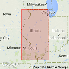
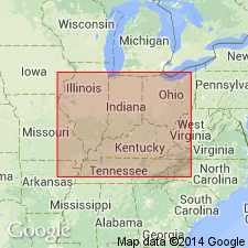
Pg. 74. Carbondale formation. Series of beds of shale, sandstone, coal, and limestone, 200 to 400 feet thick, extending from bottom of Murphysboro or No. 2 coal below to top of Herrin or No. 6 coal above. Overlies Pottsville formation and underlies McLeansboro formation. Combines "LaSalle formation" and "Petersburg formation" of previous report. Present in Illinois and western Kentucky. Age is Pennsylvanian.
Named from Carbondale, Jackson Co., Illinois.
Source: US geologic names lexicon (USGS Bull. 896, p. 345).
- Usage in publication:
-
- Carbondale formation*
- Modifications:
-
- Adopted
- AAPG geologic province:
-
- Illinois basin
Summary:
Carbondale formation. Also defined Carbondale formation as extending from base of No. 2 coal to top of No. 6 coal.
[GNC remark (ca. 1938, US geologic names lexicon, USGS Bull. 896, p. 345): Top of underclay of Murphysboro or No. 2 coal is now the USGS's accepted base of formation. The Carbondale was correlated by D. White with all but uppermost part of Alleghany formation.]
Source: US geologic names lexicon (USGS Bull. 896, p. 345).
- Usage in publication:
-
- Carbondale formation
- Modifications:
-
- Revised
- AAPG geologic province:
-
- Illinois basin
Summary:
Pg. 5-6. Carbondale formation. In Pike County, Indiana, includes Arthur limestone (new) [unranked].
Source: US geologic names lexicon (USGS Bull. 1200, p. 628-629).
- Usage in publication:
-
- Carbondale formation
- Modifications:
-
- Revised
- AAPG geologic province:
-
- Illinois basin
Summary:
Pg. 22, 26. Carbondale formation. In Illinois, includes Browning sandstone and Hanover sandstone (both new) [members].
Source: US geologic names lexicon (USGS Bull. 1200, p. 628-629).
- Usage in publication:
-
- Carbondale group
- Modifications:
-
- Revised
- AAPG geologic province:
-
- Illinois basin
Summary:
Pg. 36 (footnote). Carbondale group. Principal divisions of Pennsylvanian System in Illinois (Caseyville, Tradewater, Carbondale, and McLeansboro) considered formations in previous publications are, according to present usage of Illinois Geological Survey, groups.
Source: US geologic names lexicon (USGS Bull. 1200, p. 628-629).

- Usage in publication:
-
- Carbondale formation
- Modifications:
-
- Revised
- AAPG geologic province:
-
- Illinois basin
Summary:
Pg. 8 (fig. 1), 34-36, 46-48 (table 1), 65-66, pl. 1. Carbondale formation of Kewanee Group (new). Redefined as formation to include strata between base of Colchester (No. 2) coal and top of Danville (No. 7) coal. As originally defined Carbondale included strata from bottom of Murphysboro coal to top of Herrin (No. 6) coal. Murphysboro coal was then considered equivalent to No. 2 coal of western Illinois. Intent was to use No. 2 coal as base of Carbondale, and except at Murphysboro, it was so used. Dominantly gray shale with sandstone prominent locally. Commonly 225 to 300 feet thick; in parts of northern, western, and southwestern Illinois, thins to about 125 feet, locally even less; about 400 feet thick in part of southeastern Illinois. Overlies Spoon formation (new); underlies Modesto formation (new). Type section designated. Age is Middle Pennsylvanian (Desmoinesian). Report presents new rock-stratigraphic classification of Pennsylvanian of Illinois. Cyclical classification is retained but is independent of rock-stratigraphic classification; includes rocks also assigned to (alphabetical): Bankston, Brereton, Briar Hill, Cutler (part), Jamestown, Liverpool (part), Lowell, St. David, Sparland (part), Summum, and Tonica (part) cyclothems.
Members in southern Illinois (ascending): Colchester (No. 2) coal, Shawneetown coal (new), Roodhouse coal, Summum (No. 4) coal, Hanover limestone, Harrisburg (No. 5) coal, St. David limestone, Briar Hill (No. 5A) coal, Vermillionville sandstone, Herrin (No. 6) coal, Brereton limestone, Jamestown coal, Conant limestone (new), Anvil Rock sandstone, Bankston Fork limestone, Allenby coal (new), Galum limestone, and Danville (No. 7) coal.
Members in northern and western Illinois (ascending): Colchester (No. 2) coal, Francis Creek shale, Jake Creek sandstone, Lowell coal, Oak Grove limestone, Purington shale, Pleasantview sandstone, Kerton Creek coal, Summum (No. 4) coal, Hanover limestone, Covel conglomerate, Springfield (No. 5) coal, St. David limestone, Canton shale, Vermillionville sandstone, Big Creek shale, Herrin (No. 6) coal, Brereton limestone, Lawson shale (new), Pokeberry limestone, Copperas Creek sandstone, and Danville (No. 7) coal.
Members in eastern Illinois (ascending): Colchester (No. 2) coal, Shawneetown coal, Summum (No. 4) coal, Harrisburg (No. 5) coal, Herrin (No. 6) coal, and Danville (No. 7) coal.
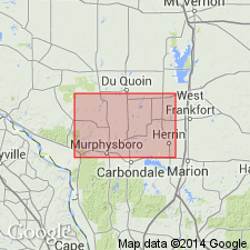
Type section [composite]: exposures in SE/4 NE/4 sec. 1, T. 7 N., R. 4 E., Glasford quadrangle, and in NW/4 NE/4 NW/4 sec. 20 and SW corner sec. 21, T. 8 N., R. 3 E., Canton quadrangle, Fulton Co., northwestern IL.
Source: US geologic names lexicon (USGS Bull. 1200, p. 628-629).

- Usage in publication:
-
- Carbondale Formation
- Modifications:
-
- Revised
- Biostratigraphic dating
- Overview
- AAPG geologic province:
-
- Illinois basin
Summary:
Carbondale Formation. Currently recognized throughout the Illinois basin, but its definition varies from one locality to another. Within the study area, the Carbondale is subdivided into (ascending) Davis Coal Member, Dekoven Coal Member, Palzo Sandstone Member, Colchester Coal Member, Mecca Quarry Shale Member, Survant Coal Member, Houchin Creek Coal Member, and the Excello Shale Member. The Murphysboro Coal, originally defined as the basal member of the Carbondale, is discontinuous in the study area, while the Davis Coal is both widely continuous and minable. Therefore, authors adopt the base of the Davis Coal as the base of the Carbondale. This revises the Spoon-Carbondale boundary of Kosanke et al (1960), moving it downward 70 or 80 feet, from the base of the Colchester Coal Member. Maximum thickness of the Carbondale in the Eddyville quadrangle is approximately 225 feet, the upper 175 to 250 feet of the Carbondale having been eroded. Unit here is Middle Pennsylvanian (middle to middle late Desmoinesian), based on fusulinids (Douglass, 1987) and palynology (Peppers, 1988).
Source: GNU records (USGS DDS-6; Reston GNULEX).
- Usage in publication:
-
- Carbondale Group*
- Modifications:
-
- Overview
- AAPG geologic province:
-
- Illinois basin
Summary:
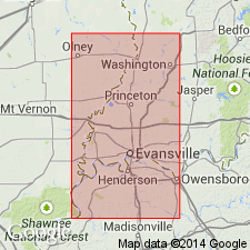
Springfield Coal Member of Petersburg Formation of Carbondale Group is split locally in Warrick and Gibson Counties, Indiana, by Folsomville Member of Petersburg Formation.
Source: GNU records (USGS DDS-6; Reston GNULEX).
- Usage in publication:
-
- Carbondale Group
- Carbondale Formation
- Modifications:
-
- Revised
- AAPG geologic province:
-
- Illinois basin
Summary:
Pg. 9-13, pl. 1. Carbondale Formation (Illinois and Kentucky) and Carbondale Group (Indiana). Mostly shales that contain marine and plant fossils, thin coals, and siderite nodules, and locally interfinger with sandstones. Thickness ranges from about 200 to 500 feet. In Indiana, divided into (ascending) Linton Formation, Petersburg Formation, and Dugger Formation. Lower boundary placed at base of Seelyville Coal Member or Davis coal bed (Davis Coal Member). Upper boundary varies: in Illinois and Kentucky, placed at base of Providence (Brereton) Limestone Member, = base of lowermost limestone of McLeansboro Group in Illinois and above Herrin coal bed in Kentucky, and where limestone is absent, boundary placed at top of underlying black shale (Anna Shale Member in Illinois); in Indiana, upper boundary placed at top of Danville Coal Member. Age is Middle Pennsylvanian (Desmoinesian). Classification proposed in this report agreed upon by State Geological Surveys of Illinois, Indiana, and Kentucky.
Source: Publication.
For more information, please contact Nancy Stamm, Geologic Names Committee Secretary.
Asterisk (*) indicates published by U.S. Geological Survey authors.
"No current usage" (†) implies that a name has been abandoned or has fallen into disuse. Former usage and, if known, replacement name given in parentheses ( ).
Slash (/) indicates name conflicts with nomenclatural guidelines (CSN, 1933; ACSN, 1961, 1970; NACSN, 1983, 2005, 2021). May be explained within brackets ([ ]).