

- Usage in publication:
-
- Caneadea shale
- Modifications:
-
- Original reference
- Dominant lithology:
-
- Shale
- AAPG geologic province:
-
- Appalachian basin
Summary:
(No. 3, areal refinements, p. 189-204, Oct. 1933.) Pg. 200. Caneadea shale. In a section of rocks from Olean to Genesee River, [southwestern New York], placed Caneadea below Rushford sandstones, above Dunkirk shale (=Canaseraga) and opposite Gowanda. On p. 203 he stated: If Gowanda beds of western New York should prove not strictly coterminous with those we have so identified on Genesee River, then to the beds between the Dunkirk and the Rushford sandstones on this meridian the term Caneadea shale will naturally apply, for it is on Canadea Creek, below the new power dam (near its mouth), that they have their finest section, just under the type exposures of the Rushford, but, unfortuanately, the bottom (i.e., the Dunkirk top) is not reached. Age is Late Devonian.
Source: US geologic names lexicon (USGS Bull. 896, p. 331-332).
- Usage in publication:
-
- Caneadea member*
- Modifications:
-
- Revised
- Dominant lithology:
-
- Shale
- Sandstone
- Siltstone
- AAPG geologic province:
-
- Appalachian basin
Summary:
Caneadea member of Perrysburg formation. Rank reduced to member status in Perrysburg formation (new). Restricted to all rocks between top of Hume shale member (new) and base of Luther's Rushford sandstone which is exposed in Caneadea Gorge 3.3 miles east of Rushford, [Allegany County, southwestern New York]. Lower part of member consists of gray siltstone ranging in thickness from 1 to 20 inches, which is interbedded with gray silty shale. Middle part is largely shale containing some siltstone. Upper part, which is exposed along Caneadea Creek below Rushford Dam, is shale containing many thin beds of siltstone. No complete exposure present. Estimated thickness 280 feet. Figure 4 shows that Caneadea, Canisteo (new) and Gowanda members, although closely related at time of deposition, are not strictly correlative throughout. Age is Late Devonian.
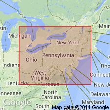
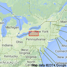
Well exposed in Caneadea Gorge, west of town of Caneadea in Angelica quadrangle, Allegany Co., southwestern NY (= stratigraphic section 10).
Source: Publication; US geologic names lexicon (USGS Bull. 1200, p. 604-605).
- Usage in publication:
-
- Caneadea member
- Modifications:
-
- Revised
- AAPG geologic province:
-
- Appalachian basin
Summary:
Pg. 10 (fig. 1), 12. Caneadea member of Canadaway formation. [Reallocated.] Overlies Hume member; underlies Rushford member. [Age is Late Devonian.]
Source: US geologic names lexicon (USGS Bull. 1200, p. 604-605).
- Usage in publication:
-
- Caneadea formation
- Modifications:
-
- Revised
- AAPG geologic province:
-
- Appalachian basin
Summary:
Pg. 17 (table 2), 18. Caneadea formation of Canadaway group. Overlies Hume shale; underlies Rushford sandstone. [Age is Late Devonian.]
Source: US geologic names lexicon (USGS Bull. 1200, p. 604-605).

- Usage in publication:
-
- Caneadea shale
- Modifications:
-
- Revised
- AAPG geologic province:
-
- Appalachian basin
Summary:
Pg. 7, pl. 3. Caneadea Shale of Canadaway Group. The Caneadea of Pepper and de Witt (1951) consists of strata of Portage facies = to Dunkirk of western New York. Lies above Hume Shale and below Forty Bridge Formation. Age is Late Devonian (early Famennian; early Chautauquan); conodont biozones PALMATOLEPIS TRIANGULARIS to P. CREPIDA.
Source: Publication.
For more information, please contact Nancy Stamm, Geologic Names Committee Secretary.
Asterisk (*) indicates published by U.S. Geological Survey authors.
"No current usage" (†) implies that a name has been abandoned or has fallen into disuse. Former usage and, if known, replacement name given in parentheses ( ).
Slash (/) indicates name conflicts with nomenclatural guidelines (CSN, 1933; ACSN, 1961, 1970; NACSN, 1983, 2005, 2021). May be explained within brackets ([ ]).