

- Usage in publication:
-
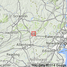
- Buttermilk Falls limestone
- Modifications:
-
- Named
- Dominant lithology:
-
- Limestone
- Chert
- AAPG geologic province:
-
- Appalachian basin
Summary:
Named the Buttermilk Falls limestone for Buttermilk Falls on Marshall Creek, Monroe Co., PA. Unit replaces what was formerly called Onondaga limestone since the Onondaga was raised to group rank and includes a larger part of the stratigraphic column. Consists of heavily bedded dark- or blue-gray limestone with nodules and lenses of dark chert. Chert more abundant in middle part of unit. Thickness is about 200 ft, but thins westward. Overlies the Esopus shale and underlies the Marcellus formation. The Buttermilk Falls is of Devonian age.
Source: GNU records (USGS DDS-6; Reston GNULEX).
- Usage in publication:
-
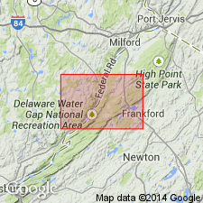
- Buttermilk Falls Limestone
- Modifications:
-
- Areal extent
- AAPG geologic province:
-
- Appalachian basin
Summary:
Buttermilk Falls Limestone extended to Sussex Co., NJ, where it underlies the Marcellus Formation and grades into the underlying Schoharie Formation. Thickness 270 ft. Age is Middle Devonian.
Source: GNU records (USGS DDS-6; Reston GNULEX).
- Usage in publication:
-
- Buttermilk Falls Limestone*
- Modifications:
-
- Age modified
- Biostratigraphic dating
- AAPG geologic province:
-
- Appalachian basin
Summary:
Age of Buttermilk Falls Limestone changed to Early Devonian (Emsian) and Middle Devonian (Eifelian). Buttermilk Falls Limestone in NJ contained no conodonts, but samples from measured sections in type area of Buttermilk Falls near East Stroudsburg, PA, indicate lower one-third of formation is no older than SEROTINUS Zone (Emsian) and remainder of formation formed during PARTITUS and COSTATUS Zones (Eifelian). Also in type area, Tioga Ash Bed occurs 9 m below top of Buttermilk Falls; Tioga is known to lie within COSTATUS Zone at many localities in Appalachian basin.
Source: GNU records (USGS DDS-6; Reston GNULEX).
- Usage in publication:
-
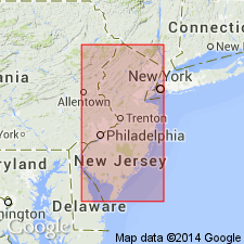
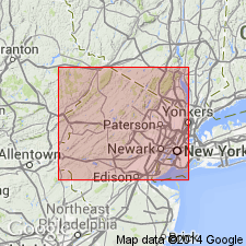
- Buttermilk Falls Limestone*
- Modifications:
-
- Areal extent
- AAPG geologic province:
-
- Appalachian basin
Summary:
Buttermilk Falls Limestone mapped in northern NJ. Consists of light- to medium-light-gray weathering, medium- to dark-gray, thin- to medium-bedded, clayey silty, fossiliferous, flaggy limestone with nodular black chert. Thickness is approximately 82 m. Conformably overlies the Onondaga Limestone and conformably underlies the Marcellus Shale. The Buttermilk Falls is of Middle Devonian age.
Source: GNU records (USGS DDS-6; Reston GNULEX).
For more information, please contact Nancy Stamm, Geologic Names Committee Secretary.
Asterisk (*) indicates published by U.S. Geological Survey authors.
"No current usage" (†) implies that a name has been abandoned or has fallen into disuse. Former usage and, if known, replacement name given in parentheses ( ).
Slash (/) indicates name conflicts with nomenclatural guidelines (CSN, 1933; ACSN, 1961, 1970; NACSN, 1983, 2005, 2021). May be explained within brackets ([ ]).