- Usage in publication:
-
- Brownwood bed
- Modifications:
-
- Original reference
- Dominant lithology:
-
- Clay
- AAPG geologic province:
-
- Bend arch
- Llano uplift
Summary:
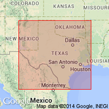
Pg. 387, 389. Brownwood bed in Canyon division. Chiefly bluish, slightly sandy clay, though dark blue to black carbonaceous shaly clay, or even shale, is common at southern end, and lenticular beds of sandstone of considerable extent occur in places. Fossiliferous (foraminifers, corals, crinoids, brachiopods, echinoids, gastropods, cephalopods, pelecypods). Thickness 200 to 250 feet. Member of Canyon division [Canyon is 3rd from top of 5 Carboniferous divisions of Cummins, 1891]. Underlies Adams Branch limestone and believed to overlie Rochelle conglomerate, but may belong to same horizon as the Rochelle. Age is Pennsylvanian.
[Named from Brownwood, Brown Co., Colorado River region, central TX.]
Source: Publication; US geologic names lexicon (USGS Bull. 896, p. 278).
- Usage in publication:
-
- Brownwood shale member
- Modifications:
-
- Revised
- AAPG geologic province:
-
- Llano uplift
- Bend arch
- Fort Worth syncline
Summary:
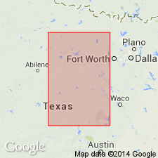
Pg. 24, 31; Univ. Texas Bull., no. 2132. Brownwood shale member of Graford formation of Canyon group. Graford formation is composed of Adams Branch limestone member (at top) and Brownwood shale member, which was named by Drake. The Brownwood member consists of dark-gray and blue clay shale weathering to light-gray and yellow. It contains some lenses of sandstone and a number of thin beds of limestone. Is 180+/- feet thick at Brownwood and at least 400 feet thick at Graford. As here defined it overlies Palo Pinto limestone and includes Rochelle conglomerate at or near base. Near Brownwood it includes Capps limestone lentil in lower part, and in Palo Pinto County it includes a fairly continuous sandstone lentil designated Oran sandstone. Traced from Joplin, in Jack County, to Rochelle, in McCulloch County, central Texas. Age is Pennsylvanian. Report includes measured sections, geologic map, fossil lists.
Source: Publication; US geologic names lexicon (USGS Bull. 896, p. 278).

- Usage in publication:
-
- Brownwood shale member
- Modifications:
-
- Revised
- AAPG geologic province:
-
- Bend arch
- Llano uplift
Summary:
Pg. 105, 109, 111-112. Brownwood shale member of Grafton formation. Revised the definition of Brownwood by transferring Capps limestone to top of underlying Strawn group. Locally (Colorado River Valley) includes Rochelle conglomerate near base. Contains fossils; ammonoids (citing [unpub.] manuscript of ammonoids of the Carboniferous and Permian formations in north-central Texas by F.B. Plummer and Gayle Scott). Age is Permian.
Source: Publication; US geologic names lexicon (USGS Bull. 896, p. 278).
- Usage in publication:
-
- Brownwood shale member
- Modifications:
-
- Areal extent
Summary:
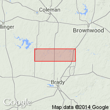
Pg. 201. Brownwood shale member of Graford formation. Followed Sellard's definition of Brownwood shale and Capps limestone.
Source: US geologic names lexicon (USGS Bull. 896, p. 278).

- Usage in publication:
-
- Brownwood shale member
- Modifications:
-
- Not used
Summary:
The USGS at present [ca. 1938] treats Capps limestone as top member of Mineral Wells formation, the upper formation of Strawn group, and does not use Brownwood.
Source: US geologic names lexicon (USGS Bull. 896, p. 278).
- Usage in publication:
-
- Brownwood shale member
- Modifications:
-
- Revised
- AAPG geologic province:
-
- Llano uplift
Summary:
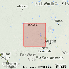
Pg. 94-95. Referred to as Brownwood shale member in Canyon group. Shale is quite sandy throughout, contains at least a dozen sandstone lentils and layers and one conglomerate bed designated as Rough Mountain conglomerate. Thickness measured 3.5 miles north of Rochelle, 325 feet. Overlies Rochelle conglomerate; underlies Adams Branch limestone. [Age is Late Pennsylvanian.]
Source: US geologic names lexicon (USGS Bull. 1200, p. 500-501).
- Usage in publication:
-
- Brownwood shale
- Modifications:
-
- Biostratigraphic dating
- AAPG geologic province:
-
- Bend arch
Summary:
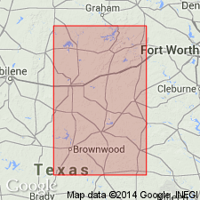
Pg. 47-49. Brownwood shale. On basis of faunal studies in Brown County, Texas, the lower Brownwood is probably late Strawn and upper Brownwood early Canyon. Base of conglomerate separating the two parts of the Brownwood should apparently be regarded as Strawn-Canyon contact.
Source: US geologic names lexicon (USGS Bull. 1200, p. 500-501).
- Usage in publication:
-
- Brownwood shale member*
- Modifications:
-
- Areal extent
- AAPG geologic province:
-
- Bend arch
Summary:
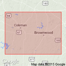
Pg. 51. Brownwood shale member of Graford formation. Shown on composite section of Brown and Coleman Counties, Texas, as member of Graford formation. Underlies Adams Branch member; is base of section here described. Thickness about 200 feet. Consists of silty gray to red fissile shale; contains sandstone beds locally, and coquinas of crinoid columnals, brachiopods, and pelecypods. Fusulinid-bearing limestone about 60 feet below top, 1.2 miles east of Winchell. [Age is Late Pennsylvanian.]
Source: US geologic names lexicon (USGS Bull. 1200, p. 500-501).
- Usage in publication:
-
- Brownwood shale member*
- Modifications:
-
- Revised
- AAPG geologic province:
-
- Bend arch
Summary:
Pg. 58 (table 1), 63-64, pl. 27. Brownwood shale member of Graford formation of Canyon group. Drake (1893) placed Brownwood bed in Canyon division of Cummins (1891). He included in it shale and some sandstone which overlies both the Rochelle conglomerate and his Coral limestone bed (Capps limestone lentil of Plummer and Moore, [1922]). Drake's Brownwood bed is practically identical with unit that has been considered by later geologists as Brownwood shale member. Plummer and Moore used term Brownwood shale in sense that Drake used it but considered the Rochelle conglomerate to underlie their Capps limestone lentil. Some geologists [see bibliography of this report] have considered base of Brownwood shale to be top of Capps limestone lentil. Most geologists have considered base farther south, where the Capps is absent, to be the base of Rochelle conglomerate. Name Brownwood shale member is proposed for formal adoption in area of present report [Brown and Coleman Counties] because of lateral continuity of the member, its conspicuous topographic expression, its consistent relationship to other traceable units, and also because of wide usage of name at present time. Recommended that base of member be drawn at top of Capps limestone lentil of Plummer and Moore. Also proposed that top of Brownwood be drawn at base of Adams Branch limestone member. In Brown County, base beds of Brownwood member are gray shale containing marine fossils. They grade upward into red shale containing several beds of impure limestone and beds of sandstone. About 50 feet above base are additional beds of gray shale containing marine fauna, including brachiopod genus CHONETINA. This shale is overlain alternately by lenticular beds of sandstone and a calcareous bed that appears in different places to be a desiccation breccia of limestone fragments, a cemented mass of algal(?) limestone pebbles, an impure clastic limestone, a sandy limestone, or (as in Winchell area) a bed of gray limestone 2 feet thick containing fusulinids. This is the limestone considered to be the Palo Pinto equivalent by Nickell, 1938 (Texas Univ. Bur. Econ. Geol. Pub., no. 3801) and by Cheney and Eargle, 1951 (West Texas Geol. Soc. Gdbk. Spring Field Trip, June 1-2). Above this carbonate bed, and in many places cutting into it, is conglomeratic sandstone. Mostly gray silty shale and some lenticular beds of sandstone occupy interval from the conglomeratic sandstone, near middle part of the Brownwood, to base of Adams Branch member. This part of the Brownwood was called lower member of Graford formation by Nickell (1938). Thickness about 225 feet along Colorado River; about 300 feet in central part of Brown County where entire unit is exposed. [Age is Late Pennsylvanian.]
Source: US geologic names lexicon (USGS Bull. 1200, p. 500-501).
- Usage in publication:
-
- Brownwood formation
- Modifications:
-
- Revised
- AAPG geologic province:
-
- Bend arch
Summary:
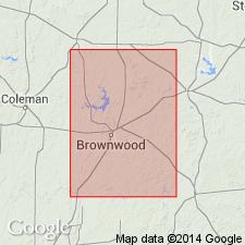
Brownwood formation of Canyon group. Rank raised to formation (Graford formation not used in this report). Includes Rochelle conglomerate member at base. Underlies Brookesmith formation (new). [Age is Late Pennsylvanian] (Canyon).
Report area in vicinity of Brownwood, Brown Co., Colorado River Valley, TX.
[Author does not capitalize rank terms; however, units are considered to be formal.]
Source: Modified from GNU records (USGS DDS-6; Denver GNULEX).
For more information, please contact Nancy Stamm, Geologic Names Committee Secretary.
Asterisk (*) indicates published by U.S. Geological Survey authors.
"No current usage" (†) implies that a name has been abandoned or has fallen into disuse. Former usage and, if known, replacement name given in parentheses ( ).
Slash (/) indicates name conflicts with nomenclatural guidelines (CSN, 1933; ACSN, 1961, 1970; NACSN, 1983, 2005, 2021). May be explained within brackets ([ ]).

