

- Usage in publication:
-
- Brigham formation*
- Modifications:
-
- Original reference
- Dominant lithology:
-
- Sandstone
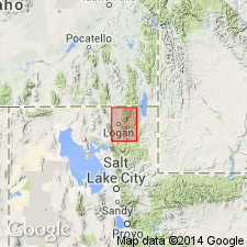
- AAPG geologic province:
-
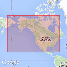
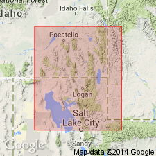
- Snake River basin
- Wasatch uplift
Summary:
Pg. 6, 7. Brigham formation. Massive quartzitic sandstones underlying Langston formation. Thickness at Brigham, Utah, 2,000+ feet; in Blacksmith Fork, northeastern Utah, 1,250 feet; in section west of Liberty, Bear Lake County, southeastern Idaho, 1,000+ feet. Characteristic Middle Cambrian fossils in upper part. [Age is Early(?) and Middle Cambrian.]
Type locality: west front of Wasatch Range, northeast of Brigham, Box Elder Co., northeastern UT.
Source: US geologic names lexicon (USGS Bull. 896, p. 266).
- Usage in publication:
-
- Brigham quartzite*
- Modifications:
-
- Age modified
- AAPG geologic province:
-
- Snake River basin
- Wasatch uplift
Walcott, C.D., 1912, Cambrian Brachiopoda: U.S. Geological Survey Monograph, 51, pt. 1, 872 p.
Summary:
Pg. 153, footnote. Line of separation between Middle and Lower Cambrian occurs somewhere in Brigham quartzite.
Source: US geologic names lexicon (USGS Bull. 896, p. 266).

- Usage in publication:
-
- Brigham quartzite*
- Modifications:
-
- Areal extent
- AAPG geologic province:
-
- Wasatch uplift
Summary:
Pg. 1115-1116, 1117 (fig. 4), 1118. Brigham quartzite. Walcott's (1908) Blacksmith Fork section restudied. Base of Brigham not exposed. Estimated thickness 1,000 feet. Underlies Langston limestone (emended). [Age is Early(?) and Middle Cambrian.]
Source: US geologic names lexicon (USGS Bull. 1200, p. 479).
- Usage in publication:
-
- Brigham quartzite*
- Modifications:
-
- Areal extent
- AAPG geologic province:
-
- Wasatch uplift
- Northern Rocky Mountain region
Summary:
Pg. 809-812. Brigham quartzite. Described in Bakers Canyon (which may have been Walcott's type locality for Brigham quartzite). Underlies Langston limestone. Total thickness below limestone 1,775 feet. [Age is Early(?) and Middle Cambrian.]
Source: US geologic names lexicon (USGS Bull. 1200, p. 479).
- Usage in publication:
-
- Brigham quartzite*
- Modifications:
-
- Areal extent
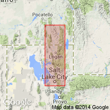
- AAPG geologic province:
-
- Wasatch uplift
Summary:
Pg. 7-8, pl. 1. Brigham quartzite. Described in Randolph quadrangle, where it is about 1,600 feet thick, base not exposed. Underlies Langston limestone. [Age is Early(?) and Middle Cambrian.]
Source: US geologic names lexicon (USGS Bull. 1200, p. 479).
- Usage in publication:
-
- Brigham quartzite*
- Modifications:
-
- Mapped
- AAPG geologic province:
-
- Wasatch uplift
Summary:
Pg. 1130 (table), 1131-1132, pl. 1. Brigham quartzite. Gray, pink, brown, and greenish-brown quartzites; gray and light brown varieties predominate. Thickness 1,800 to 4,800+ feet; 1,800 feet in measured section on Wellsville Mountain. Lies above Precambrian Big Cottonwood Canyon series and below Langston formation (Albertan). Fossils; SCOLITHUS [SKOLITHOS] common in upper part. Age is Early Cambrian (Waucobian).
Source: Publication; US geologic names lexicon (USGS Bull. 1200, p. 479).
- Usage in publication:
-
- Brigham quartzite*
- Modifications:
-
- Areal extent
- AAPG geologic province:
-
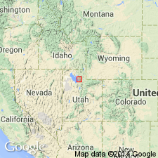
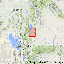
- Snake River basin
- Wasatch uplift
Summary:
Pg. 14. Brigham quartzite. Summary discussion. Although no fossils known, great thickness suggests span of deposition from at least early to middle Cambrian time. Probably passes into Flathead quartzite to north and east. Up to 6,000 feet thick with base not exposed.
Source: Publication; US geologic names lexicon (USGS Bull. 1200, p. 479).
- Usage in publication:
-
- Brigham quartzite*
- Modifications:
-
- Revised
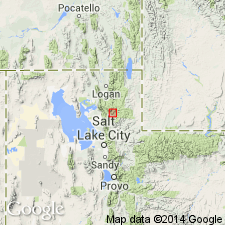
- AAPG geologic province:
-
- Great Basin province
- Wasatch uplift
Summary:
Pg. 667. Brigham quartzite. In area of this report [northern Utah and southeastern Idaho], all but uppermost shaly units of so-called Brigham quartzite are assigned to Prospect Mountain quartzite. [Age is Early(?) and Middle Cambrian.]
Source: US geologic names lexicon (USGS Bull. 1200, p. 479).
- Usage in publication:
-
- Brigham Group*
- Modifications:
-
- Principal reference
- Revised
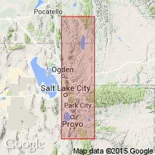
- AAPG geologic province:
-
- Wasatch uplift
- Northern Rocky Mountain region
Summary:
In its type area, Wasatch Mountains, Brigham is raised to group rank. Includes (ascending): Caddy Canyon(?) Quartzite (new), Inkom(?) Formation (new), Mutual Formation, and Browns Hole Formation (new), all of Precambrian age; and Geertsen Canyon Quartzite (new) of Early Cambrian and Precambrian age. In the Huntsville area, Weber County, Utah, is largely quartzite, approx. 7,000 feet thick; overlies Kelley Canyon Formation (new) and underlies Cambrian carbonate or pelitic rocks. Brigham Quartzite remains in good usage in southeasternmost Idaho. Is restricted from usage in Pocatello area, Idaho, because name has been applied in several different ways; interval is thick and includes several different lithologies. In Pocatello area is replaced with Papoose Creek Formation (new), Caddy Canyon Quartzite (new), Inkom Formation, Mutual Formation, Camelback Mountain Quartzite (new), and Gibson Jack Formation (new). Age is Precambrian and Early Cambrian. Report includes geologic map, cross sections.
Principal reference section: on north wall of Middle Fork, Ogden River, in secs. 21 to 18, T. 7 N., R. 2 E., Weber Co., UT. The best exposed and least faulted section beginning at base of Caddy Canyon and extending to base of Cambrian limestone at head of Geertsen Canyon [not described].
Type locality of Walcott (lower 5,000 feet is faulted out): presumed to be along U.S. Highway 89-91, 2 mi east of Brigham City, UT.
[GNU remark (ca. 1987, USGS DDS-6; Denver GNULEX): The Precambrian formations lie in the Northern Rocky Mountain region. The Cambrian formation lies in the Wasatch uplift province.]
Source: Changes in stratigraphic nomenclature, 1971 (USGS Bull. 1372-A, p. A4-A5); GNU records (USGS DDS-6; Denver GNULEX).
- Usage in publication:
-
- Brigham Quartzite*
- Modifications:
-
- Overview
- AAPG geologic province:
-
- Snake River basin
- Northern Rocky Mountain region
Summary:
Pg. 5-19; 36 (fig. 5), pls. 1-3, 7. Brigham Quartzite. Disscussion of nomenclature history and stratigraphic problems in study area (Idaho) and nearby areas (Utah). Study area is in the Soda Springs, Bancroft, and Preston quadrangles, Caribou, Bannock, Franklin, and Bear Lake Counties, Idaho (Snake River Plain physiographic province). These quadrangles include the northern part of the Bear River Range on the east and the south-central part of the Portneuf Range on the west. Only the upper part of the Brigham is exposed in the Bancroft and Soda Springs quadrangles; the middle and lower parts are exposed in the Preston quadrangle and in the Pocatello area. In the Bancroft quadrangle of southeastern Idaho, Brigham Quartzite is divided into (ascending): Kasiska Quartzite Member (Precambrian), Windy Pass Argillite Member (Precambrian?), and Sedgwick Peak Quartzite Member (Early Cambrian); all three new. In the Soda Springs quadrangle (next quadrangle east), Brigham is not divided into members. Most, but not all, quartzite strata in the Brigham are characterized by poor to very poor sorting. Grain sizes range from very fine to very coarse; both pebble conglomerates and scattered pebbles are not uncommon, but granule conglomerates are the most abundant. Grains and pebbles consist overwhelmingly of quartz and quartzite; a minor constituent is chert. Dominant colors are shades of light-tan, light-gray, and pink; purple and purplish red to brown are common low in the Brigham and green to olive brown, near the top. Weathered surfaces are dominantly reddish brown, red, brown, and pink; locally, some beds are shades of gray and others are almost white. Argillites and phyllites differ from the same rock types in units above and below in both sorting and degree of metamorphism. In Idaho age becomes younger eastward: in Portneuf Range and to the west, age is Precambrian to late Early Cambrian; in Bear River Range, age is early Middle Cambrian and older. Report includes geologic map.
[GNC remark (USGS Bull. 1394-A, p. A7): Brigham Quartzite usage in Idaho adopted by the USGS. Brigham Group usage [of Crittenden and others, 1971; see remarks in USGS Bull. 1372-A, p. A4-A5] in Utah is unchanged.
GNU remark (October 27, 1987, USGS DDS-6; Denver GNULEX): The Precambrian members are in the Northern Rocky Mountain region geologic province. The Cambrian member is in the Snake River basin geologic province.]
Source: Publication; Changes in stratigraphic nomenclature, 1972 (USGS Bull. 1394-A, p. A6-A7); GNU records (USGS DDS-6; Denver GNULEX).
- Usage in publication:
-
- Brigham Group*
- Modifications:
-
- Areal extent
- Revised
- AAPG geologic province:
-
- Great Basin region
- Great Basin province
Summary:
Brigham Group. Extended into the Sheeprock Mountains of north-central Utah where it includes (ascending): Caddy Canyon Quartzite, Inkom Formation, and Mutual Formation, all of Late Proterozoic age; and newly assigned Prospect Mountain Quartzite, of Early Cambrian age. Overlies Kelley Canyon Formation of Sheeprock Group (rank raised). Report includes geologic map, stratigraphic charts.
Source: Modified from GNU records (USGS DDS-6; Denver GNULEX).
- Usage in publication:
-
- Brigham Group*
- Modifications:
-
- Revised
- AAPG geologic province:
-
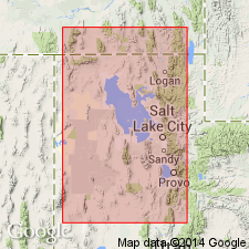
- Snake River basin
- Wasatch uplift
- Northern Rocky Mountain region
Summary:
Group rank applied in southeast Idaho. In northern Bannock and Portneuf Ranges, Bannock County, the Brigham Group includes (ascending) Papoose Creek Formation, Caddy Canyon Quartzite, Inkom Formation, Mutual Formation, Camelback Mountain Quartzite, and Gibson Jack Formation. Overlies Blackrock Canyon Limestone and underlies Elkhead Limestone. In southern Bannock Range, Bannock County, and in Bear River Range, the Brigham Group includes (ascending) Papoose Creek Formation, Caddy Canyon Quartzite, Inkom Formation, Mutual Formation, Camelback Mountain Quartzite, Windy Pass Argillite, and Sedgwick Peak Quartzite. Overlies Pocatello Formation and underlies Twin Knobs Formation. Brigham Group consists of four depositional sequences that are separated by regional disconformities (ascending): "Sequence 1" is marine (tidal, shoreface, open marine, braided fluvial), includes Papoose Creek and most of Caddy Canyon; "Sequence 2" is marine, includes part of Caddy Canyon and Inkom; "Sequence 3" is a braided fluvial and lacustrine unit, includes Mutual; and "Sequence 4" is marine, includes Camelback Mountain, Gibson Jack, Windy Pass, and Sedgwick Peak. The Proterozoic-Cambrian boundary is questionably placed in the upper part of the Camelback Mountain. Report includes a cross section.
Source: Modified from GNU records (USGS DDS-6; Denver GNULEX).
- Usage in publication:
-
- Brigham Group*
- Modifications:
-
- Overview
- AAPG geologic province:
-
- Wasatch uplift
- Northern Rocky Mountain region
Summary:
Pg. 139 (charts 15, 16), 140 (chart 17); see also p. 12-13 (fig. 15), 16-17 (fig. 16). Brigham Group.
In the Wellsvile Mountain-Brigham City area, northernmost Utah, the Brigham Group includes (ascending) Caddy Canyon Quartzite, Inkom Formation, Mutual Formation, Browns Hole Formation, and Geertsen Canyon Quartzite. Overlies Papoose Creek Formation and underlies Langston Formation. [Hintze and Kowalis (2009, p. 179 chart 23) include the Papoose Creek in the Brigham; overlies Kelly Canyon Formation.]
In the Logan-Bear River Range area, northernmost Utah, the Brigham Group includes Mutual Formation and Geertsen Canyon Quartzite. Underlies Langston Formation.
In the Preston-Pocatello area, southernmost Idaho, the Brigham Group includes (ascending): Papoose Creek Formation, Caddy Canyon Quartzite, Inkom Formation, Mutual Formation, Camelback Mountain Quartzite, and Gibson Jack Formation. Overlies Blackrock Canyon Limestone; underlies Langston Dolomite, and in some places underlies Twin Knobs Limestone.
Brigham Group (undivided) is also present in subsurface in Laketown Canyon area, northernmost Utah, where base is marked by a thrust-fault (citing Valenti, G.L., 1980, Structural geology of Laketown quadrangle, Rich County, Utah, Univ. Wyoming, Laramie, unpub. MS thesis, 97 p.; map published seperately as Utah Geol. and Min. Survey Map, no. 58, 1982).
Age is Late Proterozoic through Early Cambrian; although in the Bear River Range allochthon, the Geertsen Canyon Quartzite extends into the early Middle Cambrian ALBERTELLA trilobite zone (see fig. 16; chart 16). Placement of the Proterozoic-Cambrian boundary at the base of Camelback Mountain or Geertsen Canyon is more of convenience than from fossil, radiometric, or magnetic data (see p. 14-15 for brief discussion).
Source: Publication.
For more information, please contact Nancy Stamm, Geologic Names Committee Secretary.
Asterisk (*) indicates published by U.S. Geological Survey authors.
"No current usage" (†) implies that a name has been abandoned or has fallen into disuse. Former usage and, if known, replacement name given in parentheses ( ).
Slash (/) indicates name conflicts with nomenclatural guidelines (CSN, 1933; ACSN, 1961, 1970; NACSN, 1983, 2005, 2021). May be explained within brackets ([ ]).