The National Geologic Map Database is migrating to a new infrastructure. We apologize for any service disruptions during this process.
|
|---|


- Usage in publication:
-
- Brazil formation
- Modifications:
-
- Original reference
- Dominant lithology:
-
- Shale
- Sandstone
- Coal
- AAPG geologic province:
-
- Illinois basin
Summary:
Brazil formation. Alternating shales and thin sandstones, with an occasional thin limestone and several coal beds; 300 feet thick; massive sandstone near top and near base. Extends from top of Mansfield sandstone to base of Petersburg coal (basal member of Petersburg formation). Present in southwestern Indiana. Age is Pennsylvanian. [Includes strata of Pottsville and Allegheny age.]
Named from Brazil, Clay Co., southwestern IN.
Source: US geologic names lexicon (USGS Bull. 896, p. 256).
- Usage in publication:
-
- Brazil formation
- Modifications:
-
- Revised
- AAPG geologic province:
-
- Illinois basin
Summary:
Pg. 525. Brazil formation. Brazil formation of Fuller and Ashley corresponds to nothing significant in Coal Measures stratigraphically, overlapping from the Pottsville into the Allegheny, and includes beds unknown in vicinity of Brazil. Either the name should be abandoned, or it should be restricted to limits consonant with stratigraphic requirements, and in keeping with the rocks exhibited at Brazil. Writer prefers latter procedure, and has accordingly amended the name Brazil formation to include only the Brazil block coal intervals and the Minshall coals up to the marked disconformity above coal No. 2. The Mansfield and Brazil as emended constitute the Pottsville of Indiana. The disconformity overlain by Staunton formation. Age is Pennsylvanian (Pottsville).
Source: US geologic names lexicon (USGS Bull. 896, p. 256).

- Usage in publication:
-
- Brazil formation
- Modifications:
-
- Revised
- AAPG geologic province:
-
- Illinois basin
Summary:
Pg. 477-478. Brazil formation. Divided the Pennsylvanian rocks of Putnam County, southwestern Indiana, into Brazil (Allegheny) and Mansfield (Pottsville). On other pages of this report he classified the Pennsylvanian rocks as post-Allegheny, Allegheny, and Pottsville.
Source: US geologic names lexicon (USGS Bull. 896, p. 256).

- Usage in publication:
-
- Brazil group
- Modifications:
-
- Revised
- AAPG geologic province:
-
- Illinois basin
Summary:
Pg. 30-34. Brazil group. Pottsville division of western and southwestern Indiana divided into (descending): (1) Brazil group (80 feet thick, including coal No. 2 at top and Lower Block coal at base) and (2) Mansfield group (100 to 400 feet thick, resting unconformably on Mississippian). Brazil group underlies Staunton group, lowest group of Allegheny division. [This classsification was followed by M.A. Harrell, 1935 (Indiana Dept. Cons. Pub., no. 133).] Age is Pennsylvanian (Pottsville).
Source: US geologic names lexicon (USGS Bull. 896, p. 256).
- Usage in publication:
-
- Brazil formation
- Modifications:
-
- Revised
- AAPG geologic province:
-
- Illinois basin
Summary:
Pg. 96. Brazil formation. Includes Minshall limestone (new) [unranked].
Source: US geologic names lexicon (USGS Bull. 1200, p. 462).

- Usage in publication:
-
- Brazil group
- Modifications:
-
- Revised
- AAPG geologic province:
-
- Illinois basin
Summary:
Pg. 89, 90. Brazil group. Referred to as Brazil group. Contains Grandview limestone (new) near top.
Source: US geologic names lexicon (USGS Bull. 1200, p. 462).

- Usage in publication:
-
- Brazil formation
- Modifications:
-
- Revised
- AAPG geologic province:
-
- Illinois basin
Summary:
Chart no. 6 (column 25, Indiana, collated by H.R. Wanless and J.M. Weller). Brazil formation. Shown on Pennsylvanian correlation chart as Brazil formation. Includes strata from base of Cannellton coal to a little above top of Minshall limestone. Underlies Staunton formation; overlies Mansfield formation. Age is [Middle Pennsylvanian]; Westphalian B to early Westphalian C (Katharina bed = base Westphalian B; Aegir bed = base Westphalian C).
Source: Publication; US geologic names lexicon (USGS Bull. 1200, p. 462).
- Usage in publication:
-
- Brazil formation*
- Modifications:
-
- Revised
- AAPG geologic province:
-
- Illinois basin
Summary:
Brazil formation. As defined by Cumings (1922, Indiana Dept. Conserv. Spec. Pub., no. 21, pt. 4) formation includes rocks between base of Lower Block coal and unconformity at top of Coal II. In type area, formation is about 75 feet thick and includes four principal named coals (ascending): Lower Block, Upper Block, Minshall, and Coal II. Between Minshall coal and Coal II is Minshall limestone. In strictest sense, unconformity at top of Brazil is not at top of Coal II but at base of prominent sandstone that lies a few feet below Coal III. In Coal City quadrangle, this sandstone, which is basal member of overlying Staunton formation, generally rests on Minshall limestone member, on the gray or black shale beneath the limestone, or on Minshall coal. Hence, thickness of formation in Coal City quadrangle ranges from 35 to 94 feet. Overlies Mansfield formation. Age is Pennsylvanian.
Source: US geologic names lexicon (USGS Bull. 1200, p. 462).
- Usage in publication:
-
- Brazil formation
- Modifications:
-
- Revised
- Mapped
- AAPG geologic province:
-
- Illinois basin
Summary:
Pg. 12-21, pl. 1. Brazil formation. Described in Brazil quadrangle where it ranges from 40 to 90 feet in thickness and includes commercially mined coals, the Minshall and Coal II, and Perth limestone member (new) which closely overlies Minshall coal. Overlies Mansfield formation and underlies Staunton formation.
Source: US geologic names lexicon (USGS Bull. 1200, p. 462).

- Usage in publication:
-
- Brazil formation
- Modifications:
-
- Overview
- AAPG geologic province:
-
- Illinois basin
Summary:
Pg. 21, pls. Brazil formation, middle formation of Raccoon Creek Group. Consists of shale, sandstone, underclay, and coal. Thickness 40 to 90 feet (12 to 27 m). Includes (ascending): Lower Block, Upper Block, Minshall, and Buffaloville Coal Members. In places, where Lower Block coal is absent, the Brazil is nearly indistinguishable from underlying Mansfield. Equivalent to upper Abbott Formation and lower Spoon Formation of Illinois, and part of Tradewater Formation of western Kentucky. Age is Pennsylvanian (Atokan), based on stratigraphic position (basal limestone beds in overlying Staunton Formation yielded lowest Desmoinesian FUSULINELLA IOWAENSIS). Report includes map of type sections-localities-areas, correlation chart.
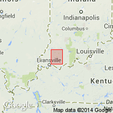
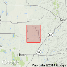
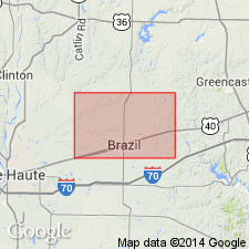
Indiana geologists consider type locality to be around Brazil, in southwest corner T. 13 N., R. 6 W., northern Clay Co., southwestern IN.
Source: Publication.
For more information, please contact Nancy Stamm, Geologic Names Committee Secretary.
Asterisk (*) indicates published by U.S. Geological Survey authors.
"No current usage" (†) implies that a name has been abandoned or has fallen into disuse. Former usage and, if known, replacement name given in parentheses ( ).
Slash (/) indicates name conflicts with nomenclatural guidelines (CSN, 1933; ACSN, 1961, 1970; NACSN, 1983, 2005, 2021). May be explained within brackets ([ ]).