

- Usage in publication:
-
- Bostwick member
- Modifications:
-
- Original reference
- Dominant lithology:
-
- Conglomerate
- Limestone
- Sandstone
- AAPG geologic province:
-
- South Oklahoma folded belt
Summary:
Pg. 14. Bostwick member of Dornick Hills formation. The most resistant part of Dornick Hills formation is a massive limestone conglomerate with associated limestones and sandstones known as Bostwick member. It disappears northward from Ardmore. Above Bostwick member occur 3 or more very fossiliferous limestones including the coarsely crystalline and oolitic Lester limestone. The Bostwick member lies higher in [the] formation than Otterville limestone.
Source: US geologic names lexicon (USGS Bull. 896, p. 240).
- Usage in publication:
-
- Bostwick member
- Modifications:
-
- Principal reference
- Dominant lithology:
-
- Conglomerate
- Limestone
- Sandstone
- AAPG geologic province:
-
- South Oklahoma folded belt
Summary:
Pg. 30-32. Bostwick member of Dornick Hills formation. Forms Bostwick Ridge. Lies 750 feet above Otterville member as here defined, and 400 to 500 feet below Lester limestone member to north of Ardmore, and 800 to 1,000 feet below to south. Included in this interval are 2 or 3 other highly fossiliferous limestones from a few inches to 2 feet thick. Maximum thickness of Bostwick member 300 feet. It disappears within a mile along the strike in each direction from Dornick Hills Country Club, due either to strike faulting or to unconformity within Dornick Hills formation or to a combination of these 2 factors. Has not been yet identified certainly anywhere north of that locality.
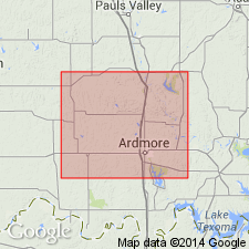
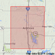
Type locality: on Bostwick Dairy Farm, in W/2 NE/4 sec. 11, T. 5 S., R. 1, E., whose buildings stand upon the ridge, Carter Co., south-central OK. Probably named from Bostwick Ridge or Bostwick Dairy Farm in Carter Co., OK.
Source: US geologic names lexicon (USGS Bull. 896, p. 240).
- Usage in publication:
-
- Bostwick member
- Modifications:
-
- Revised
Summary:
(See 1934 entry under Confederate limestone member.)
Source: US geologic names lexicon (USGS Bull. 896, p. 240).

- Usage in publication:
-
- Bostwick limestone
- Modifications:
-
- Revised
- AAPG geologic province:
-
- South Oklahoma folded belt
Summary:
Chart no. 6 (column 37, Ardmore basin, southern Oklahoma, collated by R.C. Moore). Bostwick limestone. Shown on Pennsylvanian correlation chart as Bostwick limestone of Dornick Hills group. Lies above Otterville limestone and below Lester limestone, both of Dornick Hills group. Age is [Middle Pennsylvanian]; early Lampasas [early Atokan]; early Westphalian B (Katharina bed = base of Westphalian B).
Source: Publication; US geologic names lexicon (USGS Bull. 1200, p. 437).
- Usage in publication:
-
- Bostwick member
- Modifications:
-
- Revised
- AAPG geologic province:
-
- South Oklahoma folded belt
Summary:
Pg. 140, 141 (fig. 3). Rank reduced to member status in Lake Murray formation (new) of Dornick Hills group. Underlies Griffin sandstone member (new).
Source: US geologic names lexicon (USGS Bull. 1200, p. 437).
- Usage in publication:
-
- Bostwick conglomerate
- Modifications:
-
- Revised
- AAPG geologic province:
-
- South Oklahoma folded belt
Summary:
Pg. 32-33. Bostwick conglomerate at base of Lake Murray formation is most prominent exposed unit in Ardmore basin, south-central Oklahoma. Consists of limestone and chert conglomerate, sandstone, limestone, and shale. Maximum thickness 500 feet. Age is Pennsylvanian.
Source: US geologic names lexicon (USGS Bull. 1200, p. 437).
- Usage in publication:
-
- Bostwick Conglomerate Member*
- Modifications:
-
- Adopted
Summary:
Pg. A4-A5, A54, A56-A57 (fig. 5). Bostwick Member of Tomlinson (1928) adopted as Bostwick Conglomerate Member and assigned to Lake Murray Formation of Dornick Flills Group. Present in southern Arbuckle Mountains, south-central Oklahoma. Overlies Otterville Limestone Member of Golf Course Formation; underlies Griffin Member of Lake Murray. Age is Middle Pennsylvanian (Atokan; Westphalian A of Europe); lower part of foram zone 21, and ammonoid zone DIABOLOCERAS VARICOSTATUM. [See also Mackenzie Gordon, Jr., and G.C. Stone, 1976, Arkansas Geol. Commission Symposium on the geology of the Ouachita Mountains, v. 1.]
Source: Publication.
For more information, please contact Nancy Stamm, Geologic Names Committee Secretary.
Asterisk (*) indicates published by U.S. Geological Survey authors.
"No current usage" (†) implies that a name has been abandoned or has fallen into disuse. Former usage and, if known, replacement name given in parentheses ( ).
Slash (/) indicates name conflicts with nomenclatural guidelines (CSN, 1933; ACSN, 1961, 1970; NACSN, 1983, 2005, 2021). May be explained within brackets ([ ]).