The National Geologic Map Database is migrating to a new infrastructure. We apologize for any service disruptions during this process.
|
|---|


- Usage in publication:
-
- Bonanza King formation
- Modifications:
-
- Original reference
- AAPG geologic province:
-
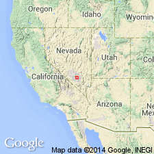
- Great Basin province
Summary:
Pg. 229-240. Bonanza King formation. Consists of (descending): (1) sandy dolomite and platy shale, thin; (2) light-gray, fine- to medium-grained dolomite, 200 to 225 feet; (3) Silver King dolomite member, 200 to 250 feet; (4) nodular and lenticular chert underlain by light- and dark-gray dolomite, 900+/-feet; (5) sandy, reddish, platy dolomite, 25 to 30 feet.; (6) light- and dark-gray dolomite and partially dolomitized limestone, 600 to 650 feet. Thickness of formation, 2,000+/- feet. Poorly preserved fossils in lower 100 feet in Providence Mountains indicate Middle Cambrian. Overlies Cadiz formation (Middle Cambrian) and underlies Cornfield Springs formation, in part at least Middle Cambrian. Occurs in Providence and Marble Mountains, San Bernardino County, southeastern California.
[Type locality:] exposures near Bonanza King Mine, on east side of Providence Mountains, San Bernardino Co., southeastern CA. [Mine in sec. 3, T. 10 N., R. 14 E., Flynn 15-min quadrangle, San Bernardino Co., southeastern CA.]
Source: US geologic names lexicon (USGS Bull. 896, p. 232); supplemental information from GNU records (USGS DDS-6; Menlo GNULEX).
- Usage in publication:
-
- Bonanza King formation
- Modifications:
-
- Areal extent
- AAPG geologic province:
-
- Great Basin province
Summary:
Type locality is indirectly referred to as the Providence Mountains exposures (Hazzard and Mason, 1936). Bonanza King formation is extended into the Nopah and Resting Springs Mountains. Thickness is 1,515 feet in area studied.
Source: GNU records (USGS DDS-6; Menlo GNULEX).
- Usage in publication:
-
- Bonanza King formation
- Modifications:
-
- Areal extent
- AAPG geologic province:
-
- Great Basin province
Summary:
Pg. 643-655. Bonanza King formation. Geographically extended into Goodsprings area, southeastern Nevada, where it lies within Goodsprings dolomite of Hewett, 1931 (USGS Prof. Paper 162, 172 p., geol. map). Age is Middle Cambrian.
Source: Publication; US geologic names lexicon (USGS Bull. 1200, p. 423).
- Usage in publication:
-
- Bonanza King formation
- Modifications:
-
- Areal extent
- Age modified
- AAPG geologic province:
-
- Great Basin province
Summary:
At its type locality, age is considered Late and Middle Cambrian rather than wholly Middle Cambrian. The names Cornfield Springs and Bonanza King were misapplied [in the Nopah Range] by Hazzard (1937). Units formerly designated by these names in the Nopah Range should be considered as unnamed upper and lower divisions, respectively, of the Bonanza King.
Source: GNU records (USGS DDS-6; Menlo GNULEX).
- Usage in publication:
-
- Bonanza King formation*
- Modifications:
-
- Revised
- AAPG geologic province:
-
- Great Basin province
Summary:
Bonanza King Formation substituted for the Yucca Flat Formation (abandoned) as name for carbonate sequence on the test site. Lower member of unit is named Papoose Lake member (new) after the playa 9 miles east of Banded Mountain; upper member is named Banded Mountain member (new), after area of its most conspicuous exposure.
Source: GNU records (USGS DDS-6; Menlo GNULEX).
- Usage in publication:
-
- Bonanza King formation*
- Modifications:
-
- Adopted
- Areal extent
- AAPG geologic province:
-
- Great Basin province
Summary:
Bonanza King formation (Hazzard and Mason [1953]; Palmer and Hazzard, 1956) is adopted. At Bare Mountain unit shows many zones containing white to yellowish-gray very coarse dolomite. Age is considered to be Middle and probably in part Late(?) Cambrian. Overlies Carrara formation; underlies Nopah formation.
Source: GNU records (USGS DDS-6; Menlo GNULEX).
- Usage in publication:
-
- Bonanza King Formation*
- Modifications:
-
- Revised
- AAPG geologic province:
-
- Great Basin province
Summary:
Lower contact of Papoose Lake Member of Bonanza King Formation raised 250 ft. This 250 ft now comprises part of subunit 7 (290 ft thick) of Carrara Formation since detailed lithology shows subnunit 7 is more like Carrara Formation with its shales and silty limestones.
Source: GNU records (USGS DDS-6; Menlo GNULEX).
- Usage in publication:
-
- Bonanza King Formation*
- Modifications:
-
- Areal extent
- AAPG geologic province:
-
- Great Basin province
Summary:
Mapped in Independence 15' quad, Inyo Co, CA in Mazourka Canyon, Inyo Mountains, where total thickness is more than 2800 ft. Described as varied gray, laminated to thick-bedded dolomite. Alternating light-gray and dark-gray layers (few inches to several tens of ft thick) give many areas "zebra striping". Spheroidal algal(?) structure (GIRVANELLA?) locally abundant in lower part. Upper few 100 ft more massive and buff colored. Assigned Cambrian age.
Source: GNU records (USGS DDS-6; Menlo GNULEX).
- Usage in publication:
-
- Bonanza King Formation*
- Modifications:
-
- Areal extent
- AAPG geologic province:
-
- Great Basin province
Summary:
Mapped in Inyo Mountains in extreme lower right corner of Blanco Mountain 15' quad, Inyo Co, CA. Consists of coarse-grained gray to buff dolomite, largely transformed to dolomite marble. Only lower part of unit, of Middle and Late Cambrian age, is present in map area.
Source: GNU records (USGS DDS-6; Menlo GNULEX).

- Usage in publication:
-
- Bonanza King Dolomite*
- Modifications:
-
- Redescribed
- Dominant lithology:
-
- Dolomite
- AAPG geologic province:
-
- Great Basin province
Summary:
Pg. O17-O19, pl. 1 (geol. map). Bonanza King Dolomite. Consists almost exclusively of dolomite, in various colors and shades of gray, banded in layers from a few inches to a few tens of feet thick; exhibits a conspicuous "zebra striping." Present locally are a few thin beds of limestone; slightly argillaceous dolomite layers; and black chert in nodules and beds as much as 1 foot thick. Contains algal structures (GIRVANELLA?). At measured section, east of Bluebell mine, is divided into five distinct units on basis of color differences; total thickness about 2,800 feet. South of measured section, a distinctive black dolomite zone many feet thick occurs about 200 feet from top of formation, between uppermost massive unit and underlying striped sequence. This black dolomite is an excellent marker bed, and it can be traced for several miles to the south. Where delineated on accompanying geologic map, it is shown as a dotted line. Bonanza King crops out in a broad arcuate belt from north boundary of Independence 15-min quadrangle to vicinity of Barrel Spring. South from there, outcrop tails off to a thinner belt that extends nearly to mouth of Mazourka Canyon. Conformably underlies Lead Gulch Formation; conformably overlies Monola Formation. Tentatively assigned to Middle and Late Cambrian age, based on stratigraphic position and ages of correlative rocks in other areas.
[Name Bonanza King Dolomite is applied to correlative rocks in Inyo Mountains because lithologies other than dolomite are extremely scarce (citing Code of stratigraphic nomenclature, 1961, art. 15 (change in lithologic designation), p. 654).
GNC remark (1965, USGS Bull. 1244-A, p. A11): Bonanza King Dolomite used in report area. Bonanza King Formation in good usage elsewhere.]
Source: Publication; GNU records (USGS DDS-6; Menlo GNULEX); Changes in stratigraphic nomenclature, 1965 (USGS Bull. 1244-A, p. A11).
- Usage in publication:
-
- Bonanza King Formation*
- Modifications:
-
- Areal extent
- AAPG geologic province:
-
- Great Basin province
Summary:
Unit geographically extended into report area [in several locales in north and central Funeral Mountains and central Panamint Range, Death Valley]. Shown on geologic map of Death Valley. Age given as Middle and Late Cambrian.
Source: GNU records (USGS DDS-6; Menlo GNULEX).
- Usage in publication:
-
- Bonanza King Formation*
- Modifications:
-
- Areal extent
- AAPG geologic province:
-
- Great Basin province
Summary:
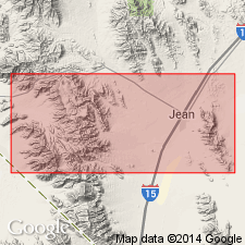
Geographically extended into area of report which includes cross sections at Bare Mountain, Eagle Mountain, Echo Canyon, Groom district, Indian Pass, Last Chance Range, and Nopah Range in Nevada and California.
Source: GNU records (USGS DDS-6; Menlo GNULEX).
- Usage in publication:
-
- Bonanza King Dolomite*
- Modifications:
-
- Areal extent
- AAPG geologic province:
-
- Great Basin province
Summary:
Mapped in upper plate of Last Chance thrust in lower left corner of Magruder 15' quad, Inyo Co, CA. Consists of medium- to thin-bedded, gray, white, and black dolomite with few interbeds of limestone. Has distinctive zebra-striped appearance. Basal contact is fault and unknown amount of unit is missing. Is about 2000 ft thick. Thrust contact over Mississippian Rest Spring Shale and Perdido Formation. Underlies upper Cambrian Nopah Formation and its Dunderberg Shale Member; also [unconformably] underlies Miocene diorite of Last Chance Range. Age is Middle and Late Cambrian.
Source: GNU records (USGS DDS-6; Menlo GNULEX).
- Usage in publication:
-
- Bonanza King Formation*
- Modifications:
-
- Areal extent
- AAPG geologic province:
-
- Great Basin province
Summary:
(advance copy). Unit geographically extended into report area (northern Sheep Range), as Nopah and Bonanza King (upper part) Formations undivided. Age is Cambrian.
Source: GNU records (USGS DDS-6; Menlo GNULEX).
- Usage in publication:
-
- Bonanza King Formation*
- Modifications:
-
- Areal extent
- AAPG geologic province:
-
- Great Basin province
Summary:
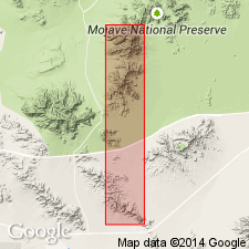
Bonanza King Formation geographically extended into report area [southern Avawatz Mountains, northeastern Mojave Desert region, CA]. Age given as Cambrian.
Source: GNU records (USGS DDS-6; Menlo GNULEX).
- Usage in publication:
-
- Bonanza King Formation*
- Modifications:
-
- Areal extent
- AAPG geologic province:
-
- Great Basin province
Summary:
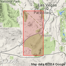
Unit geographically extended into southern Sheep Range, Fossil Ridge, and Castle Rock area, Clark Co, NV. Age given as Middle and Late Cambrian.
Source: GNU records (USGS DDS-6; Menlo GNULEX).
For more information, please contact Nancy Stamm, Geologic Names Committee Secretary.
Asterisk (*) indicates published by U.S. Geological Survey authors.
"No current usage" (†) implies that a name has been abandoned or has fallen into disuse. Former usage and, if known, replacement name given in parentheses ( ).
Slash (/) indicates name conflicts with nomenclatural guidelines (CSN, 1933; ACSN, 1961, 1970; NACSN, 1983, 2005, 2021). May be explained within brackets ([ ]).