The National Geologic Map Database is migrating to a new infrastructure. We apologize for any service disruptions during this process.
|
|---|


- Usage in publication:
-
- Bluestone formation*
- Modifications:
-
- Original reference
- Dominant lithology:
-
- Shale
- Limestone
- AAPG geologic province:
-
- Appalachian basin
Summary:
Pg. 3. Bluestone formation. In general red shale, but contains many beds of impure limestone, sometimes conglomeratic, and red sandstone of varying thickness and character. At Pocahontas extends upward to coal-bearing series whose base is generally marked by a heavy bed of sandstone. Probably throughout area of Pocahontas quadrangle this heavy sandstone marks upper limit of red shales, but eastward the red shales extend several hundred feet higher. Thickness 800 feet. Overlies Princeton conglomerate and underlies Pocahontas formation. Age is Mississippian.
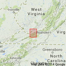
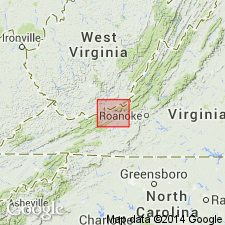
[Named from Bluestone River, Tazewell Co., southwestern VA. Extends into southern WV.]
Source: US geologic names lexicon (USGS Bull. 896, p. 222).
- Usage in publication:
-
- Bluestone Formation*
- Modifications:
-
- Revised
- AAPG geologic province:
-
- Appalachian basin
Summary:
Use of Mauch Chunk Group extended into Giles Co., VA, and bordering areas of Mercer, Summer, and Monroe Cos., WV. Mauch Chunk Group is divided into ascending Bluefield Formation, Hinton Formation, Princeton Sandstone, and Bluestone Formation.
Source: GNU records (USGS DDS-6; Reston GNULEX).

- Usage in publication:
-
- Bluestone Formation
- Modifications:
-
- Revised
- AAPG geologic province:
-
- Appalachian basin
Summary:
Pennington Group in eastern KY is divided into (ascending) Bluefield Formation, Hinton Formation, Princeton Sandstone, and Bluestone Formation, which author states are "informally projected" into the study area. Bluestone is composed of red and green, and gray to dark-gray shales, siltstones, sandstones, minor calcareous beds, and thin coals. The Pride Shale Member, which occurs at the base of the Bluestone, is a distinctive unit of dark-gray shale and siltstone. Bluestone is frequently referred to as "Red Rock" by drillers. Reaches a maximum of 180 m, but is absent in the Hazard and Pineville strike sections and the Booneville and Lake City dip sections. Gradationally(?) underlies Pocahontas Formation of the Breathitt Group in the southeastern part of the study area. Elsewhere unconformably underlies the Warren Point Sandstone of Breathitt Group. Age is this report is Late Mississippian.
Source: GNU records (USGS DDS-6; Reston GNULEX).
- Usage in publication:
-
- Bluestone Formation*
- Modifications:
-
- Biostratigraphic dating
- AAPG geologic province:
-
- Appalachian basin
Summary:
Based on the brachiopod PRODUCTUS n. sp. A-INFLATIA n. sp. A Assemblage Zone, the upper shale member of the Bluestone Formation correlates with the lower to middle parts of the Pitkin Limestone of the Ozark region and probably with the Menard Limestone of the Illinois basin.
Source: GNU records (USGS DDS-6; Reston GNULEX).
- Usage in publication:
-
- Bluestone Formation*
- Modifications:
-
- Areal extent
- AAPG geologic province:
-
- Appalachian basin
Summary:
Upper part of upper member of Pennington Formation, just above tongue of Pinnacle Overlook Member of Lee Formation, is approximately equivalent to Pride Shale Member of Bluestone Formation elsewhere in Appalachian basin. A fossil bed is common to both units.
Source: GNU records (USGS DDS-6; Reston GNULEX).

- Usage in publication:
-
- Bluestone Formation
- Modifications:
-
- Areal extent
- AAPG geologic province:
-
- Appalachian basin
Summary:
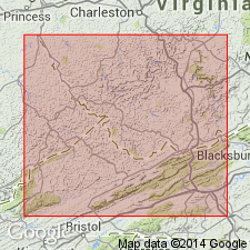
Bluestone Formation crops out from Pennington Gap to Little Stone Gap where it curves around the nose of the Powell Valley anticline. The Bluestone ranges in thickness from 150 ft to 600 ft. Unit is composed of shale, siltstone, and sandstone. The shales are grayish red to greenish gray and occasionally medium to dark gray, are partly calcareous, locally carbonaceous, and may contain fossil fragments. Siltstones are pale red to pale green, mottled, and calcareous. Sandstones are thin to discontinuous, dark yellowish brown to gray, very fine to fine grained, and micaceous. In this report the Bluestone is composed of three distinct members: the Pride Shale Member, a middle sandstone member, and an upper shale member. Underlies rocks of Pennsylvanian age throughout the area. Overlies the Princeton Sandstone where present and elsewhere the Pratter Shale Member or the Tallery Sandstone Member of the Hinton Formation. Southwest of Big Stone Gap and into Lee Co. the Bluestone intertongues with the Chadwell Member of the Lee Formation. Age is Late Mississippian (Chesterian).
Source: GNU records (USGS DDS-6; Reston GNULEX).
For more information, please contact Nancy Stamm, Geologic Names Committee Secretary.
Asterisk (*) indicates published by U.S. Geological Survey authors.
"No current usage" (†) implies that a name has been abandoned or has fallen into disuse. Former usage and, if known, replacement name given in parentheses ( ).
Slash (/) indicates name conflicts with nomenclatural guidelines (CSN, 1933; ACSN, 1961, 1970; NACSN, 1983, 2005, 2021). May be explained within brackets ([ ]).