The National Geologic Map Database is migrating to a new infrastructure. We apologize for any service disruptions during this process.
|
|---|


- Usage in publication:
-
- Bluebell dolomite*
- Modifications:
-
- Original reference
- Biostratigraphic dating
- Dominant lithology:
-
- Dolomite
- AAPG geologic province:
-
- Wasatch uplift
- Great Basin province
- South Western Overthrust
Summary:
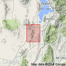
Bluebell dolomite. Alternating beds of medium to dark-gray or bluish-gray dolomite, mostly fine-grained but some beds medium- to coarse-grained. Between 100 and 200 feet above base of formation throughout the district the beds contain a number of small nodules and thin seams of chert. Thickness 700 to 1,100(?) feet. Conformably underlies Pinyon Peak limestone and overlies Opohonga limestone with sharp contact. Is most extensively exposed formation in Tintic district. Named from Bluebell Mine, [near Eureka in T. 10 S., R. 2 W., Juab Co., Tintic district, central northern Utah]. Fossils indicate that it ranges in age from Lower to Upper Ordovician, and it is possible the upper 400 feet include Silurian to Devonian strata. [Age is considered Early to Late Ordovician.]
Source: US geologic names lexicon (USGS Bull. 896, p. 217).

- Usage in publication:
-
- Bluebell dolomite*
- Modifications:
-
- Revised
- AAPG geologic province:
-
- Great Basin province
- Wasatch uplift
Summary:
Restricted to the Upper Ordovician, Silurian, and Devonian rocks that were the upper two-thirds of the Bluebell as defined by Loughlin (1919). Lower one-third of Loughlin's Bluebell is assigned to underlying Fish Haven dolomite. Base placed at base of light-gray-weathering, thin-bedded, fine-grained dolomite; a unit readily recognized that also directly overlies the Leopard Skin marker bed which forms the top of the underlying Fish Haven dolomite. The top of the Bluebell placed at base of first sandstone or quartzite of the Victoria formation, a very distinctive bed. Ranges from 300 to more than 600 ft thick. Measured section 491 ft thick, described in N1/2 NE1/4 sec 13, T10S, R3W, Juab Co, Great Basin province, and another 336 ft thick described in W1/2 sec 34, T9S, R2W, Utah Co, Wasatch uplift. Is sparsely fossiliferous, but they confirm the age range from Late Ordovician to Devonian. Geologic map. Cross sections.
Source: GNU records (USGS DDS-6; Denver GNULEX).
- Usage in publication:
-
- Bluebell Dolomite*
- Modifications:
-
- Age modified
- AAPG geologic province:
-
- Great Basin province
- Wasatch uplift
Summary:
Age of the upper part of the Bluebell Dolomite is Late Devonian [shown in correlation chart].
Source: GNU records (USGS DDS-6; Menlo GNULEX).
For more information, please contact Nancy Stamm, Geologic Names Committee Secretary.
Asterisk (*) indicates published by U.S. Geological Survey authors.
"No current usage" (†) implies that a name has been abandoned or has fallen into disuse. Former usage and, if known, replacement name given in parentheses ( ).
Slash (/) indicates name conflicts with nomenclatural guidelines (CSN, 1933; ACSN, 1961, 1970; NACSN, 1983, 2005, 2021). May be explained within brackets ([ ]).