- Usage in publication:
-
- Blach Ranch limestone
- Modifications:
-
- Original reference
- AAPG geologic province:
-
- Bend arch
Summary:
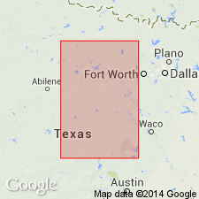
Pg. 24, 31; see also Univ. Texas Bull., no. 2132, p. 154-158. Blach Ranch limestone, 3 to 5 feet thick, lies 20 to 40 feet below top of Thrifty formation and 17 to 35 feet below Breckenridge limestone member of Thrifty. [Present in Brazos River region, central northern Texas. Age is Pennsylvanian.]
Source: US geologic names lexicon (USGS Bull. 896, p. 197).
- Usage in publication:
-
- Blach Ranch limestone member
- Modifications:
-
- Original reference
- Dominant lithology:
-
- Limestone
- AAPG geologic province:
-
- Bend arch
Summary:
Pg. 154-158; see also Jour. Geol., v. 30, p. 24, 31. Blach Ranch limestone member of Thrifty formation of Cisco group. Massive light-gray limestone; weathers buff or brown and in large slabs or rounded boulders. Rather unfossiliferous. Thickness 3 to 8 feet. Lies 30+/- feet above Ivan limestone member of Thrifty and 25 to 45 feet below Breckenridge limestone, top member of the Thrifty. Is thought to be = Chaffin limestone of Drake in Colorado River section. [Age is Pennsylvanian.]
Named from exposures in vicinity of Blach Brothers Ranch east of Breckenridge, Stephens Co., Brazos River region, central northern TX.
Source: US geologic names lexicon (USGS Bull. 896, p. 197).
- Usage in publication:
-
- Blach Ranch limestone member*
- Modifications:
-
- Areal extent
- AAPG geologic province:
-
- Bend arch
Summary:
Pg. 58-61. Blach Ranch limestone member of Thrifty formation. Is first reliable datum above Avis sandstone member. In southern part of Young County, consists of two limestones separated by 2 to 3 feet of bluish clay. Separated from overlying Breckenridge limestone member by unnamed interval of shale and sandstone. [Age is Late Pennsylvanian.]
Source: US geologic names lexicon (USGS Bull. 1200, p. 357-358).
- Usage in publication:
-
- Blach Ranch limestone
- Modifications:
-
- Revised
- AAPG geologic province:
-
- Bend arch
Summary:
Fig. 4. Blach Ranch limestone of Graham group. Shown on generalized columnar section of Brazos River area as Blach Ranch limestone in Graham group. Occurs below Breckenridge limestone and above Ivan limestone. [Age is Late Pennsylvanian.]
Source: US geologic names lexicon (USGS Bull. 1200, p. 357-358).
- Usage in publication:
-
- Blach Ranch limestone member*
- Modifications:
-
- Principal reference
- Dominant lithology:
-
- Limestone
- Shale
- AAPG geologic province:
-
- Bend arch
Summary:
Pg. 14-17, pl. 1. Blach Ranch limestone member of Thrifty formation. Plummer and Moore [1922] proposed term Blach Ranch for "a limestone which occurs about 30 feet in most sections above the Ivan member." They described the limestone from "typical exposures in vicinity of Blach Brothers Ranch east of Breckenridge." However, type locality that is given for section (id., p. 156) measured on "Blach Brothers Ranch four miles east of Crystal Falls." Plummer and Moore described the limestone as light gray, massive, weathering to large buff or brown slabs or rounded boulders, and rather fossiliferous. They reported average thickness to be 3 or 4 to as much as 8 feet. Type Blach Ranch limestone redescrlbed and locality noted. Blach Ranch limestone is uniform persistent unit throughout area. Lower limestone is about 1.4 feet thick and separated by about 1 foot of shale from upper 0.8- to 1-foot limestone bed. About 1 foot of platy, argillaceous, fossiliferous limestone commonly occurs at top of upper bed. Separated from overlying Breckenridge limestone member by unnamed shale member 30 to 50 feet thick.
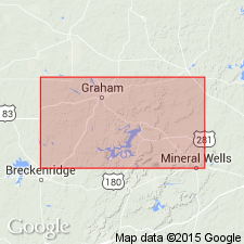
Type section (redescribed): on original Blach Brothers Ranch, now two ranches owned by heirs Jack and Bill Black and B.H. Trammell of Breckenridge. Type section is 3.75 mi east of Crystal Falls, northeast of Breckenridge in north-central Stephens Co., central northern TX. Ranch name was misspelled in original description. Limestone crops out in north-south belt across Black and Trammell Ranches. New Type section is in and near RR cut on Chicago, Rock Island, and Pacific RR.
Source: US geologic names lexicon (USGS Bull. 1200, p. 357-358).
- Usage in publication:
-
- Blach Ranch Limestone
- Modifications:
-
- Mapped
- AAPG geologic province:
-
- Bend arch
- Fort Worth syncline
Summary:
Blach Ranch Limestone [unranked] in Cisco Group. Consists of (descending): gray to yellow-brown, fine-grained, bioclastic, massive limestone, 1 to 6 feet thick; gray to olive shale, 3 to 9 feet thick; gray to brown, fine-grained, bioclastic massive limestone, 1 to 2 feet thick. Occurs above Eddleman coal. Rocks included in Thrifty Formation by earlier workers. Age is Late Pennsylvanian (Virgil).
Source: Publication.
For more information, please contact Nancy Stamm, Geologic Names Committee Secretary.
Asterisk (*) indicates published by U.S. Geological Survey authors.
"No current usage" (†) implies that a name has been abandoned or has fallen into disuse. Former usage and, if known, replacement name given in parentheses ( ).
Slash (/) indicates name conflicts with nomenclatural guidelines (CSN, 1933; ACSN, 1961, 1970; NACSN, 1983, 2005, 2021). May be explained within brackets ([ ]).

