

- Usage in publication:
-
- Beaverburk limestone
- Modifications:
-
- Original reference
- Dominant lithology:
-
- Limestone
- AAPG geologic province:
-
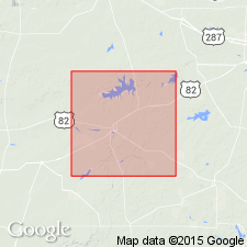
- Palo Duro basin
Summary:
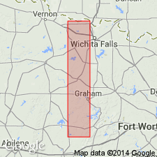
Pg. 31-36, 42-43. Beaverburk limestone. Limestone, capping upland bluffs on north side of Wichita River in southwest corner of Wichita County. Mostly tough dark-gray rock, 0 to 3 feet thick. Traced from basin of Beaver Creek northeast to Burk. Is member of Wichita formation, 125 feet above base. Separated from overlying Bluff bone bed by 65 feet of shale. Lies 102 feet below top of Wichita formation, and the Wichita rests on the Cisco. Fossils listed.
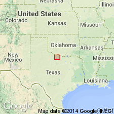
Named from development in basin of Beaver Creek and exposures at and around Burk, Wichita Co., central northern TX.
Source: US geologic names lexicon (USGS Bull. 896, p. 138).
- Usage in publication:
-
- Beaverburk limestone
- Modifications:
-
- Areal extent
- AAPG geologic province:
-
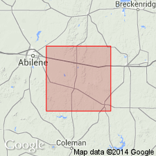
- Bend arch
- Palo Duro basin
Summary:
Beaverburk limestone or, more properly, dolomite, is important key horizon and can be traced southwest to south line of Baylor County, central northern Texas. [Age is Permian.]
Source: US geologic names lexicon (USGS Bull. 896, p. 138).
- Usage in publication:
-
- Beaverburk(?) limestone
- Modifications:
-
- Areal extent
- AAPG geologic province:
-
- Bend arch
Summary:
Pg. 69-76. Beaverburk(?) limestone is top bed of Belle Plains formation in Baylor and Archer Counties, central northern Texas. [Age is Permian.]
Source: US geologic names lexicon (USGS Bull. 896, p. 138).
- Usage in publication:
-
- Beaverburk limestone
- Modifications:
-
- Revised
- AAPG geologic province:
-
- Palo Duro basin
Summary:
Placed Beaverburk limestone in interval between Bead Mountain limestone above and Elm Creek limestone below. [Age is Permian.]
Source: US geologic names lexicon (USGS Bull. 896, p. 138).
- Usage in publication:
-
- Beaverburk limestone
- Modifications:
-
- Revised
- AAPG geologic province:
-
- Bend arch
Summary:
Assigned Beaverburk limestone to top of Belle Plains formation, as did J. Hornberger, Jr., 1932 (Texas Bur. Econ. Geol. geol. map of Throckmorton Co.). [Age is Permian.]
Source: US geologic names lexicon (USGS Bull. 896, p. 138).
- Usage in publication:
-
- Beaverburk limestone
- Modifications:
-
- Revised
- AAPG geologic province:
-
- Bend arch
Summary:
Assigned Beaverburk limestone to top of Belle Plains formation and 20+/- feet above Bead Mountain limestone. [Age is Permian.]
Source: US geologic names lexicon (USGS Bull. 896, p. 138).

- Usage in publication:
-
- Beaverburk limestone
- Modifications:
-
- Revised
- AAPG geologic province:
-
- Bend arch
- Palo Duro basin
Summary:
Pg. 169, 173. Included in top of Belle Plains formation the Bluff bone bed of Udden and Beaverburk limestone of Udden, both of which he assigned to higher horizon than Bead Mountain limestone. The Bead Mountain limestone is top member of Belle Plains formation according to original definition and usage, and Clyde formation overlies Belle Plains. [Age is Permian.]
Source: US geologic names lexicon (USGS Bull. 896, p. 138).

- Usage in publication:
-
- Beaverburk member
- Modifications:
-
- Revised
- AAPG geologic province:
-
- Bend arch
- Palo Duro basin
Summary:
Pg. 66 (fig. 1). Beaverburk member of Bead Mountain formation. Shown on chart as a member of Bead Mountain formation. [Age is Early Permian (Leonard).]
Source: US geologic names lexicon (USGS Bull. 1200, p. 258).

- Usage in publication:
-
- Beaverburk Limestone [unranked]
- Modifications:
-
- Mapped
- AAPG geologic province:
-
- Bend arch
- Palo Duro basin
Summary:
Beaverburk Limestone [unranked] in basal part of Bead Mountain Formation of Albany Group (Baylor Co.) and Waggoner Ranch Formation of Wichita Group (Wilbarger Co.). Consists of gray and dark-brown, fine- to medium-grained, thin- to medium-bedded, argillaceous limestone, 8 inches to 3 feet thick. Fossils. Age is Early Permian (Leonard).
Source: Publication.
For more information, please contact Nancy Stamm, Geologic Names Committee Secretary.
Asterisk (*) indicates published by U.S. Geological Survey authors.
"No current usage" (†) implies that a name has been abandoned or has fallen into disuse. Former usage and, if known, replacement name given in parentheses ( ).
Slash (/) indicates name conflicts with nomenclatural guidelines (CSN, 1933; ACSN, 1961, 1970; NACSN, 1983, 2005, 2021). May be explained within brackets ([ ]).