The National Geologic Map Database is migrating to a new infrastructure. We apologize for any service disruptions during this process.
|
|---|


- Usage in publication:
-
- Bearpaw shales*
- Modifications:
-
- Original reference
- Dominant lithology:
-
- Shale
- AAPG geologic province:
-
- Williston basin
Summary:
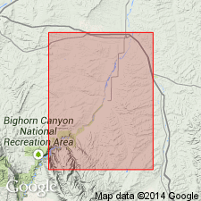
Pg. 211-212; and T.W. Stanton and others, 1905, USGS Bull. 257. Bearpaw shales. Dark clay shale, with many calcareous concretions. Of marine origin. Thickness 600 to 700 feet. Conformably overlies Judith River beds. Well developed around north, east, and south borders of Bearpaw Mountains, [Blaine County, Montana (Williston basin)]. Not yet determined whether Bearpaw includes equivalents of Fox Hills sandstone or is wholly of Pierre age. Age is Late Cretaceous.
Source: US geologic names lexicon (USGS Bull. 896, p. 133).
- Usage in publication:
-
- Bearpaw shale*
- Modifications:
-
- Areal extent
- AAPG geologic province:
-
- Central Montana uplift
- Montana folded belt
Summary:
Bearpaw shale. In Crazy Mountains region, Montana, Bearpaw shale underlies newly named Lennep sandstone. Fossils identified from the Bearpaw are typical marine fauna (listed); collected in sec. 5, T. 7 N., R. 9 E., Meagher Co., MT. Age is Late Cretaceous (Montana age). Report includes cross section. [See also M.G. Wilmarth, 1938, Geologic Names Committee remark (USGS Bull. 896, p. 762) under Fort Union.]
Source: Modified from GNU records (USGS DDS-6; Denver GNULEX).
- Usage in publication:
-
- Bearpaw shale*
- Modifications:
-
- Areal extent
- AAPG geologic province:
-
- Sweetgrass arch
Summary:
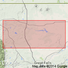
Bearpaw shale of Montana group. Poorly exposed; forms subdued rounded topography, gumbo soil. Consists of dark-gray clay shale with limestone concretions; contains abundant ammonites. Thickness 490 feet. Overlies Two Medicine formation (new) and underlies Horsethief sandstone, both of Montana group. Described from section in valley of Two Medicine River, from its mouth, in T. 31 N., R. 5 W., to a point 3 miles above T. 31 N., R. 9 W., eastern central Blackfeet Indian Reservation, Glacier and Pondera Counties, northwestern Montana. [Age is Late Cretaceous.] Report includes regional cross section.
Source: Modified from GNU records (USGS DDS-6; Denver GNULEX).
- Usage in publication:
-
- Bearpaw shale*
- Modifications:
-
- Areal extent
- AAPG geologic province:
-
- Central Montana uplift
- Sweetgrass arch
Summary:
Pg. 167 (table). Bearpaw shale. Correlated Bearpaw shale with upper part of Pierre shale and lower part of Fox Hills sandstone. [Age is Late Cretaceous.]
Source: US geologic names lexicon (USGS Bull. 896, p. 133).

- Usage in publication:
-
- Bearpaw shale
- Modifications:
-
- Overview
- AAPG geologic province:
-
- Central Montana uplift
- Sweetgrass arch
Summary:
In central Montana the Bearpaw is overlain by Lennep sandstone (of Fox Hills age) and in northwest Montana it is overlain by Horsethief sandstone (also of Fox Hills age).
Source: US geologic names lexicon (USGS Bull. 896, p. 133).
- Usage in publication:
-
- Bearpaw shale*
- Modifications:
-
- Mapped 1:63k
- AAPG geologic province:
-
- Powder River basin
Summary:
Mapped in northeasternmost part of study area Big Horn Co, MT, northwestern Powder River basin. As shown on measured section (sheet 2), Bearpaw is 866 ft thick and consists of dark-gray shale; bentonitic in middle part. Assigned to Montana group. Overlies Parkman sandstone; underlies Hell Creek formation. Late Cretaceous age.
Source: GNU records (USGS DDS-6; Denver GNULEX).
- Usage in publication:
-
- Bearpaw shale*
- Modifications:
-
- Revised
- Areal extent
- AAPG geologic province:
-
- Sweetgrass arch
Summary:
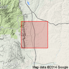
Pg. 108 (fig. 1), 116 (fig. 7), 117-118. Bearpaw shale. On northwest flank of Sweetgrass arch, northwestern Montana, present only in area north of Dupuyer Creek. Consists largely of dark-gray marine shale that contains ferruginous concretions, bentonite, and thin layers of sandstone. Thickness 225 to 400 feet. Overlies Two Medicine formation. Upper part of Bearpaw passes westward and southwestward into shallow-water sandy unit that is treated herein as a separate unit and designated as Bearpaw-Horsethief transition.
Source: US geologic names lexicon (USGS Bull. 1200, p. 251).
- Usage in publication:
-
- Bearpaw shale
- Modifications:
-
- Mapped 1:48k
- AAPG geologic province:
-
- Powder River basin
Summary:
Pg. B6-B65, pl. 6. Bearpaw shale. Described in Crazy Woman Creek area, Johnson County, Wyoming, where it overlies Parkman sandstone and underlies Lance formation. Consists mainly of dark-greenish-gray shale with light-gray siltstone laminae. Age is Late Cretaceous.
Source: US geologic names lexicon (USGS Bull. 1200, p. 251).
- Usage in publication:
-
- Bearpaw shale
- Modifications:
-
- Areal extent
- AAPG geologic province:
-
- Montana folded belt
Summary:
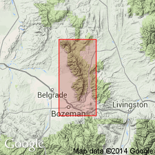
Pl. 7. Bearpaw shale. Plate 7 shows that Livingston formation intertongues with Claggett, Judith River, Bearpaw, Lennep, Hell Creek, Tullock, and Lebo formations. Age is Late Cretaceous.
Source: US geologic names lexicon (USGS Bull. 1200, p. 251).
- Usage in publication:
-
- Bearpaw shale
- Modifications:
-
- Revised
- AAPG geologic province:
-
- Powder River basin
Summary:
Pg. 12 (fig. 3), 16, 36-42, pls. 1, 2. Bearpaw shale of Montana group. Revised locally in southern part of Hardin district, Montana-Wyoming. Strata previously assigned to the lower part of formation (citing Thom and others, 1935, USGS Bull. 856) are reassigned to unnamed upper member of Judith River formation; authors believe sand content is more typical of Judith River than Bearpaw. In northern Hardin district, the upper member of the Judith is indistinguishable from Bearpaw strata. Thickness about 865 feet as exposed east of Hardin, Montana. Middle part of Bearpaw includes bentonite beds V, W, and X and is equivalent to Monument Hill bentonitic member of Pierre shale of the Black Hills. In northern Hardin district, overlies unnamed upper member of Judith River formation of Montana group and, in southern Hardin district, overlies Parkman sandstone member of Judith River formation of Montana group; underlies Hell Creek formation. Age is Late Cretaceous. Report includes geologic map, stratigraphic nomenclature chart, fossil list.
Source: Publication; supplemental information from US geologic names lexicon (USGS Bull. 1200, Judith River entry p. 1946).
- Usage in publication:
-
- Bearpaw Shale*
- Modifications:
-
- Biostratigraphic dating
- Geochronologic dating
- AAPG geologic province:
-
- Williston basin
Summary:
Bearpaw Shale. Sample collected from a 60-cm-thick bentonite bed in middle of Bearpaw Shale, about 6 m below the BACULITES COMPRESSUS ammonite zone, in SW/4 NE/4 sec. 4, T. 14 N., R. 31 E., Garfield Co., MT (Williston basin). K-Ar age on biotite 71.5 +/-0.7 Ma. Age is Late Cretaceous (Campanian) following Cobban's ammonite zonation.
Source: Modified from GNU records (USGS DDS-6; Denver GNULEX).
- Usage in publication:
-
- Bearpaw Shale Member*
- Modifications:
-
- Revised
- Reference
- Dominant lithology:
-
- Sandstone
- Mudstone
- AAPG geologic province:
-
- Montana folded belt
Summary:
Reduced in stratigraphic rank in report area in Montana folded belt province to a member of Sedan Formation (new) of Livingston Group (new affiliation). Reference section designated in SW1/4 sec 17 and SE1/4 sec 18, T4N, R8E, where a 81.2 m (266.5 ft) section measured. Is composed of interbedded brown-gray to olive-gray, siliceous, zeolitic to sandy mudstone and gray-green, medium- to coarse-grained conglomeratic, cross-bedded sandstone, and fine- to medium-grained, calcareous volcanic sandstone at reference section. Overlies mudstone member and underlies Lennep Sandstone Member, both of Sedan. Is mapped in northern part of Wallrock and southeast part of Sixteen NE quads. Cannot be mapped easily to south. Assigned a late Campanian, Late Cretaceous age.
Source: GNU records (USGS DDS-6; Denver GNULEX).
- Usage in publication:
-
- Bearpaw Shale*
- Modifications:
-
- Biostratigraphic dating
- AAPG geologic province:
-
- Williston basin
- Central Montana uplift
- Powder River basin
- Bighorn basin
Summary:
Is formation in Blaine, Phillips, Garfield, and Valley Cos, MT in Williston basin; Fergus and Stillwater Cos, MT in Central Montana uplift; Rosebud Co, MT in Powder River basin; and Carbon Co, MT in Bighorn basin. Collections of the ammonite genus RHAEBOCERAS from numerous localities indicate an early Maestrichtian (Late Cretaceous) age for upper part of Bearpaw. General stratigraphic position of RHAEBOCERAS includes the zones of BACULITES REESIDEI Elias and B. JENSENI Cobban.
Source: GNU records (USGS DDS-6; Denver GNULEX).
For more information, please contact Nancy Stamm, Geologic Names Committee Secretary.
Asterisk (*) indicates published by U.S. Geological Survey authors.
"No current usage" (†) implies that a name has been abandoned or has fallen into disuse. Former usage and, if known, replacement name given in parentheses ( ).
Slash (/) indicates name conflicts with nomenclatural guidelines (CSN, 1933; ACSN, 1961, 1970; NACSN, 1983, 2005, 2021). May be explained within brackets ([ ]).