The National Geologic Map Database is migrating to a new infrastructure. We apologize for any service disruptions during this process.
|
|---|


- Usage in publication:
-
- Battery Rock conglomerate
- Modifications:
-
- Incidental mention
- Dominant lithology:
-
- Conglomerate
- AAPG geologic province:
-
- Illinois basin
Summary:
Pg. 49. Incidental mention as Battery Rock conglomerate.
Source: US geologic names lexicon (USGS Bull. 1200, p. 237-238).
- Usage in publication:
-
- Battery Rock formation
- Modifications:
-
- Principal reference
- Dominant lithology:
-
- Sandstone
- Shale
- AAPG geologic province:
-
- Illinois basin
Summary:
Pg. 36, 37-38. Battery Rock formation of Caseyville group. Has maximum thickness of more than 200 feet and consists of two nearly equal parts: Battery Rock sandstone below and Drury shale member above. The sandstone is medium- to coarse-grained, cross-bedded, and massive; it ranges from less than 50 to more than 100 feet in thickness. Transition from sandstone to Drury shale member is locally abrupt, but elsewhere thin-bedded and shaly sandstone beds make determination of sharp boundary impossible; thin beds of massive sandstone also are locally present above Battery Rock member so that, where exposures are discontinuous, its upper limit is difficult to determine. Underlies Pounds formation (new); probably unconformable but actual contact rarely exposed. Unconformably overlies Lusk formation (new) except in parts of northwestern Union County, Illinois, where it overlaps Chester strata. Relations to Lick Creek sandstone at Cedar Bluff not entirely clear, and use of this name for widespread sandstone at base of Battery Rock is questionable. Age is Early Pennsylvanian.
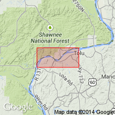
Type locality: along Ohio River bluff, in sec. 26, T. 11 S., R. 10 E., Shawneetown quadrangle, Hardin Co., IL. [Named from Battery Rock in sec. 21, T. 11 S., R. 10 E.]
Source: US geologic names lexicon (USGS Bull. 1200, p. 237-238).
- Usage in publication:
-
- Battery Rock sandstone
- Modifications:
-
- Revised
- AAPG geologic province:
-
- Illinois basin
Summary:
Pg. 136. Lick Creek sandstone now considered to be Battery Rock.
[Misprint (US geologic names lexicon, USGS Bull. 1200, p. 238): Publication date should be 1946, not 1944.]
Source: US geologic names lexicon (USGS Bull. 1200, p. 237-238).

- Usage in publication:
-
- Battery Rock sandstone member
- Modifications:
-
- Revised
- AAPG geologic province:
-
- Illinois basin
Summary:
Pg. 29, 30, 44 (table 1), 61, pl. 1. Battery Rock sandstone member of Caseyville formation of McCormick group (new). In southeastern Illinois, occurs above Lusk shale member and below Sellers limestone member; in southwestern Illinois, occurs above Wayside sandstone member and below the Drury shale member. Thickness 98 feet in type section of Caseyville. Age is Early Pennsylvanian. Report presents new rock-stratigraphic classification of Pennsylvanian strata in Illinois. Cyclical classification retained but is entirely independent of rock-stratigraphic classification.
Source: US geologic names lexicon (USGS Bull. 1200, p. 237-238).
- Usage in publication:
-
- Battery Rock Sandstone Member*
- Modifications:
-
- Adopted
- AAPG geologic province:
-
- Illinois basin
Summary:
Battery Rock Sandstone Member of Caseyville Formation accepted for USGS use in Kentucky.
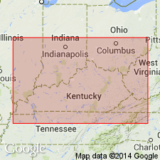
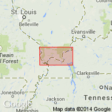
[Mapped in Livingston Co., western KY, in areas along Ohio River.]
Source: Modified from GNU records (USGS DDS-6; Reston GNULEX).

- Usage in publication:
-
- Battery Rock Sandstone Member
- Modifications:
-
- Overview
- AAPG geologic province:
-
- Illinois basin
Summary:
Pg. 179, 181. Battery Rock Sandstone Member of the Caseyville Formation (Cox, 1875, p. 204) is named for Battery Rock, a bluff of massive sandstone on the west bank of the Ohio River in Hardin County, the type section (sec. 26, T. 11 S., R. 10 E.). The Battery Rock Sandstone, a prominent bluff-forming unit, is very well developed in Gallatin, Hardin, and Pope Counties, where it is 50 to 100 feet thick in a large area. It is also as much as 100 feet thick in the western part of the southern Illinois outcrop belt, but there it is more lenticular. Along the southwestern side of the Illinois basin, the sandstone extends only as far north as Randolph County. In the subsurface to the north and northeast of the outcrop belt, the Battery Rock is difficult to trace because several other thick sandstone units occur in the lower part of the McCormick Group. The Battery Rock is generally medium-grained sandstone, but at places it becomes coarse; almost everywhere it contains scattered quartz granules and pebbles, which in places form conglomerate beds. Although the Caseyville sandstone have been called conglomerates, the term “conglomeritic” is more appropriate. The Battery Rock is correlated with the lower Caseyville conglomerate, or Kyrock Sandstone Member, of western Kentucky and with the lower part of the Mansfield Sandstone of Indiana.
See also E.T. Cox, 1875, Geol. Gallatin Co., Chap. 17, IN A.H. Worthen and others, Geol. and Paleo., Illinois Geol. Survey, v. 6, pt. 1, p. 197-219; available online from the Univ. Chicago Library: http://worthen.lib.uchicago.edu/ (accessed July 1, 2010).
Source: Publication.

- Usage in publication:
-
- Battery Rock Sandstone Member
- Modifications:
-
- Mapped
- AAPG geologic province:
-
- Illinois basin
Summary:
Pg. 13 (fig. 6), 18-20, pl. 1. Battery Rock Sandstone Member of Caseyville Formation. Present in Stonefort, Eddyville, and Waltersburg 7.5-min quadrangles, Johnson and Pope Counties, Illinois. Nearly white, light- to medium-gray weathering, thick-bedded to massive, conglomeratic, quartzose sandstone. Almost all outcrops contain abundant quartz pebbles 0.25 to 1 inch diameter. Lenses of quartz-pebble conglomerate common. Large-scale and planar and trough cross-bedding common. Thickness 30 to 60 feet in most places; probably ranges to 100 feet. Underlies Drury Member of Caseyville; contact abrupt in most places. Overlies Wayside Member of Caseyville; contact sharp and appears erosional. Age is Early Pennsylvanian (Morrowan), based on fossils.
Mapped in Stonefort quadrangle (http://ngmdb.usgs.gov/Prodesc/proddesc_10341.htm) and Eddyville quadrangle (http://ngmdb.usgs.gov/Prodesc/proddesc_10314.htm).
Source: Publication.
- Usage in publication:
-
- Battery Rock
- Modifications:
-
- Overview
- Dominant lithology:
-
- Sandstone
- Shale
- AAPG geologic province:
-
- Illinois basin
Summary:
Pg. 4-6, pl. Caseyville Formation of Raccoon Creek Group. Recognized in Illinois and Kentucky. Includes Pounds Sandstone Member at top. Lithology varies; can be entirely quart pebble-bearing sandstones, mixed sandstones and shales, or thick shaly sequences. Thickness up to 600+ feet; varies greatly because of uneven topography on which it was deposited. Underlies Tradewater Formation of Raccoon Creek Group; unconformably overlies Ordovician to Mississippian rocks. Age is Morrowan.
This is classification agreed upon by state geological surveys of Illinois and Kentucky. Equivalent rocks in Indiana called Mansfield Formation of Raccoon Creek Group.
Source: Publication.
For more information, please contact Nancy Stamm, Geologic Names Committee Secretary.
Asterisk (*) indicates published by U.S. Geological Survey authors.
"No current usage" (†) implies that a name has been abandoned or has fallen into disuse. Former usage and, if known, replacement name given in parentheses ( ).
Slash (/) indicates name conflicts with nomenclatural guidelines (CSN, 1933; ACSN, 1961, 1970; NACSN, 1983, 2005, 2021). May be explained within brackets ([ ]).