The National Geologic Map Database is migrating to a new infrastructure. We apologize for any service disruptions during this process.
|
|---|


- Usage in publication:
-
- Ajax limestone*
- Modifications:
-
- Original reference
- Dominant lithology:
-
- Limestone
- AAPG geologic province:
-
- Great Basin province
- South Western Overthrust
Summary:
Ajax limestone. In descending order: (1) dark bluish gray cherty magnesium limestone, upper part calcareous, 440+/- feet; (2) Emerald dolomite member (30 to 40 feet of cream white dolomite); (3) dark-gray clouded dolomite or highly magnesium limestone, partly cross-bedded and in part consisting of thin conglomeratic beds, also many thin lenses and nodules of light-gray chert, with quartzite and limestone conglomerate at base, 90 feet. Grades into overlying Opohonga limestone and unconformably overlies Opex dolomite. Age is Early Ordovician.
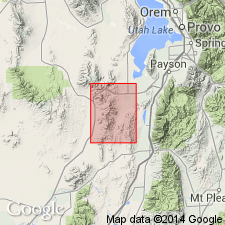
Named from Ajax Mine, [Lat. 39 deg. 55 min. 38 sec. N., Long. 112 deg. 06 min. 46 sec. W., Eureka 7.5-min quadrangle, Juab Co.], Tintic district, central northern UT.
Source: US geologic names lexicon (USGS Bull. 896, p. 20).
- Usage in publication:
-
- Ajax limestone
- Modifications:
-
- Areal extent
- AAPG geologic province:
-
- Great Basin province
- South Western Overthrust
Summary:
Pg. 5 (fig. 2), 9, 11 (fig. 3). Ajax limestone. Described in East Tintic Mountains, central northern Utah. Subdivided into three members: lower, 90 to 100 feet thick, chiefly medium- to coarse-grained medium- to dark-blue-gray faintly mottled dolomite which encloses pods and short lenses of black and brown chert; Emerald dolomite member, about 30 feet; upper, averaging about 450 feet, chiefly dolomite with thin-bedded argillaceous dolomite at top. Conformably overlies Opex formation; conformably underlies Opohonga limestone. [Age is Late Cambrian.]
Source: US geologic names lexicon (USGS Bull. 1200, p. 32-33).
- Usage in publication:
-
- Ajax limestone
- Modifications:
-
- Areal extent
- AAPG geologic province:
-
- Great Basin province
- Wasatch uplift
Rigby, J.K., 1958, Geology of the Stansbury Mountains, [Utah]: Utah Geological Society, Guidebook to the geology of Utah, no. 13, p. 1-134.
Summary:
Pg. 25-26, 28 (fig. 4). Ajax limestone. Described in Stansbury Mountains, central northern Utah, where it is 750 to 900 feet thick. Overlies Dunderbeg shale and underlies Garden City formation. [Age is Late Cambrian.]
Source: US geologic names lexicon (USGS Bull. 1200, p. 32-33).
- Usage in publication:
-
- Ajax dolomite
- Modifications:
-
- Redefined
- AAPG geologic province:
-
- Great Basin province
Summary:
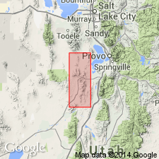
Pg. 12 (table 1), 57, pls. 1, 17. Ajax dolomite; Ajax formation [heading]. Described in Sheeprock Mountains, western Utah, where it is entirely dolomite. Thickness in west Lookout Hills 1,012 feet [Lookout Pass area, in T. 8 and 9 S., R. 6 and 7 W., Tooele Co.]. Includes Emerald member, 150 feet thick, near middle. Underlies House limestone; overlies Opex formation. Age is considered middle Late Cambrian, based on stratigraphic position.
Source: Publication; US geologic names lexicon (USGS Bull. 1200, p. 32-33).

- Usage in publication:
-
- Ajax dolomite*
- Modifications:
-
- Redefined
- Biostratigraphic dating
- Age modified
- AAPG geologic province:
-
- Great Basin province
- South Western Overthrust
Summary:
Pg. 47-53, pls. 3, 4. Ajax dolomite. Chiefly dark-gray, massive, somewhat cherty dolomite, 520 to 730 feet thick. Divided into, descending: (1) upper dolomite member, 265 to 520 feet thick; (2) Emerald member, medium- to coarse-grained, creamy-white-weathering dolomite about 30 feet thick; and (3) lower dolomite member, 90 to 180 feet thick. Conformably underlies Opohonga limestone; conformably overlies Opex formation. Age is Late Cambrian. Fossils, notably brachiopod EOORTHIS sp. from basal part and trilobite EUREKIA sp. from top (identified by A.R. Palmer, USGS), indicate middle Franconian (CONAPSIS trilobite zone) through Trempealeauan of standard Upper Cambrian section (see Howell and others, 1944, GSA Bull., v. 55).
Measured sections, main Tintic district, Juab Co., central northern UT: (1) lower member, loc. 9a, on ridge btw. Opex and Grand central shafts, south of Eureka, in SE/4 SE/4 sec. 24, T. 10 S., R. 3 W., [Eureka 7.5-min quadrangle]; (2) Emerald member, loc. [9a], type area, in SE/4 SE/4 sec. 24, T. 10 S., R. 3 W., [Eureka 7.5-min quadrangle]; and (3) upper member, loc. 9b, west slope Keystone Ridge, western edge of Eureka, in S/2 sec. 13, T. 10 [S.]., R. 3 W., [Tintic Junction 7.5-min quadrangle].
Source: Publication.
- Usage in publication:
-
- Ajax Dolomite
- Modifications:
-
- Biostratigraphic dating
- Age modified
- Areal extent
- AAPG geologic province:
-
- Great Basin province
Summary:
Ajax Dolomite is geographically extended to Stansbury Island, UT. Thickness is 900 ft. Overlies Corset Spring(?) Shale; underlies Garden City Formation. Local age is Late Cambrian (lower 847 ft) and Early Ordovician (upper 53 ft; based of conodonts). [age and geographic extensions are NOT adopted due to publication in as an Open-File Report].
Source: GNU records (USGS DDS-6; Menlo GNULEX).
- Usage in publication:
-
- Ajax Dolomite*
- Modifications:
-
- Overview
- AAPG geologic province:
-
- Great Basin province
- Wasatch uplift
- South Western Overthrust
Summary:
Pg. 20-21 (fig. 25); charts 39, 40, 44, 54, 55, 61, 67. Ajax Dolomite. Thickness 300 to 1,000 feet. Overlies Opex Formation; underlies Opohonga Limestone (Ordovician), and in places, Pogonip Group (Ordovician) or Fitchville Formation (Devonian). Correlative with Notch Peak Formation and most of St. Charles Formation. Age is Late Cambrian (Millardan; Sunwaptan), TAENICEPHALUS to SYMPHISURINA BREVISPICATA trilobite zones. Locally in East Tintic Mountains, extends into earliest Ordovician.
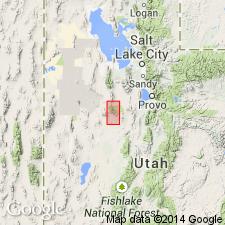
Recognized in central part of Utah, in Sheeprock, Simpson, East Tintic, and West Tintic Mountains, and Mount Nebo area [Juab, Tooele, and Utah Counties], to south in Valley Mountains [Millard, Sanpete, and Sevier Counties], and to northwest in Stansbury Mountains (some geologists apply Notch Peak Formation to these rocks).
Source: Publication.
For more information, please contact Nancy Stamm, Geologic Names Committee Secretary.
Asterisk (*) indicates published by U.S. Geological Survey authors.
"No current usage" (†) implies that a name has been abandoned or has fallen into disuse. Former usage and, if known, replacement name given in parentheses ( ).
Slash (/) indicates name conflicts with nomenclatural guidelines (CSN, 1933; ACSN, 1961, 1970; NACSN, 1983, 2005, 2021). May be explained within brackets ([ ]).