- Usage in publication:
-
- Admire shales*
- Modifications:
-
- Original reference
- Dominant lithology:
-
- Shale
- AAPG geologic province:
-
- Forest City basin
Summary:
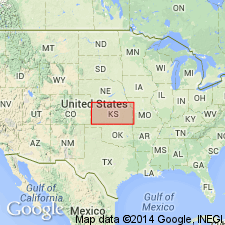
Pg. 53. Admire shales. Fossiliferous shales, 40 feet thick, overlying Emporia limestone and underlying Americus limestone. [C.S. Prosser, 1902 (Jour. Geol., v. 10, p. 707) gave thickness of rocks between Emporia and Americus limestones as 300 feet, consisting chiefly of shales but including many thin beds of coal, and sandstone.] Fossils (fusulinids, brachiopods). Age is late Carboniferous. Have been mapped in Lyon County, eastern Kansas.
Source: US geologic names lexicon (USGS Bull. 896, p. 15-16); supplemental information from GNU records (USGS DDS-6; Denver GNULEX).
- Usage in publication:
-
- Admire(?) formation
- Modifications:
-
- Revised
- AAPG geologic province:
-
- Forest City basin
- Nemaha anticline
Summary:
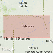
Admire(?) formation. In southeastern Nebraska, includes the following members (ascending): Brownville limestone, 2 to 6 feet; unnamed shale, 10 to 25 feet; Aspinwall limestone, 16 inches; unnamed shale, 18 to 37 feet; Falls City limestone, 5.5 feet; unnamed shale, 40 to 50 feet; and unnamed limestones and shale, 35 feet. Underlies Eskridge shale; overlies McKissick Grove shale. Age is Pennsylvanian. Report includes measured sections, cross sections.
Source: GNC KS-NE Pennsylvanian Corr. Chart, sheet 1, Oct. 1936; supplemental information from GNU records (USGS DDS-6; Denver GNULEX).
- Usage in publication:
-
- Admire shale member
- Modifications:
-
- Revised
- AAPG geologic province:
-
- Forest City basin
Summary:
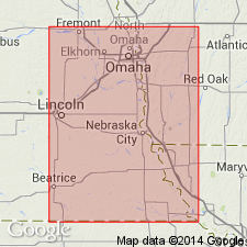
Pg. 72, 81, etc. Admire shale member of Wabaunsee formation. Adams in proposing Admire in 1903 introduced it for the shales lying between Emporia limestone and Americus limestone, with thickness of 40 feet. Just what bed or beds Adams erroneously correlated as Emporia limestone in arriving at thickness of 40 feet is not known. It may have been Falls City limestone, which is poorly exposed southwest of Admire [Lyon County, Kansas], about 60 feet below Americus limestone. It could not have been Emporia limestone, which is much lower in section and does not crop out in this vicinity. Only upper part of Admire, as later recognized by Prosser, Haworth, Moore, and others is exposed at Admire, which means that Admire as now used is not properly applied. The Admire shale of Kansas geologists extends from base of Americus limestone down to top of Emporia limestone. The Nebraska Geol. Survey is to use Admire shale member for the beds beneath Americus limestone down to base of Brownville limestone, because this portion of the section constitutes about what Adams defined as a member. The Brownville limestone outcrops on creek just northeast of Admire and Americus limestone is exposed southwest of it. The Admire shale member as thus revised is here divided into (descending): (1) West Branch shale (new), 24+/- feet; (2) Falls City limestone, 4+/- feet; (3) Aspinwall shale, 25+/- feet; (4) Brownville limestone, 4+/- feet. Age is Late Pennsylvanian (Missouri age). Report includes cross sections, measured sections, geologic maps, stratigraphic tables.
Source: US geologic names lexicon (USGS Bull. 896, p. 15-16); GNC KS-NE Pennsylvanian Corr. Chart, sheet 1, Oct. 1936; supplemental information from GNU records (USGS DDS-6; Denver GNULEX).
- Usage in publication:
-
- Admire shale
- Modifications:
-
- Revised
- AAPG geologic province:
-
- Nemaha anticline
Summary:
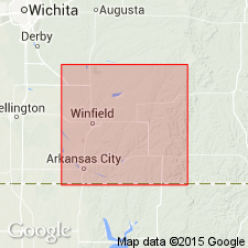
Pg. 43, footnote. Admire shale. As revised by G.E. Condra, "Admire shale" as here used includes, in ascending order, Willard shale, Tarkio limestone (apparently absent in southern Kansas), McKissick Grove shale, and Admire shale (restricted). The Kansas Geol. Survey accepts this revised classification.
Source: US geologic names lexicon (USGS Bull. 896, p. 15-16).
- Usage in publication:
-
- Admire shale
- Modifications:
-
- Revised
- AAPG geologic province:
-
- Forest City basin
- Nemaha anticline
Summary:
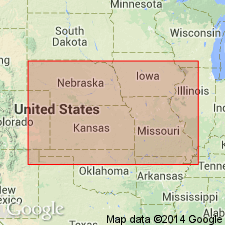
Admire shale of Wabaunsee group. Discarded his 1929 definition of Admire shale, and adopted a still further restricted definition, i.e., for the beds overlying Brownville limestone and underlying Americus limestone (Brownville limestone being treated as a distinct unit); and divided it into (descending) West Branch shale, Falls City limestone, and Aspinwall shale. Moore and Condra in their Oct. 1932 revised classification chart for Kansas and Nebraska defined Admire shale as underlying Americus limestone and overlying Brownville limestone, but they transferred to it, at top, Houchen Creek limestone and Stine shale, which had previously been included in overlying Elmdale shale. They divided Admire shale into (descending) Oaks shale, Houchen Creek limestone, Stine shale, Five Point limestone, West Branch shale, Falls City limestone, Hawxby shale, Aspinwall limestone, and Towle shale. Their Oaks shale was appararently previously included in Elmdale shale, which overlies Americus limestone. Age is Late Pennsylvanian (Virgil).
Source: US geologic names lexicon (USGS Bull. 896, p. 15-16); GNC KS-NE Pennsylvanian Corr. Chart, sheet 2, Oct. 1936.
- Usage in publication:
-
- Admire group
- Modifications:
-
- Revised
- AAPG geologic province:
-
- Forest City basin
Summary:
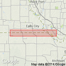
Pg. 8-9, and R.C. Moore, 1936, Kansas Geol. Survey Bull., no. 22, p. 50. Used Admire group in southeast Nebraska, instead of Admire shale, to include the same subdivisions mentioned in 1932 definition above [R.C. Moore, 1932, Kansas Geol. Soc. 6th Ann. Field Conf. Gdbk., Aug. 28 to Sept. 3], (ascending) Towle shale, Aspinwall limestone, Hawxby shale, Falls City limestone, West Branch shale, Five Point limestone, and Hamlin shale formations. Underlies Council Grove group; overlies Pennsylvanian Wabaunsee group. Age is considered Permian (lower part of Big Blue).
Source: US geologic names lexicons (USGS Bull. 896, p. 15-16; USGS Bull. 1200, p. 21-22); GNC KS-NE Pennsylvanian Corr. Chart, sheet 2, Oct. 1936.

- Usage in publication:
-
- Admire shale*
- Modifications:
-
- Overview
- AAPG geologic province:
-
- Forest City basin
- Nemaha anticline
Summary:
Pg. 16. The Kansas and Nebraska Geological Surveys now include the Admire in Permian. The USGS has not yet considered this change in boundary between Permian and Pennsylvanian nor the restricted definitions of Admire.
See also "Modern classifications of the Pennsylvanian rocks of eastern Kansas and southeastern Nebraska," compiled by M.G. Wilmarth, Secretary of Committee on Geologic Names, USGS unpub. corr. chart, Oct. 1936, 2 sheets.
Source: US geologic names lexicon (USGS Bull. 896, p. 15-16).
- Usage in publication:
-
- Admire shale*
- Modifications:
-
- Areal extent
- AAPG geologic province:
-
- Anadarko basin
Summary:
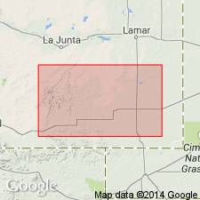
Admire group. Extended into subsurface of Baca County, Colorado. Consists of maroon and gray shale, thin fossiliferous limestone, and brown micaceous sandstone. Thickness 100 feet. Unconformably overlies Wabaunsee group, undivided; underlies Council Grove group, undivided.
Source: Modified from GNU records (USGS DDS-6; Denver GNULEX).
- Usage in publication:
-
- Admire group
- Modifications:
-
- Mapped 1:500k
Summary:
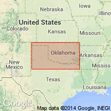
Admire group mapped in Oklahoma. Not subdivided.
Source: US geologic names lexicon (USGS Bull. 1200, p. 21-22).
- Usage in publication:
-
- Admire formation
- Modifications:
-
- Overview
- AAPG geologic province:
-
- Chautauqua platform
Summary:
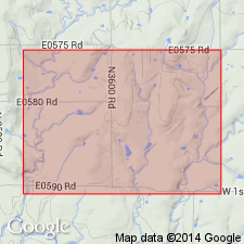
Pg. 123, 124-125. Admire formation. Stratigraphic unit from top of Brownville limestone to base of Foraker limestone is indivisible in Lincoln, Payne, and Pawnee Counties, Oklahoma. Corresponds to entire Admire group of Kansas and can be referred to as Admire formation.
Source: US geologic names lexicon (USGS Bull. 1200, p. 21-22).
- Usage in publication:
-
- Admire group*
- Modifications:
-
- Revised
Summary:
Pg. 2274 (fig. 1). Admire group. Redefined. Sudivided into three formations (ascending): Onaga shale (new), Falls City limestone, and Janesville shale (new). Overlies Wood Siding formation of Wabaunsee group. Age is Early Permian (Wolfcampian).
Source: US geologic names lexicon (USGS Bull. 1200, p. 21-22).
- Usage in publication:
-
- Admire group
- Modifications:
-
- Areal extent
- AAPG geologic province:
-
- Chautauqua platform
Summary:
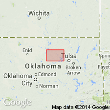
Pg. 73-77. Admire group, as currently defined, is basal Permian (Wolfcampian) unit of Midcontinent area and includes beds overlying Brownville limestone and underlying Americus limestone. In Nebraska and Kansas, group is subdivided into seven limestone and shale units; Indian Cave channel sandstone occurs locally at base. Taylor (1953), Vosburg (1954), and Fisher (1956) in unpublished theses made tentative correlations with some Kansas units. In Pawnee County, Oklahoma, exposures of group are poor, and no attempt at subdivision has been made. Branson (1956) proposed that where subdivision of group is not possible, name Admire formation be applied to sedimentary sequence separating BrownvilIe and Americus limestones. Formation in Pawnee County forms broad valley, averaging 3 miles in width, that trends north-south across county. Thickness 140 feet, representing abrupt increase in thickness southward from Osage County [Oklahoma].
Source: US geologic names lexicon (USGS Bull. 1200, p. 21-22).
- Usage in publication:
-
- Admire Group*
- Modifications:
-
- Biostratigraphic dating
- Areal extent
- AAPG geologic province:
-
- Chautauqua platform
- Cherokee basin
- Forest City basin
- Nemaha anticline
Summary:
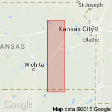
Admire Group. Includes (ascending) Onaga Shale, Falls City Limestone, and Janesville Shale. Underlies Council Grove Group and overlies Wabaunsee Group. Interpreted to be nearshore marine and land deposits. Age is Late Pennsylvanian (late Gzhelian; STREPTOGNATHODUS BELLUS and S. FLEXUOSUS conodont zones).
Described from measured sections in Chautauqua, Cowley, Greenwood, Pottawatomie, and Wabaunsee Counties, eastern Kansas, and Osage County, northern Oklahoma.
Source: Publication.
For more information, please contact Nancy Stamm, Geologic Names Committee Secretary.
Asterisk (*) indicates published by U.S. Geological Survey authors.
"No current usage" (†) implies that a name has been abandoned or has fallen into disuse. Former usage and, if known, replacement name given in parentheses ( ).
Slash (/) indicates name conflicts with nomenclatural guidelines (CSN, 1933; ACSN, 1961, 1970; NACSN, 1983, 2005, 2021). May be explained within brackets ([ ]).

