The National Geologic Map Database is migrating to a new infrastructure. We apologize for any service disruptions during this process.
|
|---|


- Usage in publication:
-
- South Platte formation*
- Modifications:
-
- Named
- Dominant lithology:
-
- Shale
- Sandstone
- AAPG geologic province:
-
- Denver basin
Summary:
Named as upper formation, Dakota group for South Platte River, Jefferson and Douglas Cos, CO, Denver basin. No single exposure typical. Type locality measured 0.5 mi north of Kassler in NE1/4 NW1/4 SE1/4 sec 27, T6S, R69W, Jefferson Co; standard section measured in SW1/4 NW1/4 sec 2, T3N, R70W; standard marine section measured in W1/2 NE1/4 sec 9, T10N, R69W, Larimer Co. Consists of 200-350 ft of alternating gray to black shale and brown-weathering, chiefly fine-grained, sandstone. Grades laterally northward from dominantly nonmarine clastic phase (Kassler quad) to dominantly marine phase (Larimer Co). Individual sandstones have considerable lateral extent, vary in thickness, nature of bedding, and argillaceous matter. Shales in nonmarine phase are hard, laminated and noncalcareous. Transition to marine phase marked by change of dominant clay mineral to illite, decrease in sand content in shale, and calcareous shale containing thin beds of fossiliferous silty limestone. Thin white, yellow, or light-gray claystone presumed to be altered volcanic ash. Divisible into Plainview sandstone member (new), base, third shale, third sandstone, second shale, Kassler sandstone member (new), Van Bibber shale member (new), and first sandstone (top). Disconformably overlies Lytle formation; underlies Benton shale. Contains marine mollusks. Assigned to Early Cretaceous. Correlation with units in WY and CO shown on fig. 19.
Source: GNU records (USGS DDS-6; Denver GNULEX).

- Usage in publication:
-
- South Platte formation*
- Modifications:
-
- Mapped 1:24k (Littleton quad, Arapahoe, Douglas, and Jefferson Cos, CO)
- Dominant lithology:
-
- Sandstone
- Shale
- Siltstone
- Conglomerate
- AAPG geologic province:
-
- Denver basin
Summary:
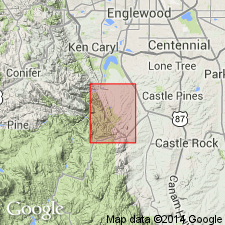
Is Lower Cretaceous formation mapped in east-central Jefferson Co, CO (Denver basin). Outcrops in area of Deer Creek to south edge of quad. Divided into (ascending) Plainview sandstone member, unnamed shaly unit, Kassler sandstone member, Van Bibber shale member, and unnamed sandstone unit. [Subdivisions not separately mapped.] Plainview, 56 ft thick, is gray fine-grained cross-bedded sandstone with gray clayey siltstone beds and partings. Unnamed shaly unit, 64 ft thick, is gray and brown siltstone and fine-grained sandstone; near top is gray silty shale with some marine fossils identified by Waage (1955) as INOCERAMUS BELLVUENSIS, I. COMANCHEANUS, and PTERIA SALINENSIS). Kassler, 72 ft thick, is gray fine- to coarse-grained cross-laminated friable sandstone, and clay pellets and a chert and quartzite pebble conglomerate at base. Van Bibber, 20 ft thick, consists of up to five minable refractory-clay beds in thin gray sandstone beds; clay is finely laminated and gray on fresh surfaces and white where weathered. Unnamed sandstone unit, 85 ft thick, consists of 45-ft-thick gray tabular to massive fine- to medium-grained cross-bedded sandstone in lower part (sandstone is quarried for silica sand near Kassler); overlain by thin gray soft fine-grained sandstone beds interlayered with thin beds of clayey siltstone and porcellanite. Unconformably overlies Lytle formation; underlies Graneros shale.
Source: GNU records (USGS DDS-6; Denver GNULEX).
- Usage in publication:
-
- South Platte formation*
- Modifications:
-
- Mapped 1:24k (Kassler quad, Douglas and Jefferson Cos, CO)
- Dominant lithology:
-
- Sandstone
- Shale
- AAPG geologic province:
-
- Denver basin
Summary:
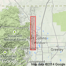
Is Lower Cretaceous formation mapped in northwestern Douglas and southeastern Jefferson Cos, CO (Denver basin). Mapped undivided with Lower Cretaceous Lytle formation. Outcrops as northwesterly striking, northeast dipping, narrow band along Hogback in central part of map. Consists of (ascending): Plainview sandstone member (56 ft), unnamed shaly unit (64 ft), Kassler sandstone member (72 ft), Van Bibber shale member (20 ft), and unnamed sandstone unit (85 ft). Description (p. 94) of subdivisions follows. Plainview is light-gray and yellowish-gray fine-grained cross-bedded sandstone with gray clayey siltstone and partings. Unnamed shaly unit is gray and brown siltstone and fine-grained sandstone; near top is dark-gray silty shale with fossils (including INOCERAMUS BELLVUENSIS, I. COMANCHEANUS, and PTERIA SALINENSIS). Kassler is yellowish-gray fine- to coarse-grained cross-laminated friable sandstone; chert and quartzite pebble conglomerate at base. Van Bibber contains up to five minable refractory clay beds within yellowish-gray sandstone. Upper unnamed sandstone consists of basal light-gray, tabular to massive, fine- to medium-grained, cross-bedded sandstone with scattered clay pellets overlain by thin gray soft fine-grained sandstone interlayered with thin beds of clayey siltstone and porcelanite. Disconformably overlies Lytle (Lower Cretaceous); conformably underlies Graneros shale (Lower Cretaceous).
Source: GNU records (USGS DDS-6; Denver GNULEX).
- Usage in publication:
-
- South Platte Formation
- Modifications:
-
- Areal extent
- AAPG geologic province:
-
- Denver basin
Summary:
Name was applied to a formation of the Lower Cretaceous Dakota Group in section near Denver, Colorado, in the Denver basin to a lithofacies of very limited areal extent. A marine facies near Fort Collins equivalent to South Platte is separable into a lower sandstone, middle marine shale, and an upper sandstone. These three divisions recognized over much of WY as well as eastern CO. The nomenclature of the larger area--south-central WY--is substituted for section near Denver so that rocks equivalent to South Platte north of Boulder are assigned to Plainview Formation (base), Skull Creek Shale and Muddy Sandstone (top). Skull Creek and Muddy extended into the CO part of the western Denver basin. Correlation chart.
Source: GNU records (USGS DDS-6; Denver GNULEX).

- Usage in publication:
-
- South Platte Formation*
- Modifications:
-
- Mapped 1:24k (Morrison quad, Jefferson Co, CO)
- Dominant lithology:
-
- Sandstone
- Shale
- AAPG geologic province:
-
- Denver basin
Summary:
Is Lower Cretaceous formation mapped in north-central Jefferson Co, CO (Denver basin). Is upper formation of Dakota Group. Outcrops occur along east side of Hogback. Conformably overlies Lytle Formation (Lower Cretaceous) of Dakota; conformably underlies Graneros Shale (Upper and Lower Cretaceous). Described as containing three sandstone members separated by two shale members. Sandstone is yellowish gray, well sorted, cross stratified, porous; composed of well-rounded to subrounded fine to medium quartz sand. Shale is dark gray, silty, hard, parallel bedded; interbedded with thin gray sandstone layers; contains gray or white refractory clay or porcelanite layers. Asphalt occurs in a seep and with pyrite in uranium prospects near Turkey Creek. Dinosaur footprints along Alameda Parkway. Thickness is about 220 ft.
Source: GNU records (USGS DDS-6; Denver GNULEX).
For more information, please contact Nancy Stamm, Geologic Names Committee Secretary.
Asterisk (*) indicates published by U.S. Geological Survey authors.
"No current usage" (†) implies that a name has been abandoned or has fallen into disuse. Former usage and, if known, replacement name given in parentheses ( ).
Slash (/) indicates name conflicts with nomenclatural guidelines (CSN, 1933; ACSN, 1961, 1970; NACSN, 1983, 2005, 2021). May be explained within brackets ([ ]).