

- Usage in publication:
-
- Sand Springs basalt*
- Modifications:
-
- Named
- Dominant lithology:
-
- Basalt
- AAPG geologic province:
-
- Snake River basin
Summary:
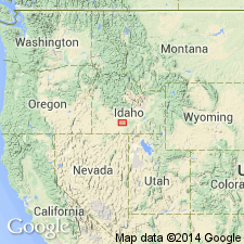
Named for exposures in wall of Snake River Canyon at Sand Springs cascade, its type locality, Gooding Co, ID in the Snake River basin. Exposed for 14 mi up Snake River to Sand Springs cascade. Is a pahoehoe basalt flow 500+ ft thick. Is younger than Bliss basalt; is older than Burley lake beds. Assigned to the Pleistocene.
Source: GNU records (USGS DDS-6; Denver GNULEX).
- Usage in publication:
-
- Sand Springs basalt*
- Modifications:
-
- Overview
- AAPG geologic province:
-
- Snake River basin
Summary:
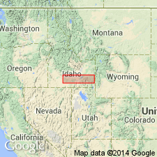
Extends within Snake River Canyon for about 50 mi upstream from mouth of Cove Creek, Gooding Co, ID to Devils Wash Bowl Spring [Jerome Co?], Snake River basin. Thickness at Cove Creek is about 100 ft suggesting unit may have extended farther downstream. Bliss basalt may represent downstream extension of flow, though there is little evidence to support this concept. Consists of vesicular, jointed, fresh gray pahoehoe basalt containing feldspar (labradorite) and iron-rich olivine phenocrysts; has ophitic texture and interstitial dark-brown glass. Probably consists of one flow. Thick section near Thousand Springs is filled with tubes, many of which appear to have carried water at one time. Rocky Ridge, a broad lava dome between Kamama and Hazelton, is probable source of flow. Burley lake beds (not mapped) were deposited in ancient Burley lake which was formed by damming of Snake River by Sand Springs. Geologic maps; stratigraphic chart. Overlies Bliss volcanics, locally unconformably; underlies Minidoka basalt, locally unconformably. Pleistocene age.
Source: GNU records (USGS DDS-6; Denver GNULEX).
- Usage in publication:
-
- Sand Springs Basalt*
- Modifications:
-
- Revised
- Overview
- AAPG geologic province:
-
- Snake River basin
Summary:
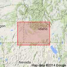
Assigned to Snake River Group as fifth from base of seven formations (uppermost part of Snake River includes unnamed Recent lava flows). Extends from source 20 mi northwest of Burley to near Hagerman, Jerome and Gooding Cos, ID, Snake River basin. Consists of a single flow of fresh, gray, pahoehoe basalt with abundant olivine and few plagioclase phenocrysts. Basalt fills former canyon of Snake River. Thickness at Blue Lake alcove, near Twin Falls, ID, is 300 ft. Springs issue from base of basalt at several places; permeability due to vesicularity and jointing. Younger than Crowsnest Gravel (new); older than Bancroft Springs Basalt (new). Stratigraphic chart. Assigned late Pleistocene age.
Source: GNU records (USGS DDS-6; Denver GNULEX).
For more information, please contact Nancy Stamm, Geologic Names Committee Secretary.
Asterisk (*) indicates published by U.S. Geological Survey authors.
"No current usage" (†) implies that a name has been abandoned or has fallen into disuse. Former usage and, if known, replacement name given in parentheses ( ).
Slash (/) indicates name conflicts with nomenclatural guidelines (CSN, 1933; ACSN, 1961, 1970; NACSN, 1983, 2005, 2021). May be explained within brackets ([ ]).