

- Usage in publication:
-
- Redwater shale member*
- Modifications:
-
- Named
- Dominant lithology:
-
- Limestone
- Shale
- Sandstone
- AAPG geologic province:
-
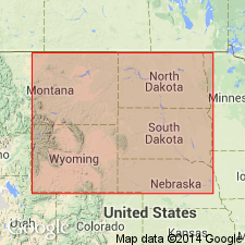
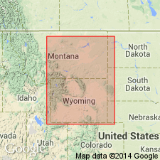
- Williston basin
Summary:
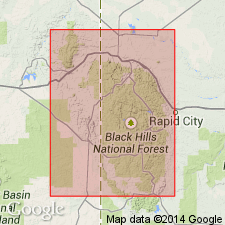
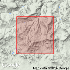
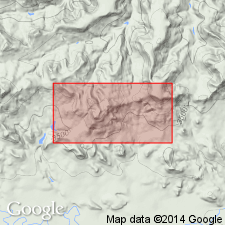
Named as a member of Sundance formation. Type section: bluff 1/2 mi north of Redwater Creek, near mouth of Crow Creek, 9 mi northwest of Spearfish, in S1/2 sec 2, T7N, R1E, Butte Co, SD in Williston basin. Consists of 80 to 190 ft or more of greenish-gray to gray, soft, fissile shale that includes some soft, glauconitic sandstone in lower 20 to 30 ft and some thin beds of coquinoid or oolitic limestone in upper half. At type section, lower 18 ft consists of alternating beds of gray shale and soft, yellow sandstone; upper 118 ft consists mainly of soft, dark-gray shale but contains lenses of sandy limestone at several levels and many limestone concretions in upper half. Overlies Lak member (new); underlies Morrison formation, contact gradational through an interval of 10 to 15 ft. Is of Late Jurassic (Oxfordian and Callovian) age.
Source: GNU records (USGS DDS-6; Denver GNULEX).
- Usage in publication:
-
- Redwater shale member
- Modifications:
-
- Biostratigraphic dating
- AAPG geologic province:
-
- Williston basin
Summary:
56 species of FORAMINIFERA belonging to eight families are described and figured. Collected from type section of Redwater shale member in S1/2 sec 2, T7N, R1E, Butte Co, SD in the Williston basin. Late Jurassic (Oxfordian) in age.
Source: GNU records (USGS DDS-6; Denver GNULEX).
- Usage in publication:
-
- Redwater shale member
- Modifications:
-
- Biostratigraphic dating
- AAPG geologic province:
-
- Williston basin
Summary:
Nine species of OSTRACODA, all of them apparently marine, are described from Redwater shale member of Sundance formation, Upper Jurassic (Oxfordian) at its type locality, S1/2 sec 2, T7N, R1E, Butte Co, SD in Williston basin.
Source: GNU records (USGS DDS-6; Denver GNULEX).
- Usage in publication:
-
- Redwater shale member*
- Modifications:
-
- Biostratigraphic dating
- AAPG geologic province:
-
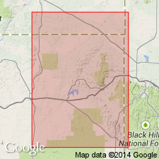
- Central Montana uplift
- Williston basin
- Powder River basin
- Chadron arch
- Bighorn basin
Summary:
Describes and shows distribution of ostracodes in Swift formation, Phillips, Fergus, and Carbon Cos, MT; Park Co, WY; and from the Redwater shale member of Sundance formation, Sheridan and Weston Cos, WY; and Fall River, Butte, and Lawrence Cos, SD. Is Late Jurassic in age.
Source: GNU records (USGS DDS-6; Denver GNULEX).
- Usage in publication:
-
- Redwater shale member
- Modifications:
-
- Revised
Summary:
Reallocated to member status in Swift formation herein assigned to Sundance group. Is of Late Jurassic (Oxfordian and Callovian) age.
Source: GNU records (USGS DDS-6; Denver GNULEX).
- Usage in publication:
-
- Redwater Shale Member*
- Modifications:
-
- Revised
- AAPG geologic province:
-
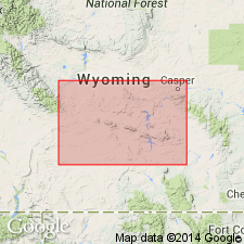
- Powder River basin
Summary:
Yellow-weathering sandstone 2-30 ft thick is considered the top bed of the member. [This bed was included in the Morrison Formation in the type section of the member along Red Water Creek and elsewhere in the Black Hills, Powder River basin, by Imlay (1947).] Is of Late Jurassic (Oxfordian and Callovian) age.
Source: GNU records (USGS DDS-6; Denver GNULEX).
- Usage in publication:
-
- Redwater Shale Member*
- Modifications:
-
- Overview
Summary:
The Pine Butte Member (new) of south central WY is equivalent to about the lower 30 ft of the Redwater Shale Member as defined by Imlay (1947) at Spearfish, Lawrence Co, SD, and the Windy Hill Sandstone Member (new) of south central WY correlates with a yellowish-gray sandstone bed at least 5 ft thick overlying the Redwater Shale Member as defined by Imlay (1947) near Spearfish, SD. Is of Late Jurassic age.
Source: GNU records (USGS DDS-6; Denver GNULEX).
- Usage in publication:
-
- Redwater Shale Member*
- Modifications:
-
- Areal extent
- AAPG geologic province:
-
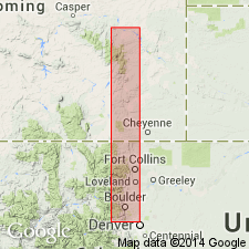
- Denver basin
- Powder River basin
Summary:
Is one of seven members of Middle and Upper Jurassic Sundance Formation. Redwater is divided into four units (ascending): lower siltstone, lower shale, upper siltstone, and upper shale units. The four units are truncated southward by erosion surface under Windy Hill Member of Sundance. All of Redwater is gone between Manning Ridge, southeast (measured section 4; NE/4 sec 4, T29N, R72W, Converse Co, WY, Powder River basin) and Chugwater Creek (measured section 6, S/2 SE/4 sec 26, T20N, R69W, Platte Co, WY, Denver basin). Members of Sundance include (ascending): Canyon Springs Sandstone, Stockade Beaver Shale, Hulett Sandstone, Lak, Pine Butte, Redwater Shale, and Windy Hill Sandstone Members. Measured sections shown graphically.
Source: GNU records (USGS DDS-6; Denver GNULEX).
- Usage in publication:
-
- Redwater Member*
- Modifications:
-
- Revised
- AAPG geologic province:
-
- Snake River basin
- Green River basin
- Yellowstone province
Summary:
Assigned as upper member of Stump Formation (redefined, revised); correlates with Redwater Member of Sundance Formation. Is much less extensive than underlying Curtis Member (revised) of Stump. Crops out in Snake River Range, ID, Snake River basin, southern Teton Range, WY (Yellowstone province), Hoback and Salt River Ranges, WY (Greater Green River basin). Areal extent map. Measured sections. Ranges irregularly from 15 m to 55 m thick. Divisible into a lower yellow gray-brown, glauconitic, chunky, fossiliferous siltstone or claystone and an upper gray to nearly white ledgy, cliff-forming, cross-bedded, glauconitic, calcareous sandstone, with some sandy oolitic, fossiliferous limestone. Fossils (pelecypods, belemnites) indicate a Late Jurassic or early to early middle Oxfordian age. Underlies Ephraim Conglomerate.
Source: GNU records (USGS DDS-6; Denver GNULEX).
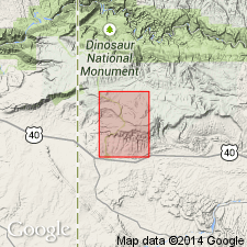
- Usage in publication:
-
- Redwater Member*
- Modifications:
-
- Mapped 1:24k (Moffat Co, CO)
- Dominant lithology:
-
- Shale
- Siltstone
- Limestone
- Sandstone
- AAPG geologic province:
-
- Green River basin
Summary:
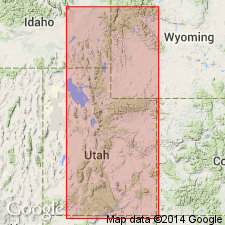
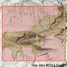
Is Upper Jurassic member of the Stump Formation (Middle and Upper Jurassic) mapped in southwest Moffat Co, CO (Greater Green River basin). Unconformably overlies Curtis Member (Middle Jurassic) of Stump Formation; unconformably underlies Morrison Formation (Upper Jurassic). Map unit described as soft olive-green and light-green mostly fissile glauconitic shale and siltstone as well as sparse interbeds of distinctive resistant tan, purplish-gray, and greenish-gray, thin-bedded (mostly less than 10 cm, or 4 in.), locally ripple-marked, vaguely cross-bedded sandy glauconitic oolitic limestone and fossiliferous sandstone. Some limestone beds contain a coquina of oysters, clams, and belemnites. Locally contains concretions and cone-in-cone structure. Correlation based on studies by Pipiringos (1969, 1972); Pipiringos, Hail, and Izett (1969); Pipiringos and O'Sullivan (1977); and Imlay (1979). Unit included in the upper part of the Curtis Formation as previously mapped in Dinosaur National Monument (Untermann and Untermann, 1954) and nearby areas (Hansen, 1955, 1965; Cullins, 1969; Kinney, 1955). Thickness about 34 m (110 ft) near well in NW1/4 sec. 7, T3N, R103W (G. N. Pipiringos, unpub. data) and somewhat thicker east of the quadrangle (Imlay, 1979).
Source: GNU records (USGS DDS-6; Denver GNULEX).

- Usage in publication:
-
- Redwater Shale Member*
- Modifications:
-
- Revised
- Overview
- AAPG geologic province:
-
- Powder River basin
- Chadron arch
Summary:
Is a member of Sundance Formation. Revised to exclude unconformably underlying Pine Butte Member in the Black Hills region in Crook and Weston Cos, WY (eastern Powder River basin), and in Fall River Co, SD (northwestern Chadron arch). Is Late Jurassic (Oxfordian) in age. Summarizes lithology, basis for dating, distribution, and correlation.
Source: GNU records (USGS DDS-6; Denver GNULEX).
- Usage in publication:
-
- Redwater Member*
- Modifications:
-
- Biostratigraphic dating
- AAPG geologic province:
-
- Uinta basin
- Green River basin
Summary:
Palynomorph evidence from samples of Redwater Member of Stump Formation at Bill White Spring in vicinity of Dinosaur National Monument, Uintah Co, UT (Uinta basin) indicate Redwater is no younger than Oxfordian (Late Jurassic) age. The J-5 regional unconformity occurs above Redwater and beneath Windy Hill Sandstone Member of Morrison Formation. List and range of fossils (fig. 3).
Source: GNU records (USGS DDS-6; Denver GNULEX).
For more information, please contact Nancy Stamm, Geologic Names Committee Secretary.
Asterisk (*) indicates published by U.S. Geological Survey authors.
"No current usage" (†) implies that a name has been abandoned or has fallen into disuse. Former usage and, if known, replacement name given in parentheses ( ).
Slash (/) indicates name conflicts with nomenclatural guidelines (CSN, 1933; ACSN, 1961, 1970; NACSN, 1983, 2005, 2021). May be explained within brackets ([ ]).