

- Usage in publication:
-
- Pajarito shale member*
- Modifications:
-
- First used
- Dominant lithology:
-
- Sandstone
- Shale
- AAPG geologic province:
-
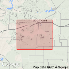
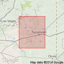
- Palo Duro basin
Summary:
First published use as a name for rocks of the upper member of the Purgatoire formation. No type locality designated. Source of name not stated. Consists of soft brown sandstone interbedded with gray shale that contains OSTREA QUADRIPLICATA, a fossil of Washita age. Overlies Mesa Rica sandstone member (first used) of Purgatoire. Underlies Graneros shale. Dakota sandstone not recognized in report area. Geologic map; cross sections. Assigned to the Early Cretaceous. Is well exposed in the southeastern and northwestern parts of the report area in the Palo Duro basin of eastern NM.
Source: GNU records (USGS DDS-6; Denver GNULEX).
- Usage in publication:
-
- Pajarito shale*
- Modifications:
-
- Revised
- AAPG geologic province:
-
- Palo Duro basin
- Sierra Grande uplift
Summary:
Raised in stratigraphic rank from Pajarito shale member, upper member of Purgatoire formation, to Pajarito shale. Term Purgatoire abandoned [should read "areally restricted"] from use in Guadalupe, Harding, San Miguel, and Quay Cos, northeast NM in the Palo Duro basin and on the Sierra Grande uplift. Overlies Mesa Rica sandstone (formerly a member of Purgatoire). Is 50-60 ft thick. Contains OSTREA QUADRIPLICATA Shumard, which is considered to be Washita, or Early Cretaceous age.
Source: GNU records (USGS DDS-6; Denver GNULEX).
- Usage in publication:
-
- Pajarito Shale
- Modifications:
-
- Areal extent
- Overview
- Dominant lithology:
-
- Shale
- Sandstone
- AAPG geologic province:
-
- Sierra Grande uplift
- Palo Duro basin
Summary:
Is Lower Cretaceous unit [unranked] that comprises the upper part of Purgatoire Formation as mapped with Dakota Sandstone, undivided, in southern Harding and adjacent southeastern Union Cos, NM (Sierra Grande uplift) and in eastern San Miguel and northwest Quay Cos, NM (Palo Duro basin). Dakota and Purgatoire, undivided, not mapped as far east as TX Panhandle. Pajarito described as shale--gray to green, locally sandstone at top, thickness 50 to 60 ft.
Source: GNU records (USGS DDS-6; Denver GNULEX).
- Usage in publication:
-
- Pajarito Formation
- Modifications:
-
- Areal extent
- Revised
- AAPG geologic province:
-
- Sierra Grande uplift
- Palo Duro basin
Summary:
Name extended north into the Dry Cimarron valley of Union Co, NM on the Sierra Grande uplift east into Cimarron Co, OK in the Palo Duro basin where it is newly assigned to the Dakota Group as its middle formation. Was included as a member of the Purgatoire Formation in some earlier reports; name Purgatoire abandoned in this report. Overlies Mesa Rica Sandstone and underlies Romeroville Sandstone (first used), both formations of the Dakota Group. Consists of as much as 20 m of interbedded sandstone, siltstone, and shale that are poorly exposed in the valley. Measured sections. Correlation chart. Deposited in a delta plain environment. Has fossil dinosaur footprints, marine mollusks. Contains late Albian species.
Source: GNU records (USGS DDS-6; Denver GNULEX).
For more information, please contact Nancy Stamm, Geologic Names Committee Secretary.
Asterisk (*) indicates published by U.S. Geological Survey authors.
"No current usage" (†) implies that a name has been abandoned or has fallen into disuse. Former usage and, if known, replacement name given in parentheses ( ).
Slash (/) indicates name conflicts with nomenclatural guidelines (CSN, 1933; ACSN, 1961, 1970; NACSN, 1983, 2005, 2021). May be explained within brackets ([ ]).