

- Usage in publication:
-
- McColley Canyon member*
- Modifications:
-
- Named
- Biostratigraphic dating
- Dominant lithology:
-
- Limestone
- Dolomite
- AAPG geologic province:
-
- Great Basin province
Summary:
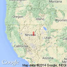
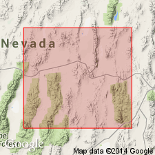
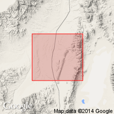
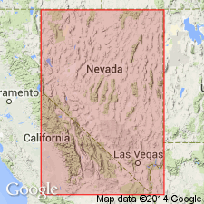
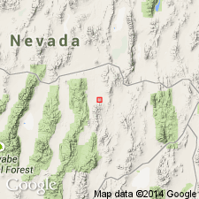
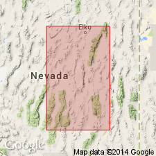
Named for exposures along McColley Canyon in north Mineral Hill 15' quad [Sulphur Springs Range, Eureka Co, NV]. Type section in McColley Canyon [40 deg 11' 51"N, 116 deg 02' 25"W]. Exposed along Sulphur Springs Range and in south part of Pinyon Range. Is lowest member of Nevada limestone in exposed area. Lower 4/5's consists of well-bedded gray limestone, calcareous dolomite and local quartzose facies at base. Upper beds are thin-bedded and platy yellow-weathering argillaceous limestone and calcareous dolomite. Thickness 420 ft at type; thickens to 625 ft south of Bald Mountain; thins northward. Underlies Union Mountain member (new). Conformably overlies Lone Mountain dolomite. Is abundantly fossiliferous. Contains SPIRIFER PINYONENSIS and TREMATOSPIRA fauna. Age is regarded as Early and Middle Devonian.
Source: GNU records (USGS DDS-6; Menlo GNULEX).
- Usage in publication:
-
- McColley Canyon Formation*
- Modifications:
-
- Revised
- Biostratigraphic dating
- AAPG geologic province:
-
- Great Basin province
Summary:
McColley Canyon Member of Nevada Formation of Carlisle and others (1957) is elevated to formation rank. Is well developed lithologically and faunally in Roberts Mountains and north Simpson Park Range. Is about 600 ft thick in Simpson Range, about 300 ft in Roberts Mountains, and 100 ft in Sulphur Springs Range. Unconformably underlies Union Mountain Sandstone Member (Carlisle and others, 1957). Contains "SPIRIFER" PINYONENSIS. Age is regarded as Early Devonian on basis of fossils. [In this paper author failed to change status of Nevada Formation and other members.]
Source: GNU records (USGS DDS-6; Menlo GNULEX).
- Usage in publication:
-
- McColley Canyon Formation*
- Modifications:
-
- Revised
- AAPG geologic province:
-
- Great Basin province
Summary:
Divided into 3 (ascending) members: Kobeh, Bartine, and Coils Creek Members (all new). The two lower members have been mapped in Sulphur Springs Range, Roberts Mountains, Lone Mountain and Table Mountain. Coils Creek Member (new) has been mapped in latter 3 ranges, but its stratigraphic position is occupied by lower Union Mountain Formation in Sulphur Springs Range. At Lone Mountain and Table Mountain three members appear conformable with one another.
Source: GNU records (USGS DDS-6; Menlo GNULEX).

- Usage in publication:
-
- McColley Canyon Formation*
- Modifications:
-
- Age modified
- AAPG geologic province:
-
- Great Basin province
Summary:
McColley Canyon Member of Carlisle and others (1957) herein adopted as raised in rank to McColley Canyon Formation by Johnson (1962) and as divided into 3 members by Murphy and Gronberg (1970), (ascending) Kobeh, Bartine, and Coils Creek Members. Kobeh Member considered Pragian (Siegenian) age; Bartine Member considered Zlichovian (Emsian) age; Coils Creek Member is youngest well-dated Early Devonian age.
Source: GNU records (USGS DDS-6; Menlo GNULEX).
- Usage in publication:
-
- McColley Canyon Formation*
- Modifications:
-
- Areal extent
- AAPG geologic province:
-
- Great Basin province
Summary:
Coils Creek and Bartine Members are recognized in north Simpson Park Range. Underlies Denay Limestone and overlies Rabbit Hill Limestone. Age is Dalejan and Zlichovian (Early Devonian).
Source: GNU records (USGS DDS-6; Menlo GNULEX).
- Usage in publication:
-
- McColley Canyon Formation*
- Modifications:
-
- Areal extent
- AAPG geologic province:
-
- Great Basin province
Summary:
Recognized in north Antelope Range. Consists of nearly all limestone except for lower 10 m which is light-brownish-gray, fine-grained, organic detrital and fossiliferous dolomite. Upper 19 m is encrinite or crinoidal packstone. Total thickness about 200 m forming slopes that are broken by thin ledges. Includes measured section. Disconformably overlies Beacon Peak Dolomite. Conformably underlies Denay Limestone. Age is Early Devonian based on conodonts.
Source: GNU records (USGS DDS-6; Menlo GNULEX).
- Usage in publication:
-
- McColley Canyon Formation*
- AAPG geologic province:
-
- Great Basin province
Summary:
At Lone Mountain, Coils Creek Member of McColley Canyon Formation (Murphy and Gronberg, 1970) conformably underlies Sadler Ranch Formation (new). In Sulphur Spring Range upper tongue of Bartine Member of McColley Canyon Formation "abruptly" underlies Sadler Ranch Formation (new).
Source: GNU records (USGS DDS-6; Menlo GNULEX).
For more information, please contact Nancy Stamm, Geologic Names Committee Secretary.
Asterisk (*) indicates published by U.S. Geological Survey authors.
"No current usage" (†) implies that a name has been abandoned or has fallen into disuse. Former usage and, if known, replacement name given in parentheses ( ).
Slash (/) indicates name conflicts with nomenclatural guidelines (CSN, 1933; ACSN, 1961, 1970; NACSN, 1983, 2005, 2021). May be explained within brackets ([ ]).