

- Usage in publication:
-
- Malad basalt*
- Modifications:
-
- Original reference
- Dominant lithology:
-
- Basalt
- AAPG geologic province:
-
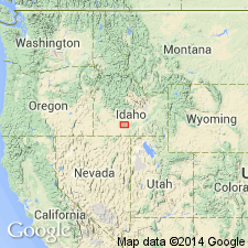
- Snake River basin
Summary:
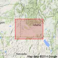
Pg. 434-439; H.T. Stearns, 1932 (Corr. chart of Idaho compiled by M.G. Wilmarth, dated Sept. 1, 1932). Malad basalt. Black feldspar pahoehoe basalt filling a deep ancient canyon of Snake River north of present canyon. In places well covered with loess. Thickness 400+ feet. Older than Thousand Springs basalt and younger than Madson basalt. Exposed in Malad Canyon, Gooding County, southern Idaho. Near Malad power plant it forms cliff 400+ feet high.
Source: US geologic names lexicon (USGS Bull. 896, p. 1271).
- Usage in publication:
-
- Malad basalt*
- Modifications:
-
- Principal reference
- AAPG geologic province:
-
- Snake River basin
Summary:
Pg. 30, 74-75, pls. 4, 5. Malad basalt. Thickness about 400 feet. In some areas, rests on Hagerman lake beds. Wedges out between Madson and McKinney basalts. Older than Thousand Springs lava. Age is Pleistocene.
Named from the thick exposures in Malad Canyon, the deep gorge at mouth of Big Wood River. Near the Malad power plant this basalt forms a cliff of about 400 feet high.
[GNC remark (ca. 1960, US geologic names lexicon, USGS Bull. 1200, p. 2335): The USGS currently classifies the Malad as a member of Thousand Springs basalt on basis of study now in progress.]
Source: Publication; US geologic names lexicon (USGS Bull. 1200, p. 2335).
- Usage in publication:
-
- Malad Member*
- Modifications:
-
- Revised
- AAPG geologic province:
-
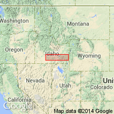
- Snake River basin
Summary:
Pg. 1214. Malad Member of Thousand Springs Basalt of Snake River Group (new). Recognized on eastern rim of Snake River Canyon from vicinity of Hagerman northward to Malad Canyon, Gooding County, southern Idaho. Overlies Madson Basalt in Malad Canyon and there consists of two flows of porphyritic plagioclase-olivine basalt capped with a flow rich in olivine. These flows extend southward from Malad Canyon along canyon rim of Snake River to a place 5 miles southeast of Hagerman. Age is Pleistocene.
Malad and Thousand Springs combined into a single formation because they cannot be separately distinguished in upland plains of Hagerman, into which they extend many miles, although they are easily differentiated in the good exposures near Hagerman.
Source: Publication.
- Usage in publication:
-
- Malad Basalt*
- Modifications:
-
- Revised
- AAPG geologic province:
-
- Snake River basin
Summary:
Malad Basalt of Snake River Group. Removed from Thousand Springs Basalt as its basal member and reinstated as a formation in Snake River Group. Mapping in the Snake River basin showed that Malad and Thousand Springs Basalts were erupted from widely separated (20 miles) source vents and flowed into two separate ancestral canyons of the Snake River south and east of Hagerman. Following eruption of Malad and prior to eruption of Thousand Springs, the Snake River excavated a new canyon to minimum depth of 150 feet south of Hagerman. Units can be distinguished both in the canyon wall and on the upland plain east of Hagerman. Age is considered Pleistocene.
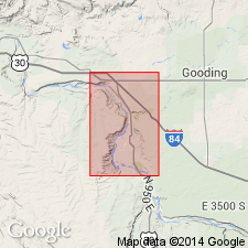
[Type section considered to be control point 187-4, in SE/4 NW/4 NW/4 sec. 35, T. 6 S., R. 13 E., approx. Lat. 42 deg. 51 min. 45 sec. N., Long., 114 deg. 53 min. 12 sec. W., Hagerman 7.5-min quadrangle, Gooding Co., southern ID (Inferred from from H.R. Covington, USGS, pers. commun., 1984; this report; USGS historical topographic map collection TopoView, USGS GNIS database, ACME Mapper 2.0, accessed April 17, 2012).]
Source: Publication; GNU records (USGS DDS-6; Denver GNULEX).
For more information, please contact Nancy Stamm, Geologic Names Committee Secretary.
Asterisk (*) indicates published by U.S. Geological Survey authors.
"No current usage" (†) implies that a name has been abandoned or has fallen into disuse. Former usage and, if known, replacement name given in parentheses ( ).
Slash (/) indicates name conflicts with nomenclatural guidelines (CSN, 1933; ACSN, 1961, 1970; NACSN, 1983, 2005, 2021). May be explained within brackets ([ ]).