

- Usage in publication:
-
- Haycock Mountain Tuff
- Modifications:
-
- Named
- Dominant lithology:
-
- Tuff
- AAPG geologic province:
-
- Paradox basin
Summary:
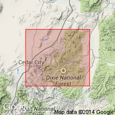
Named for Haycock Mountain located just south of type section in western Garfield Co, UT. Type section is designated in NW/4 sec 35, T35S, R7W, which is north of Panguitch Creek at the 36-mile post of Utah Highway 143 about 1.5 mi east of Panguitch Lake (Haycock Mountain quad). Occurs as widespread but isolated exposures within Fivemile Ridge and northern Haycock Mountain quads where unit caps eastern end of Haycock Mountain, Paradox basin. Consists of felsic ash-flow tuffs. Type section is measured and described; here unit is 45 ft thick. Unconformably overlies "Markagunt megabreccia" (a structurally chaotic assemblage of large masses of various stratigraphic units resulting from gravity sliding); underlies younger gravels. A K-Ar date on plagioclase indicates an age of 22.3 +-1.1 Ma (early Miocene).
Source: GNU records (USGS DDS-6; Denver GNULEX).

- Usage in publication:
-
- Haycock Mountain Tuff*
- Modifications:
-
- Named
- Dominant lithology:
-
- Tuff
- AAPG geologic province:
-
- Great Basin province
Summary:
Named for Haycock Mountain rising just south of type section. Type section is south-facing scarp where unit caps small hill north of Panguitch Creek at the 36-mile post of Utah Hwy 143 about 11/2 mi (2.4 km) east of Panguitch Lake (NW1/4 sec 35, T35S, R7W), Haycock Mountain quad, northern Markagunt Plateau, Iron Co, southwesternmost High Plateaus of southwestern UT. Consists of basal 2 in. (5 cm) of very light gray to white, finely laminated, partially reworked felsic airfall tuff overlain by two cooling units of unwelded to poorly welded ash-flow tuff. Ascending, first cooling unit is light grayish-white, which weathers light pinkish-tannish white; is punky, porous, and friable; 10 ft (3.05 m) thick. Top cooling unit is light gray, weathers orangish-tan and is dense, well indurated, vuggy on weathered surface, and prominently vertically jointed; 35 ft (10.7 m) thick. Total thickness is about 45 ft (14 m). The Haycock Mountain Tuff unconformably overlies early Miocene Markagunt megabreccia (first used) and underlies a blanket of fluvially deposited late Tertiary (probably latest Miocene to Pliocene) gravels. Age is early Miocene (22.3+/-1.1 Ma), based on a K-Ar plagioclase determination (Mehnert and others, in press) constraining upper age of gravity slides that caused the chaotic jumble called Markagunt megabreccia.
Source: GNU records (USGS DDS-6; Denver GNULEX).
For more information, please contact Nancy Stamm, Geologic Names Committee Secretary.
Asterisk (*) indicates published by U.S. Geological Survey authors.
"No current usage" (†) implies that a name has been abandoned or has fallen into disuse. Former usage and, if known, replacement name given in parentheses ( ).
Slash (/) indicates name conflicts with nomenclatural guidelines (CSN, 1933; ACSN, 1961, 1970; NACSN, 1983, 2005, 2021). May be explained within brackets ([ ]).