

- Usage in publication:
-
- Falls River Basalt*
- Modifications:
-
- Named
- Dominant lithology:
-
- Basalt
- AAPG geologic province:
-
- Yellowstone province
Summary:
Pg. B4 (fig. 2), B6 (table 1), B15-B16. Falls River Basalt. Includes basalts younger than Lava Creek Tuff (new) of Yellowstone Group (rank raised) and older than Central Plateau Member (new) of Plateau Rhyolite (new). Very similar in lithology to Swan Lake Flat Basalt (new), commonly containing sparse phenocrysts of plagioclase about 0.5 to 1 cm across. Basalts generally are moderate gray and form dense thin flows with vesicular tops. Source of some flows was probably Rising Butte, a low shield [volcano] just west of southwest corner of park. Thickness not stated. At type, overlies Lava Creek Tuff and underlies upper Pleistocene glacial deposits. About 8 or 9 km to the north, in drainage area of Bechler River, underlies Central Plateau Member of Plateau Rhyolite. Age is Pleistocene. Age bracketed by 600,000-year Lava Creek Tuff and 100,000-year Plateau Rhyolite. Is part of the third volcanic cycle of the Quaternary Yellowstone plateau. Report includes stratigraphic table, cross section.
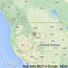
Type locality: west rim of valley of Falls River, just below Cave Falls, in southwest corner of Yellowstone National Park, Park Co., northwestern WY (Yellowstone province). Named from Falls River.
Source: Publication; US geologic names lexicon (USGS Bull. 1520, p. 100); GNU records (USGS DDS-6; Denver GNULEX).
For more information, please contact Nancy Stamm, Geologic Names Committee Secretary.
Asterisk (*) indicates published by U.S. Geological Survey authors.
"No current usage" (†) implies that a name has been abandoned or has fallen into disuse. Former usage and, if known, replacement name given in parentheses ( ).
Slash (/) indicates name conflicts with nomenclatural guidelines (CSN, 1933; ACSN, 1961, 1970; NACSN, 1983, 2005, 2021). May be explained within brackets ([ ]).