

- Usage in publication:
-
- Moenave formation*
- Modifications:
-
- Principal reference
- Dominant lithology:
-
- Sandstone
- AAPG geologic province:
-
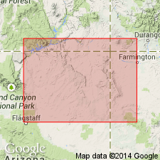
- Black Mesa basin
Summary:
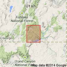
Pg. 12-18, 62, 63. Moenave formation of Glen Canyon group. At type locality, herein designated, is almost entirely sandstone and includes both Dinosaur Canyon and Springdale members. Thickness 20 to 385 feet. Basal Dinosaur Canyon intertongues with upper part of Lukachukai member of Wingate sandstone; Springdale member is gradational with overlying Kayenta. Age is Late Triassic(?).
Type locality: near Moenave, 6 mi west of Tuba City, Coconino Co., northeastern AZ.
Source: Publication; US geologic names lexicon (USGS Bull. 1200, p. 2542).
- Usage in publication:
-
- Moenave Formation*
- Modifications:
-
- Areal extent
- AAPG geologic province:
-
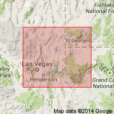
- Great Basin province
Summary:
The part of the stratigraphic section in the Great Basin province of southwest UT and southern NV formerly considered to be part of the Chinle Formation is correlated with and reassigned to the Moenave and Kayenta Formations of the Glen Canyon Group. The Chinle-Glen Canyon contact is an erosion surface that marks a hiatus in southern NV and southwestern UT that is occupied to the east by the Owl Rock and Church Rock Members of the Chinle. Of Triassic? age.
Source: GNU records (USGS DDS-6; Denver GNULEX).
- Usage in publication:
-
- Moenave Formation
- Modifications:
-
- Revised
- AAPG geologic province:
-
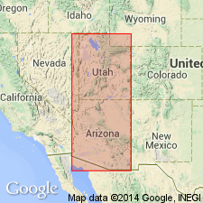
- Great Basin province
- Plateau sedimentary province
Summary:
Revised in that Whitmore Point Member named as its middle member. Within study area of southwest UT and northwest AZ [Great Basin and Plateau sedimentary provinces], Moenave, a formation within Glen Canyon Group, consists of (ascending) Dinosaur Canyon, Whitmore Point, and Springdale Sandstone Members. Whitmore Point is present west of a point about 10 mi east of Kanab, Kane Co, UT. Moenave conformably overlies strata provisionally assigned to Wingate Sandstone of Glen Canyon Group in areas of Lees Ferry and Paria; elsewhere unconformably overlies Chinle Formation. Conformably underlies Kayenta Formation. Cross section; measured section at type Whitmore Point. Late Triassic? age.
Source: GNU records (USGS DDS-6; Denver GNULEX).
- Usage in publication:
-
- Moenave Formation*
- Modifications:
-
- Overview
- AAPG geologic province:
-
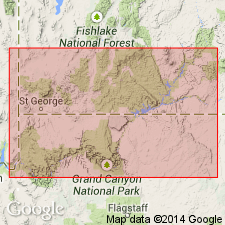
- Great Basin province
- Plateau sedimentary province
- Black Mesa basin
Summary:
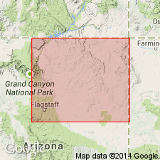
Is lower formation of Glen Canyon Group in southwest UT and northern AZ, Great Basin and Plateau sedimentary provinces, and Black Mesa basin (cross section). Intertongues with Kayenta Formation and Wingate Sandstone, both of Glen Canyon Group. Tentatively assigned to Sinemurian and Pleinsbachian, or Early Jurassic on basis of identification of Early Jurassic palynomorphs from Whitmore Point Member, middle member of Moenave. Divided into a lower member, Dinosaur Canyon Sandstone Member, and an upper member, Springdale Sandstone Member. [Age retained as Late Triassic? by USGS]. Correlation chart.
Source: GNU records (USGS DDS-6; Denver GNULEX).
- Usage in publication:
-
- Moenave Formation*
- Modifications:
-
- Areal extent
- AAPG geologic province:
-
- Plateau sedimentary province
- Paradox basin
Summary:
Includes Dinosaur Canyon (base) and Springdale (top) Sandstone Members. Is thickest (60 ft) near Paria, southwest part of quad, Kane Co, Plateau sedimentary province. Thins to northeast. Is not present at Circle Cliffs, Garfield Co, Paradox basin. Of Late Triassic age.
Source: GNU records (USGS DDS-6; Denver GNULEX).
- Usage in publication:
-
- Moenave Formation
- Modifications:
-
- Age modified
- AAPG geologic province:
-
- Plateau sedimentary province
Summary:
Horn-like scutes have been found in the Kayenta Formation at several localities in the Rock Head quad, Coconino Co, AZ in the Plateau sedimentary province, that match an obscure ornithisician dinosaur of the Early Jurassic of southwest England. These scutes [pictured] belonged to SCELIDOSAURUS. Possible late Hettangian or Sinemurian age suggested for lower part of the Kayenta. Along with palynomorphs in the Moenave Formation and magnetostratigraphic studies, the Early Jurassic age established for several parts of the group is assigned to the entire Glen Canyon Group. Formations of the Glen Canyon are thought to be--Wingate, Hettangian; Moenave, Hettangian and Sinemurian; Kayenta, Sinemurian and Pliensbachian; Navajo, Pliensbachian or Toarcian--all stages of the Early Jurassic. [Members of formations in Glen Canyon Group not discussed.]
Source: GNU records (USGS DDS-6; Denver GNULEX).

- Usage in publication:
-
- Moenave Formation*
- Modifications:
-
- Areal extent
- AAPG geologic province:
-
- Great Basin province
Summary:
Mapped in east-central Lincoln Co., NV in the Great Basin province where it overlies Petrified Forest Member of Chinle Formation unconformably and underlies a Tertiary sedimentary rock and tuff unit unconformably. Divided into two mapped parts --the Dinosaur Canyon Member at the base and the Whitmore Point and Springdale Sandstone Members at the top. Of Early Jurassic age.
Source: GNU records (USGS DDS-6; Denver GNULEX).
For more information, please contact Nancy Stamm, Geologic Names Committee Secretary.
Asterisk (*) indicates published by U.S. Geological Survey authors.
"No current usage" (†) implies that a name has been abandoned or has fallen into disuse. Former usage and, if known, replacement name given in parentheses ( ).
Slash (/) indicates name conflicts with nomenclatural guidelines (CSN, 1933; ACSN, 1961, 1970; NACSN, 1983, 2005, 2021). May be explained within brackets ([ ]).