

- Usage in publication:
-
- Wise formation*
- Modifications:
-
- Named
- Dominant lithology:
-
- Shale
- Sandstone
- Clay
- Coal
- AAPG geologic province:
-
- Appalachian basin
Summary:
Wise formation, named in this report, consists of shales and sandstones with clays and coal beds. 1,270 ft thick in upper part of Coal Measures of Bigstone Gap coal field of VA and KY. Overlies Gladeville sandstone and underlies Harlan sandstone. Assigned to upper part of Pottsville group. Age is Pennsylvanian.
Source: GNU records (USGS DDS-6; Reston GNULEX).
- Usage in publication:
-
- Wise Formation*
- Modifications:
-
- Revised
- Adopted
- AAPG geologic province:
-
- Appalachian basin
Summary:
Wise Formation. Four resistant sandstones within the Wise have been named and adopted as members of the Wise. They are (ascending): Robbins Chapel, Keokee, Clover Fork, and Marcum Hollow Sandstone Members. In addition to these named members, the Wise contains numerous other less persistent, unnamed units. Present in southwestern Virginia and southeastern Kentucky. [Age is Middle Pennsylvanian].
Source: Changes in stratigraphic nomenclature, 1967 (USGS Bull. 1324-A, p. A15).
- Usage in publication:
-
- Wise Formation*
- Modifications:
-
- Revised
- AAPG geologic province:
-
- Appalachian basin
Summary:
Rockhouse Valley Sandstone Member named as member of Wise Formation. Overlies Marcum Hollow Sandstone Member and underlies Jesse Sandstone Member of Catron Formation.
Source: GNU records (USGS DDS-6; Reston GNULEX).
- Usage in publication:
-
- Wise Formation*
- Modifications:
-
- Age modified
- AAPG geologic province:
-
- Appalachian basin
Summary:
Age of Wise Formation modified from Pennsylvanian to Middle Pennsylvanian.
Source: GNU records (USGS DDS-6; Reston GNULEX).

- Usage in publication:
-
- Wise Formation*
- Modifications:
-
- Geochronologic dating
- AAPG geologic province:
-
- Appalachian basin
Summary:
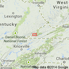
Pg. 29, geologic time scale (inside front cover). Wise Formation. Two samples from 20 cm-thick bentonite bed in upper part of formation, in Critical Fork coal mine, at [approx.] Lat. 37 deg. 02 min. N., Long. 82 deg. 41 min. W., Flat Gap quadrangle, Wise County, Virginia, yielded Pb-alpha ages of 500 +/-55 Ma and 440 +/-50 Ma (zircon); both too old, detrital zircons may be present. Age calculated using decay constants of Steiger and Jager, 1977 (Earth Planet. Sci. Letters, v. 36, p. 359-362).
Source: Publication.
- Usage in publication:
-
- Wise Formation
- Modifications:
-
- Revised
- AAPG geologic province:
-
- Appalachian basin
Summary:
Wise Formation in Lee Co., VA, includes (ascending) Cannelton Shale Member (White, 1885), Clover Fork Sandstone Member (Miller, 1969), Marcum Hollow Sandstone Member (Miller, 1969), Kendrick Shale Member (Jillson, 1919), and Magoffin Member (Morse, 1931). Also includes many named coal beds. Overlies Gladeville Sandstone.
Source: GNU records (USGS DDS-6; Reston GNULEX).
- Usage in publication:
-
- Wise Formation*
- Modifications:
-
- Revised
- AAPG geologic province:
-
- Appalachian basin
Summary:
Betsie Shale Member assigned to Wise Formation in VA.
Source: GNU records (USGS DDS-6; Reston GNULEX).

- Usage in publication:
-
- Wise Formation
- Modifications:
-
- Overview
- Areal extent
- AAPG geologic province:
-
- Appalachian basin
Summary:
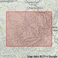
Wise Formation crops out in and underlies most of central and western Wise Co. and a wide strip in northwestern Lee Co. Is present only on hill tops in eastern Dickenson Co. and upper elevations of northwestern Buchanan Co. Ranges up to 2268 ft in thickness where it underlies Harlan Formation. Wise is absent in Russell, Scott, and Tazewell Cos. Unit is dominated by siltstone and sandstone and local development of thick sandstone units is common. Several shale beds are significant. These overlie the Clintwood coal bed, the Kelly coal bed, the Marcum Hollow Sandstone, the Low Splint coal bed, the Gin Creek Coal bed, and the Pardee coal bed. The lower, Morrowan part of the Wise is divided into three informal units. Unit 1 consists of strata between the base of the Dorchester coal bed and the base of the Cannelton Shale Member. Coal beds include the Dorchester, Lyons, Blair, Clintwood, and Addington. Unit 2 includes the Cannelton Shale Member, the Imboden Marker, the Imboden, Kelly, Upper St. Charles, and Wilson coal beds, the Clover Fork Sandstone Member, the Taggart Marker-Lower Cedar Grove, and Taggart-Cedar Grove coal bed, the Marcum Hollow Sandstone Member, the 34", Low Splint-Williamson and Low Splint "A" coal beds. Unit 3 contains only the Kendrick Shale Member and the House coal bed. The upper, Atokan portion of the Wise consists of strata between the base of the Phillips coal bed and the top of the High Splint coal bed. Other coal beds include the Gin Creek (No. 8), the Wax, the Pardee, and the Morris. Formal members include the Magoffin and the Reynolds Sandstone Members. Age of the Wise is Middle Pennsylvanian (Morrowan and Atokan). [Ages in this report follow the time scale of Harland and others (1990) who placed the Mississippian-Pennsylvanian boundary at 323 Ma. The Morrowan-Atokan boundary is placed at the base of the Phillips coal bed, at 311 Ma. The Morrowan includes the Early Pennsylvanian and the lower Middle Pennsylvanian.]
Source: GNU records (USGS DDS-6; Reston GNULEX).

- Usage in publication:
-
- Wise Formation*
- Modifications:
-
- Overview
- AAPG geologic province:
-
- Appalachian basin
Summary:
Wise Formation is used in VA for strata between Gladeville Sandstone and Harlan Sandstone; includes beds from Dorchester coal to High Split coal (near top of formation). Includes Betsie Shale Member, Kendrick Shale Member, Reynolds Sandstone Member, and Magoffin Member.
Source: GNU records (USGS DDS-6; Reston GNULEX).
For more information, please contact Nancy Stamm, Geologic Names Committee Secretary.
Asterisk (*) indicates published by U.S. Geological Survey authors.
"No current usage" (†) implies that a name has been abandoned or has fallen into disuse. Former usage and, if known, replacement name given in parentheses ( ).
Slash (/) indicates name conflicts with nomenclatural guidelines (CSN, 1933; ACSN, 1961, 1970; NACSN, 1983, 2005, 2021). May be explained within brackets ([ ]).