The National Geologic Map Database is migrating to a new infrastructure. We apologize for any service disruptions during this process.
|
|---|


- Usage in publication:
-
- Windy Pass Argillite Member*
- Modifications:
-
- Named
- Dominant lithology:
-
- Mudstone
- Claystone
- Siltstone
- AAPG geologic province:
-
- Snake River basin
Summary:
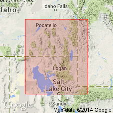
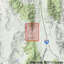
Named for exposures at and near Windy Pass in southwestern part sec. 12, T. 10 S., R. 38 E., Bannock Co, ID on Snake River basin. Type area is a belt of gentle slopes west of crest of Portneuf Range, from a point west of Twin Knobs in central part, sec. 12, T. 10 S., R. 38 E. south-southeastward to a point south of Sedgwick Peak, near middle of sec. 32, T. 10 S., R. 39 E. Type section in middle of sec. 12, T. 10 S., R. 38 E., on a spur extending southwest from Twin Knobs. Consists dominantly of metamorphosed thinly bedded to thinly laminated mudstone, claystone, and siltstone interbedded with quartzite in lenses and beds up to 30 ft thick. Is 762 ft thick where measured west of Twin Knobs. Lower contact placed at top of uppermost thick quartzite beds of Kasiska Quartzite Member (new) and at base of dominantly argillaceous sequence with quartzite units only a few ft thick of the Windy Pass. Upper contact is gradational with Sedgwick Peak Quartzite Member (new), a return to quartzite as the dominant lithology. Contains no diagnostic fossils. Assigned a Precambrian(?) age. Geologic map.
Source: GNU records (USGS DDS-6; Denver GNULEX).
- Usage in publication:
-
- Windy Pass Argillite Member*
- Modifications:
-
- Age modified
- AAPG geologic province:
-
- Snake River basin
- Northern Rocky Mountain region
Summary:
Windy Pass Argillite Member of Brigham Quartzite initially assigned a Precambrian(?) age, but it has since been observed to contain tracks and worm tubes of probable Early Cambrian age. [Not clear if author considers unit Precambrian(?) and Early Cambrian(?) age or only Early Cambrian(?) age.] Report area lies in the Snake River basin [Precambrian Northern Rocky Mountain region]; name Windy Pass used in correlation with part of Gibson Jack Formation. Windy Pass not mapped.
Source: Modified from GNU records (USGS DDS-6; Denver GNULEX).
- Usage in publication:
-
- Windy Pass Argillite
- Modifications:
-
- Revised
- AAPG geologic province:
-
- Snake River basin
- Wasatch uplift
Summary:
Raised to formation rank and assigned to Brigham Group (raised rank) as one of 7 formations in the southern Portneuf and Bear River Ranges, Bannock Co on the Snake River basin, and Bear Lake Co on the Wasatch uplift. Overlies Camelback Mountain Quartzite and underlies Sedgwick Peak Quartzite, both formations of the Brigham. Basal contact placed at base of "first thick argillite." Upper contact placed at base of "first quartzite." Is thickest (761 ft) at its type. Is 330 ft thick in southern Bear River Range. Is the offshore mud deposit assigned to depositional sequence 4. Cambrian age. Cross section.
Source: GNU records (USGS DDS-6; Denver GNULEX).
For more information, please contact Nancy Stamm, Geologic Names Committee Secretary.
Asterisk (*) indicates published by U.S. Geological Survey authors.
"No current usage" (†) implies that a name has been abandoned or has fallen into disuse. Former usage and, if known, replacement name given in parentheses ( ).
Slash (/) indicates name conflicts with nomenclatural guidelines (CSN, 1933; ACSN, 1961, 1970; NACSN, 1983, 2005, 2021). May be explained within brackets ([ ]).