

- Usage in publication:
-
- Basal or Wills Point clays
- Modifications:
-
- Original reference
- Dominant lithology:
-
- Clay
- AAPG geologic province:
-
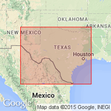
- East Texas basin
- Gulf Coast basin
Summary:
Pg. xiii, 17, 19. Basal or Wills Point clays. Great beds of stiff stratified clays of various colors interbedded with sand and containing some limestone concretions. Thickness 250 to 300 feet. Underlie Timber Belt or Sabine River beds and unconformably overlie Upper Cretaceous "Ponderosa marls." Basal Tertiary (lowermost Eocene), based on stratigraphic position.
Named from Wills Point, Van Zandt Co., eastern TX coastal plain, where well developed.
Source: US geologic names lexicon (USGS Bull. 896, p. 2345); supplemental information from GNU records (USGS DDS-6; Denver GNULEX).

- Usage in publication:
-
- Wills Point clays and sand
- Wills Point formation*
- Modifications:
-
- Overview
- AAPG geologic province:
-
- East Texas basin
- Gulf Coast basin
Summary:
In 1896 G.D. Harris (Bulls. Amer. Paleo., v. 1, no. 4, p. 155) applied Wills Point clays and sand to upper part only of Wills Point clay of Penrose. The Penrose definition, however, was generally adopted, and between 1900 and 1907 Wills Point clay was name applied to basal Eocene deposits of Texas Coastal Plain, which are now generally agreed are same as the Midway of eastern part of Gulf Coastal Plain, and are called by latter name.
H.J. Plummer, 1933, Univ. Texas Bull., no. 3201 (issued Feb. 1933 according to footnote on p. 51), p. 54, footnote. In forthcoming Univ. Texas Bull., no. 3232 the "upper Midway" will be called Wills Point formation of Midway group, and a new name will be applied to "basal Midway."
Source: US geologic names lexicon (USGS Bull. 896, p. 2345).

- Usage in publication:
-
- Wills Point formation*
- Modifications:
-
- Revised
- AAPG geologic province:
-
- Gulf Coast basin
Summary:
Pg. 555. Wills Point formation of Midway group. In 1927 the work of Mrs. [H.J.] Plummer on the Foraminfera and that of Miss [Julia] Gardner on the large fossils demonstrated that the Midway is composed of two easily mappable units containing distinctly different faunas. The USGS on preliminary edition of geologic map of Texas published in 1932, proposed to restrict Penrose's name and to apply it to upper division only of the Midway. Wills Point formation as now defined includes all strata between Wilcox group and above Tehucana limestone [of Kincaid formation, p. 532] or its equivalent horizon. Its base is drawn at base of the upper glauconite, which appears to be unconformable on underlying beds. Age is Eocene. [See Plummer, 1933, under Kincaid formation.]
Source: US geologic names lexicon (USGS Bull. 896, p. 2345).

- Usage in publication:
-
- Wills Point Formation
- Modifications:
-
- Mapped 1:250k
- Dominant lithology:
-
- Clay
- Siltstone
- Limestone
- AAPG geologic province:
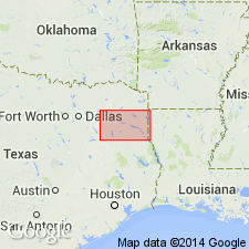
-
- East Texas basin
Summary:
Wills Point Formation of Midway Group. Mostly clay, upper part silty, locally lignitic, some calcareous siltstone concretions, thin bed of rosette limestone near middle, glauconitic near base, thin-bedded to locally massive, various shades of gray; weathers medium-gray to yellowish-gray; marine megafossils. Thickness 450+/- feet. Lies above Kincaid Formation of Midway Group and below Eocene Wilcox Group, undivided. Age is Paleocene.
[Mapped in southwestern corner of map sheet, west of Sulphur Springs, TX, in Hopkins and Hunt Cos., northeastern TX.]
Source: Publication.

- Usage in publication:
-
- Wills Point Formation
- Modifications:
-
- Mapped 1:250k
- Dominant lithology:
-
- Clay
- Limestone
- AAPG geologic province:
-
- East Texas basin
Summary:
Wills Point Formation of Midway Group. Clay, silty, sandy, silt and sand more abundant upward, slightly glauconitic near base, 10-inch-thick rosette limestone bed near middle, massive, poorly bedded, grades upward to mudstone and sand of Wilcox Group, light gray to dark bluish gray, topographically featureless. Thickness 250 to 500 feet, thins southward. Lies above Kincaid Formation of Midway Group and below Hooper Formation of Wilcox Group. Age is Eocene.
Mapped in Falls, Freestone, Limestone, Navarro, and Robertson Cos., eastern TX.
Source: Publication.

- Usage in publication:
-
- Wills Point Formation
- Modifications:
-
- Areal extent
- AAPG geologic province:
-
- Gulf Coast basin
Summary:
Wills Point Formation of Midway Group. Clay, silty and sandy, silt and sand more abundant upward, slightly glauconitic near base, massive, poorly bedded, light gray to dark bluish gray. Thickness 400 to 500 feet. Overlies Kincaid Formation of Midway Group; underlies Wilcox Group (Eocene). Age is Eocene.
Not separately mapped. (Midway Group undivided mapped in Guadalupe and Caldwell Cos., southeastern TX.)
Source: Modified from GNU records (USGS DDS-6; Denver GNULEX).
- Usage in publication:
-
- Wills Point Formation
- Modifications:
-
- Mapped 1:250k
- Dominant lithology:
-
- Clay
- Siltstone
- Limestone
- AAPG geologic province:
-
- East Texas basin
Summary:
Wills Point Formation [of Midway Group]. Clay, medium bluish gray, greenish gray, grayish green, brownish gray, silt increases upward, laminated to locally massive, glauconitic near base, rough calcareous siltstone concretions common in upper part, locally lignitic in upper part, thin bed of rosette limestone near middle; weathers medium gray to yellowish gray. Thickness 500+/- feet. Occurs above Kincaid Formation [of Midway] and below Wilcox Group. Fossiliferous. Age is Eocene. [Age changed from Paleocene (1964 ed.).]
[Mapped in Hunt, Rains, and Van Zandt Cos., eastern TX.]
Source: Publication; supplemental information from GNU records (USGS DDS-6; Denver GNULEX).

- Usage in publication:
-
- Wills Point Formation
- Modifications:
-
- Mapped 1:250k
- Dominant lithology:
-
- Clay
- Limestone
- AAPG geologic province:
-
- East Texas basin
Summary:
Wills Point Formation of Midway Group. Clay, silty, sandy, silt and sand more abundant upward, slightly glauconitic near base, 10-inch rosette limestone bed below middle, massive, poorly bedded, grades upward to mudstone and sand of Wilcox Group, light gray to dark gray; weathers medium gray to yellowish gray, topographically featureless. Thickness 550+/- feet. Lies above Kincaid Formation of Midway and below Wilcox Group. Age is Paleocene. [Age changed from Eocene (1972 ed.).]
[Mapped in Henderson, Kaufman, Navarro, and Van Zandt Cos., eastern TX.]
Source: Publication; supplemental information from GNU records (USGS DDS-6; Denver GNULEX).
For more information, please contact Nancy Stamm, Geologic Names Committee Secretary.
Asterisk (*) indicates published by U.S. Geological Survey authors.
"No current usage" (†) implies that a name has been abandoned or has fallen into disuse. Former usage and, if known, replacement name given in parentheses ( ).
Slash (/) indicates name conflicts with nomenclatural guidelines (CSN, 1933; ACSN, 1961, 1970; NACSN, 1983, 2005, 2021). May be explained within brackets ([ ]).