- Usage in publication:
-
- Wichita beds
- Modifications:
-
- Original reference
- Dominant lithology:
-
- Sandstone
- Shale
- Clay
- Conglomerate
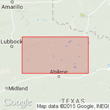
- AAPG geologic province:
-
- Bend arch
- Palo Duro basin
Summary:
Pg. 188, and E.T. Dumble's pl. 3 [table of formations facing p. xxx] and p. lxix. Wichita beds. Fossiliferous red, gray, and variegated massive and shaly sandstones and sandy shales, red and bluish clays, and a peculiar conglomerate, the sandstones and sandy shales often containing large oval concretions, the sandstones often ripple-marked and in places cross-bedded. Underlie Clear Fork beds and overlies Coleman-Albany series of the Coal Measures. [Age is Early Permian.]
[Named from Wichita River and Wichita Co., northern TX.]
[Misinterpretation.]
Source: US geologic names lexicon (USGS Bull. 896, p. 2330).
- Usage in publication:
-
- Wichita beds
- Modifications:
-
- Areal extent
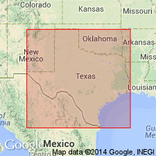
- AAPG geologic province:
-
- Bend arch
- Palo Duro basin
Summary:
Pg. 361, 373, 400-402. Wichita beds. Permian of northwestern Texas divided into (descending) Double Mountain beds, Clear Fork beds, and Wichita beds. The Wichita consists of sandstones, clay beds, and a peculiar conglomerate. There are no limestones from top to bottom. The sandstones are of various colors; the clays are red and bluish. Iron concretions occur in the red clays. The conglomerate is composed of clay, or clay ironstone, in a ferruginous matrix. The Wichita beds do not extend south of Brazos River. They are heaviest along Big Wichita River, where they attain thickness of 2,000+/- feet. [In table on p. 361 the Wichita is shown as resting on "Albany beds," and the "Albany" is excluded from Permian. In table on p. 373 the Wichita of northern field (1,800 feet thick) is shown as contemporaneous with "Albany beds" of central field (1,180 feet thick), and the "Albany" is included in Permian.] "The Albany beds not occurring north of Brazos River, the Wichita beds rest directly upon and are conformable with Cisco beds." [Age is Early Permian.]
Source: US geologic names lexicon (USGS Bull. 896, p. 2330).
- Usage in publication:
-
- Wichita division
- Modifications:
-
- Revised
- AAPG geologic province:
-
- Permian basin
Summary:
Wichita division. Includes Lueders limestone as top member. [Age is Early Permian.]
Source: US geologic names lexicon (USGS Bull. 896, Lueders entry p. 1235).
- Usage in publication:
-
- Wichita group
- Modifications:
-
- Revised
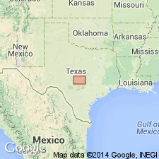
- AAPG geologic province:
-
- Bend arch
Summary:
Wichita group. Lower part of group divided into (ascending): Admiral, Belle Plains, and Clyde formations.
[Author's note: There is a tendency among geologists to refer to the Permian in the Albany and Wichita areas as the "Albany-Wichita group" and to speak of the marine limestone facies of the Brazos Valley as "Albany Beds" and the red strata of the Red River as "Wichita Red Beds."]
Source: Modified from GNU records (USGS DDS-6; Denver GNULEX).

- Usage in publication:
-
- Wichita group*
- Modifications:
-
- Overview
- AAPG geologic province:
-
- Bend arch
- Llano uplift
Summary:
Some geologists include Arroyo formation of Beede and Waite in Clear Fork group, but Beede, Waite, and Wrather include it in Wichita group. The USGS includes it in Clear Fork group. E.H. Sellards, 1933 (Univ. Texas Bull. 3232) transferred Putnam and Moran formations from Cisco group (Pennsylvanian) to overlying Wichita group, and this transfer has been adopted by the USGS.
Source: US geologic names lexicon (USGS Bull. 896, p. 2330).
- Usage in publication:
-
- Wichita formation
- Modifications:
-
- Revised
- AAPG geologic province:
-
- South Oklahoma folded belt
Summary:
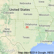
Pg. 2028-2035. In Wichita Mountains, Oklahoma, formation includes Post Oak conglomerate member (new). Member is equivalent to Wellington formation and may be as old as upper part of Pontotoc group and as young as lowermost part of Garber sandstone. [Age is Early Permian.]
Source: US geologic names lexicon (USGS Bull. 1200, p. 4222-4223).
- Usage in publication:
-
- Wichita Group
- Modifications:
-
- Revised
- AAPG geologic province:
-
- Bend arch
- Fort Worth syncline
- Palo Duro basin
Summary:
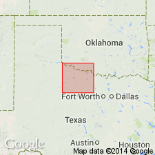
Name used north and northeast of the Salt Fork of the Brazos River from Baylor and Wilbarger Cos east across Wichita, Archer and Clay Cos, TX to the northeast border of the sheet (the Red River). These Cos are on the Bend arch, Palo Duro basin, and in the Fort Worth syncline. Divided into three formations (all first used, ascending)--the Nocona, Petrolia, and Waggoner Ranch Formations. South of the Salt Fork of the Brazos River, the equivalent rocks are assigned to formations of the Albany Group. Overlies Archer City Formation of Bowie Group (both first used); underlies Clear Fork Group (undivided). Is of Wolfcamp and Leonard age. The Wolfcamp-Leonard boundary is in the upper part of the Nocona Formation. Geologic map.
Source: GNU records (USGS DDS-6; Denver GNULEX).
For more information, please contact Nancy Stamm, Geologic Names Committee Secretary.
Asterisk (*) indicates published by U.S. Geological Survey authors.
"No current usage" (†) implies that a name has been abandoned or has fallen into disuse. Former usage and, if known, replacement name given in parentheses ( ).
Slash (/) indicates name conflicts with nomenclatural guidelines (CSN, 1933; ACSN, 1961, 1970; NACSN, 1983, 2005, 2021). May be explained within brackets ([ ]).

