The National Geologic Map Database is migrating to a new infrastructure. We apologize for any service disruptions during this process.
|
|---|


- Usage in publication:
-
- West Branch shale bed
- Modifications:
-
- Original reference
- Dominant lithology:
-
- Shale
- AAPG geologic province:
-
- Nemaha anticline
Summary:
Pg. 74, 82, 89, 111, 113. West Branch shale bed of Admire shale member of Wabaunsee formation. Greenish-blue argillaceous massive and crumbly shale; dark near top; calcareous bladed material above middle, and calcareous lensing material near base. Thickness 26+/- feet. Top bed of Admire shale member of Wabaunsee formation. Overlies Falls City limestone and underlies Americus limestone. Age is Late Pennsylvanian (Missouri age). Report includes cross sections, measured sections, geologic maps, stratigraphic tables.
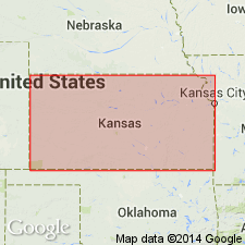
Named from exposures in West Branch Twp., Pawnee Co., southeastern NE.
Source: US geologic names lexicon (USGS Bull. 896, p. 2304); GNC KS-NE Pennsylvanian Corr. Chart, sheet 1, Oct. 1936; supplemental information from GNU records (USGS DDS-6; Denver GNULEX).
- Usage in publication:
-
- West Branch shale
- Modifications:
-
- Revised[?]
- Age modified
- AAPG geologic province:
-
- Cherokee basin
- Forest City basin
- Nemaha anticline
Summary:
R.C. Moore and G.E. Condra (Oct. 1932 revised classification chart of Pennsylvanian rocks of Kansas and Nebraska) divided Admire shale into (descending) Oaks shale, Houchen Creek limestone, Stine shale, Five Point limestone, West Branch shale, Falls City limestone, Hawxby shale, Aspinwall limestone, and Towle shale. Whether this is a restriction of West Branch shale is unknown. The Stine shale and Houchen Creek limestone were named by Condra in 1927 publication [Nebraska Geol. Survey Bull., no. 1, 2nd ser.] cited above, where they were defined as belonging to lower part of Elmdale shale, which overlies Americus limestone; but their 1932 chart includes them in Admire shale, which underlies Americus limestone.
R.C. Moore, 1936 (Kansas Geol. Survey Bull., no. 22), transferred all beds above Brownville limestone to Permian. (See "Modern classifications of the Pennsylvanian rocks of eastern Kansas and southeastern Nebraska," compiled by M.G. Wilmarth, Secretary of Committee on Geologic Names, USGS unpub. corr. chart, Oct. 1936, sheet 2.)
Source: US geologic names lexicon (USGS Bull. 896, p. 2304); GNC KS-NE Pennsylvanian Corr. Chart, sheet 2, Oct. 1936.

- Usage in publication:
-
- West Branch shale member*
- Modifications:
-
- Revised
- AAPG geologic province:
-
- Cherokee basin
- Forest City basin
- Nemaha anticline
Summary:
Pg. 2273, 2274 (fig. 1). West Branch shale member of Janesville shale. Reallocated to member status in Janesville shale (new). Underlies Five Point limestone member; overlies Falls City limestone. Age is Early Permian (Wolfcampian).
Source: US geologic names lexicon (USGS Bull. 1200, p. 4179).
- Usage in publication:
-
- West Branch shale member*
- Modifications:
-
- Areal extent
- AAPG geologic province:
-
- Forest City basin
Summary:
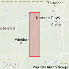
Pg. 14 (table 2), 48-49. West Branch shale member of Janesville shale of Admire group. Thickness about 27 feet in Wabaunsee County, eastern Kansas. Underlies Five Point limestone member; overlies Falls City limestone. [Age is Permian.]
Source: US geologic names lexicon (USGS Bull. 1200, p. 4179).
- Usage in publication:
-
- West Branch Shale Member*
- Modifications:
-
- Biostratigraphic dating
- Areal extent
- AAPG geologic province:
-
- Chautauqua platform
- Cherokee basin
- Forest City basin
- Nemaha anticline
Summary:
West Branch Shale Member of Janesville Shale of Admire Group. Overlies Falls City Limestone of Admire and underlies Five Point Limestone Member of Janesville. Conodont species association indicates the ADETOGNATHUS-SWEETOGNATHUS biofacies; nearshore marine depositional environment. Age is Late Pennsylvanian (late Gzhelian; STREPTOGNATHODUS BELLUS conodont zone).
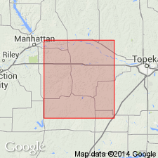
Described from measured sections in Chautauqua, Cowley, Greenwood, Pottawatomie, and Wabaunsee Counties, eastern Kansas, and Osage County, northern Oklahoma. (Locs. 1, 2, 3, 4, A11, A16, A19, A26.)
Source: Publication.
For more information, please contact Nancy Stamm, Geologic Names Committee Secretary.
Asterisk (*) indicates published by U.S. Geological Survey authors.
"No current usage" (†) implies that a name has been abandoned or has fallen into disuse. Former usage and, if known, replacement name given in parentheses ( ).
Slash (/) indicates name conflicts with nomenclatural guidelines (CSN, 1933; ACSN, 1961, 1970; NACSN, 1983, 2005, 2021). May be explained within brackets ([ ]).