The National Geologic Map Database is migrating to a new infrastructure. We apologize for any service disruptions during this process.
|
|---|


- Usage in publication:
-
- Weno formation
- Modifications:
-
- Original reference
- Dominant lithology:
-
- Marl
- Clay
- Limestone
- AAPG geologic province:
-
- South Oklahoma folded belt
Summary:
Pg. 121, 247, 269-280. Weno formation. [Weno clay member of Denison formation.] Present in northeastern Texas and central southern Oklahoma. Very ferruginous brownish clay marls and marly clays, with some impure limestone. Thickness 92 feet. Included in †Weno subgroup [later abandoned] of Denison beds. Underlies Pawpaw formation. [The "Quarry limestone," a massive arenaceous limestone, blue exteriorly but oxidizing yellow, quarried at East Denison, is both included in and excluded from this formation in report cited.] Overlies GRYPHACEA WASHITAENSIS agglomerate, in top of Denton subgroup of Denison beds. Age is Early Cretaceous (Comanche).
Type locality not stated. Named from Weno, Grayson Co., northeastern TX.
[GNC remark (ca. 1938, US geologic names lexicon, USGS Bull. 896, p. 2303): The USGS treats †Quarry limestone as basal bed of Pawpaw sandy member of Denison formation. (See L.W. Stephenson, USGS Prof. Paper 120-H, 1918.)]
Source: US geologic names lexicon (USGS Bull. 896, p. 2303).
- Usage in publication:
-
- Weno limestone
- Modifications:
-
- Areal extent
- AAPG geologic province:
-
- Arkla basin*[?]
- East Texas basin*[?]
Summary:
Chart shows Weno limestone in Washita group. Occurs below Pawpaw formation and above Denton clay. [Denison formation abandoned.] Age is Early Cretaceous.
Source: US geologic names lexicon (USGS Bull. 1200, p. 4174-4175).

- Usage in publication:
-
- Weno formation
- Modifications:
-
- Biostratigraphic dating
Summary:
Pg. 27-28, tbl. 4. Foraminifera of Weno formation described.
Source: US geologic names lexicon (USGS Bull. 1200, p. 4174-4175).
- Usage in publication:
-
- [Weno limestone member]
- Modifications:
-
- Revised
Summary:
Pg. 88, 92. In central Texas, considered member of Georgetown limestone. Overlies Denton shale member; underlies Pawpaw shale member. Thickness 40 feet in McLennan County.
Source: US geologic names lexicon (USGS Bull. 1200, p. 4174-4175)
- Usage in publication:
-
- Weno marly limestone member
- Modifications:
-
- Revised
- AAPG geologic province:
-
- Fort Worth syncline
Summary:
Pg. 9 (fig. 3), 12 (fig. 4), 31 (fig. 12), 32, 33 (fig. 13). Referred to as Weno marly limestone member of Denison formation. In Fort Worth area, consists largely of gray marl with several thick limestone beds in its uppermost and lowermost parts. Thickness about 50 feet. Overlies Denton marl member; underlies Pawpaw shale member.
Source: US geologic names lexicon (USGS Bull. 1200, p. 4174-4175)

- Usage in publication:
-
- Weno Limestone
- Modifications:
-
- Areal extent
- AAPG geologic province:
-
- Fort Worth syncline
- Ouachita folded belt
- Strawn basin
Summary:
Weno Limestone. Consists of (descending): limestone, 2 to 20 feet; alternating clay and limestone, 15 to 45 feet; and limestone, 1 to 5 feet. Thickness from about 60 feet in Tarrant County to about 25 feet in northern Hill County. Lies above Denton Clay and below Pawpaw Formation. Fossiliferous. Age is Early Cretaceous.
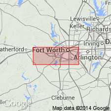
Not separately mapped. Mapped with Pawpaw Formation, Denton Clay, Fort Worth Limestone, and Duck Creek Formation [in greater Fort Worth area, in Bosque, Denton, Erath, Hill, Hood, Johnson, Parker, Somervell, and Tarrant Cos., eastern TX].
Source: Publication.

- Usage in publication:
-
- Weno Limestone
- Weno Clay Member
- Modifications:
-
- Mapped 1:250k
- Dominant lithology:
-
- Marl
- Limestone
- AAPG geologic province:
-
- Fort Worth syncline
- Ouachita folded belt
- South Oklahoma folded belt
Summary:
Pamphlet [p. 5]. Weno Limestone (Texas); Weno Clay Member of Bokchito Formation (Oklahoma).
In Texas, marl and limestone; marl, dark-gray, shaly, sandy, ferruginous, abundant clay-ironstone concretions, some thick limestone beds in uppermost and lowermost parts; thickness 70 to 135 feet, thins southward. Lies above Denton Clay and below Pawpaw Formation. Age is Early Cretaceous. [Mapped along Red River and southward to Lake Ray Roberts (btw. Sanger and Pilot Point); in Cooke, Denton, and Grayson Cos., northeastern TX; in central and northeastern part of map sheet. Pawpaw, Weno, and Denton mapped undifferentiated from Lake Ray Roberts area to southern edge of map sheet.]
In Oklahoma, brownish shales and thin interbeds of yellowish-brown ferruginous sandstone with selenite crystals common; thickness 70 to 135 feet, thins southward. Lies above Denton Clay Member and below Pawpaw Sandstone Member; both of Bokchito Formation. Age is Early Cretaceous. [Mapped in Lake Texoma and Marietta areas, Bryan, Love, and Marshall Cos., southeastern OK; along northern edge of map sheet.]
Source: Publication.
For more information, please contact Nancy Stamm, Geologic Names Committee Secretary.
Asterisk (*) indicates published by U.S. Geological Survey authors.
"No current usage" (†) implies that a name has been abandoned or has fallen into disuse. Former usage and, if known, replacement name given in parentheses ( ).
Slash (/) indicates name conflicts with nomenclatural guidelines (CSN, 1933; ACSN, 1961, 1970; NACSN, 1983, 2005, 2021). May be explained within brackets ([ ]).