

- Usage in publication:
-
- Weeks formation*
- Modifications:
-
- Biostratigraphic dating
- AAPG geologic province:
-
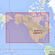
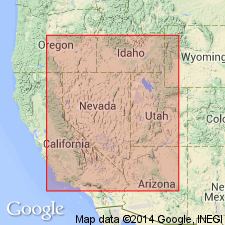
- Great Basin province
Summary:
Weeks formation consists of thin-bedded to shaly, fine-grained, bluish gray to dark gray and reddish-tinted arenaceous limestones; shales 1/8 to 1 in thick; some oolitic limestone. Is 1390 ft thick. Conformably overlies Marjum formation; conformably underlies Orr formation. Age is Middle Cambrian on the basis of fossils [trilobites, brachiopods].
Source: GNU records (USGS DDS-6; Menlo GNULEX).

- Usage in publication:
-
- Weeks formation*
- Modifications:
-
- Named
- Dominant lithology:
-
- Limestone
- AAPG geologic province:
-
- Great Basin province
Summary:
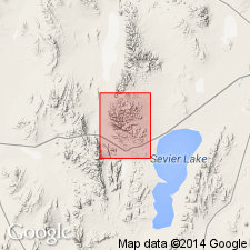
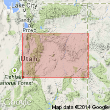
Named for exposures on north side of Weeks Canyon, north of Orr Ridge, House Range, Millard Co, UT in the Great Basin province. Is composed of thin-bedded shaly limestone with a few oolitic and arenaceous limestone beds. Is 1,390 ft thick. Overlies Marjum formation (new); underlies Orr formation (new). Contains a Middle Cambrian fauna.
Source: GNU records (USGS DDS-6; Denver GNULEX).

- Usage in publication:
-
- Weeks formation*
- Modifications:
-
- Age modified
- AAPG geologic province:
-
- Great Basin province
Summary:
Age of Weeks formation is modified to Late Cambrian based on the presence of CREPICEPHALUS TEXANUS [trilobite].
Source: GNU records (USGS DDS-6; Menlo GNULEX).
- Usage in publication:
-
- Weeks Formation
- Modifications:
-
- Overview
- Biostratigraphic dating
- Age modified
- AAPG geologic province:
-
- Great Basin province
Summary:
The Middle-Upper Cambrian boundary occurs in the lower part of the Weeks Formation [rather than in the upper part of the Marjum formation]. In the Marjum Pass-Weeks Canyon area (House Range) the lower part of the Weeks consists of 3- to 12-in beds of medium- to dark-gray fine-grained, laminated limestone that alternate with 1/8- to 1/4-in beds of medium-gray silty limestone. In the Drum Mountains a stratigraphically equivalent unit consists of beds of medium- to light-gray, thinly laminated, platy limestone that alternate with beds of fine-grained, gray-black limestone with brown silty mottles. Age is Middle and Upper Cambrian on the basis of fossils [trilobites].
Source: GNU records (USGS DDS-6; Menlo GNULEX).
- Usage in publication:
-
- Weeks Formation*
- Modifications:
-
- Age modified
- AAPG geologic province:
-
- Great Basin province
Summary:
Age of Weeks Formation is Middle and Upper Cambrian on the basis of fossils [trilobites].
Source: GNU records (USGS DDS-6; Menlo GNULEX).
- Usage in publication:
-
- Weeks Limestone*
- Modifications:
-
- Revised
- Biostratigraphic dating
- AAPG geologic province:
-
- Great Basin province
Summary:
Original description of Weeks Limestone by Walcott (1908b) used both Weeks Formation (p. 177) and Weeks Limestone (p. 174). The latter usage is considered more appropriate as it better describes the lithology. Robison (1964) placed the Middle-Upper Cambrian boundary within the Weeks based on the presence of age-diagnostic fossils [trilobites].
Source: GNU records (USGS DDS-6; Menlo GNULEX).
- Usage in publication:
-
- Weeks Limestone
- Modifications:
-
- Areal extent
- AAPG geologic province:
-
- Great Basin province
Summary:
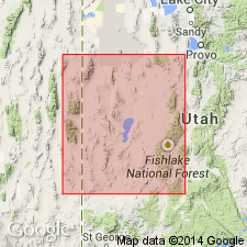
Is a valid map unit only in central House Range, UT, Great Basin province. Name should not be extended into other areas. Weeks can only be applied at its type in Weeks (now North) Canyon on Notch Peak quad. Correlates with upper part of Fish Springs Member (new) of Trippe Limestone and newly named Wah Wah Summit Formation in Wah Wah, southern House and Cricket Ranges and with Lamb Dolomite in Deep Creek, Fish Springs, northern House and Dugway Ranges; all in west-central UT. Overlies Marjum Formation; underlies Orr Formation. Middle and Late Cambrian age.
Source: GNU records (USGS DDS-6; Denver GNULEX).
- Usage in publication:
-
- Weeks Limestone*
- Modifications:
-
- Revised
- AAPG geologic province:
-
- Great Basin province
Summary:
Underlies Big Horse Limestone Member (new), basal member of Orr Formation, in House Range, UT in Great Basin province. Is of Middle and Late Cambrian age.
Source: GNU records (USGS DDS-6; Denver GNULEX).
For more information, please contact Nancy Stamm, Geologic Names Committee Secretary.
Asterisk (*) indicates published by U.S. Geological Survey authors.
"No current usage" (†) implies that a name has been abandoned or has fallen into disuse. Former usage and, if known, replacement name given in parentheses ( ).
Slash (/) indicates name conflicts with nomenclatural guidelines (CSN, 1933; ACSN, 1961, 1970; NACSN, 1983, 2005, 2021). May be explained within brackets ([ ]).