

- Usage in publication:
-
- Waterton formation, dolomite
- Modifications:
-
- Named
- Dominant lithology:
-
- Dolomite
- AAPG geologic province:
-
- Northern Rocky Mountain region
Summary:
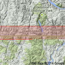
Named as the oldest formation in the area and as the basal [formation] "member" of eight formations of Lewis series. Is exposed at cliff over which the water of Oil Creek falls into Waterton Lake, BC in the Northern Rocky Mountain region. Conformably overlain by Altyn formation (also called Altyn limestone). Cross sections. Consists of 200 ft of massive, dark-gray (dark-gray, brown-gray, or buff-weathering) dolomite. Chemical analyses. Assigned to the Beltian.
Source: GNU records (USGS DDS-6; Denver GNULEX).

- Usage in publication:
-
- Waterton member
- Modifications:
-
- Revised
- AAPG geologic province:
-
- Northern Rocky Mountain region
Summary:
Assigned as basal member of Altyn formation of Ravalli group of Belt series in the Northern Rocky Mountain region. Inclusion of Waterton in Altyn represents a reduction in rank of Daly's (1912) Waterton formation and a redefinition of Willis (1902) Altyn. Present authors modified lower Altyn contact because no significant break separates Waterton from Altyn. Is described as a reddish- to dark-gray dolomite that weathers gray, brown to buff. Most of the beds 1 to 4 ft thick are finely laminated. Is about 280 ft thick. Base not known. Grades up into Hell Roaring Member (revised) of Altyn. Areal extent into MT not stated. Correlation chart. Of pre-Cambrian age.
Source: GNU records (USGS DDS-6; Denver GNULEX).

- Usage in publication:
-
- Waterton Formation
- Modifications:
-
- Overview
- AAPG geologic province:
-
- Northern Rocky Mountain region
Summary:
Is the basal Precambrian unit of the International Border area, Canada. Stratigraphic position and correlation with formations of the Belt Supergroup of the U.S. in the Northern Rocky Mountain region, and of the Purcell Supergroup of Canada in Alberta and British Columbia shown on figures 4, 5, and 6.
Source: GNU records (USGS DDS-6; Denver GNULEX).
- Usage in publication:
-
- Waterton Formation*
- Modifications:
-
- Areal extent
- AAPG geologic province:
-
- Northern Rocky Mountain region
Summary:
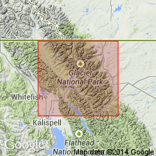
Is the lowermost unit in Belt Supergroup recognized only on the northeast part of Glacier National Park, MT in Northern Rocky Mountain region. Its lower contact is a thrust fault. Is overlain by Altyn Formation of the Belt Supergroup. Equivalent to lower part of the Prichard Formation on the west side of the Park. Nomenclature chart. Present in faulted sections near Yellow Mountain and north along the trace of the Lewis thrust fault. Is 152 to 201 m thick. Consists of gray to brown dolomite. Divisible (but not mapped) into 5 members. Chert occurs as nodules, blebs, layers and/or laminae in the lower 2 members. Stromatolites present in member 3 and 5 (top). Of Middle Proterozoic age.
Source: GNU records (USGS DDS-6; Denver GNULEX).
For more information, please contact Nancy Stamm, Geologic Names Committee Secretary.
Asterisk (*) indicates published by U.S. Geological Survey authors.
"No current usage" (†) implies that a name has been abandoned or has fallen into disuse. Former usage and, if known, replacement name given in parentheses ( ).
Slash (/) indicates name conflicts with nomenclatural guidelines (CSN, 1933; ACSN, 1961, 1970; NACSN, 1983, 2005, 2021). May be explained within brackets ([ ]).